The most accurate map of the continent at the time, finalized and published by the first female cartographer to depict North America.
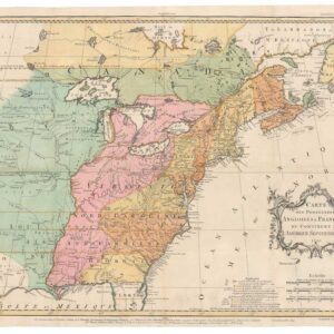
A GENERAL MAP OF NORTH AMERICA; In which is Express’d The Several New Roads, Forts, Engagements, &c. taken from Actual Surveys and Observations Made in the Army employ’d there, From the Year 1745, to 1761: Drawn by the Late JOHN ROCQUE, Topographer to his MAJESTY.
Out of stock
Description
This exceptional map checks all the boxes. It is rare. It is beautiful. Furthermore, it constitutes an important milestone in the mapping of America, being an incredibly accurate and comprehensively detailed chart. It is spectacular in every way, from its wall-map dimensions across the dramatic coloring of the colonies, to the elaborate title cartouche, flanked by the great pine forests of North America, and held in place by two rather exotic looking gentlemen, which we must presume represent the noble indigenous peoples of these lands. Essentially, each component of the map serves a purpose and contributes to its visual impact. When seeing all the components in unison, it is like witnessing the cartographic version of a great symphony. But more than that, it is an excellent summary of the state of geographical knowledge in 1762.
It is consequently not surprising that the chart was included in George Washington’s personal composite atlas (i.e. not the published The George Washington Atlas). General Washington, who himself was an accomplished surveyor and cartographer, knew that this chart was the finest rendition of the Americas available to him at the time. The atlas was acquired by the Yale Map Department in 1970 and subsequently left in the archives. It was only when a new inventory was compiled in the mid 2000s that this incredible private collation of maps was rediscovered. Holding a total of 43 charts of the Americas, the very first was Rocque’s General Map of North America (Parrish 2010).
The map was produced in two hand-colored sheets, which in our case have been joined to form a single quadratic chart measuring roughly 36 by 36 inches. The original coloring on our copy gives it the dramatic visual effect that the mapmakers intended. The map applies a scale of about 1:9,500,000 and uses pictorial relief to show topographic contours in the landscape.
As indicated in the title, it took John Rocque more than sixteen years to compile this map. And even upon his death, details in the extensive annotations and proper typesetting were yet to be completed. Luckily, Rocque’s wife, Mary Ann, had been deeply involved in his efforts and had shown considerable skill as a mapmaker herself. Moreover, she understood the cartographic significance of her husband’s labors and the potential profit it could generate. Joining with publisher Andrew Dury in London, Mary Ann Rocque saw to it that the map was finalized and published less than a year after her husband’s death.
The Rocque map of North America was, at the time of its publication in 1762, the most comprehensive and accurate map of the continent to date. It set entirely new standards in American cartography and replaced both John Mitchell’s and Braddock Mead’s earlier charts as the most important American map on the market. Of crucial significance was the inclusion of large amounts of information on the western frontiers. No other printed map of the time offered this level of geographical and historical insight. The map represents several centuries of cumulative geographic knowledge based on exploration. It includes many of the most recent findings by Spanish, English, and French expeditions, but also vital historical discoveries such as Drake’s 1579 landfall near San Francisco, and his claim of the area for Queen Elizabeth I; or the highly tentative inclusion of the strait that Juan de Fuca entered in 1592 (south of modern Vancouver Island).
In addition to the latest geographical knowledge, the map was also a political tool, delineating colonies, territories, and the great unknown in order to cement perceived borders and divisions. And not only between the colonizing nations of Europe, but also in regards to the interests and claims of semi-private enterprises such as The Hudson Bay Company. Most important perhaps were the extensive annotations on the latest Indian Treaties and what they implied. Produced during The French and Indian War (1756-63) and published only shortly before Canada was formally ceded to the British Crown in the Treaty of Paris, this chart filled the huge demand for knowledge on how the war went and what it meant territorially. The conclusion of the war saw a reshuffling of colonial possessions in North America, and a new geopolitical configuration already depicted on the map. France gave western Louisiana and New Orleans to its former ally Spain. Britain acquired Florida, which allowed the Crown to complete its control of the North American Atlantic coastline. This new possession was divided into two colonies, West Florida and East Florida, which are delineated (somewhat incorrectly by the original colorist it appears) on the map.
Being a map primarily for the British market, it focuses of the Crown’s colonies and is of course executed in English (although the title is written in French as well). Considerable effort has gone into demarcating the different colonies (later States) properly. While the formal colony borders were more or less well-established by this time, the principles upon which Britain made Her claims and organized Her territorial divisions was still anchored in colonizing principles such as primacy. That these principles continued to play a role not just in the claims made by European nations on ‘undeveloped’ or ‘newly discovered’ lands in the west, but indeed in the way established colonies organized themselves demographically and later politically, is seen in the annotations of meridian lines.
The boundaries of both New England and Virginia have in this map been extended all the way to the Pacific, though their western borders remain wholly obscure. This constituted an important political claim, and repeating it often meant cementing it. Rocque even notes various early 17th century charters on which these divisions were based and emphasizes the 40th meridian as the agreed-upon dividing line of these two British colonial claims. The same political calculus was surely Rocque’s rationale for including an extensive annotation about the West Coast landfall of Sir Francis Drake: “In this Harbour Sr Francis Drake during the great Rains remaind 5 Weeks from the 17th of June 1579.& on a Free Surender of the Natives took Possession of the Country for Q Elizabeth calling it New Albion.” Every detail in this account, from the early date to the official naming, represents a direct challenge to Spanish territorial claims in California, again according to the principle of primacy.
In general, the map is extensively annotated. As a pre-Revolutionary map, many of these annotations focus on British achievements and territories, underlining British claims to the continent. Some of the more descriptive annotations on local conditions almost come off as promotional branding. An example of this can be found in a charming little note on Bermuda or the Summer Isles: “If a terrestrial paradise is supposed, Bermuda claims it; no part of the world enjoys a pure Air, or more temperate Climate &c. is remarkable for Health, delicate Provisions, &c. they build swift sailing Vessels which they Sell to the Sugar Islands. They are dexterous in the recovery of Wrecks“. Immediately west of Bermuda, we find the map’s attractive 16-point compass rose, which is crowned by a fleur-de-lis. Immediately south of Bermuda, we find four different scale bars showing Minutes to a Degree, English Miles to a Degree, Leagues to a Degree, and Spanish Leagues to a Degree respectively.
The overall detail in which the Caribbean and its littoral have been rendered is one of many features that made this map highly desirable for both administrators and gentlemen collectors of its era. The Gulf of Mexico and Caribbean were hard waters to navigate, subject not only to seasonal storms and squalls, but riddled with reefs and shoals and subject to the ravages of both piracy and privateers. Rocque makes a number of important annotations to assist those using the map to plan expeditions – mercantile or otherwise. Within the Gulf itself, he notes the presence of the so-called Trade Winds; hard autumn and winter squalls blowing mainly from the north and exacerbated by the gravitational pool of the moon. Out in the Atlantic, on the approach to the Caribbean, the Trade Winds are discussed again, now with notes on its boreal character north of the equator. The summer hurricane season is also mentioned and noted as something that completely randomizes wind-directions. Just south of the Caribbean archipelago, off the coast of Surinam, a note identifies it as the ‘only considerable acquisition the Dutch have in America’. It goes on to remind us that this is because the Portuguese ousted them from Brazil and the British expelled them from New York.
In the Northeast, we also find an abundance of new and useful geographic details. In addition to thoroughly mapping the coastal communities of Nova Scotia, Newfoundland, and Labrador, it demarcates the Great Fishing Banks off Newfoundland as well. This includes a note informing us that it fished by about 500 vessels from all parts of Europe. The map’s eastern limits are defined by the Portuguese Azores (Ilha Flores & Corvo), which constituted the last stop for Portuguese ships crossing the Atlantic. Indeed, Rocque makes a note of the natural bounty of these islands and emphasizes it as the first place Portuguese vessels land upon returning from Africa and the Americas. And in the northernmost part of the map, we find the southern half of Greenland, with a note that it is subject to the King of Denmark. The map includes the Bay and Island of Disco.
Rocque generally made sure his map catered to those fascinated by the ever-expanding frontiers of North America. The results from expeditions seem to have been systematically incorporated, including more speculative notes, such as localizing the headwater of the Missouri River. The map also won renown because it included a hitherto unsurpassed degree of frontier infrastructure, including early road networks throughout the southern British colonies, as well as in Texas and what would later become New Mexico. An annotation informs us that “New Mexico altho divided into 20 or 24 Provinces, is very little known to us, and in all appearance not fertile, as what of it is discover’d, is mostly Heaths, Mountains and Stony Land. The only observable places in it are Santa Fe, the residence of the Spanish Governor, and an Episcopal See, and Acoma built upon very high rock. There is no coming up to this city, but by an ascent of 50 Steps cut in the rock”.
Nodal points, such as settlements and new forts, have also been extensively documented. Examples include Fort St John on the Texan part of the Rio Grande, which is linked to both Louisiana and the Southern colonies, as well as to Mexico, by an extensive road; and Fort Orleans, which was established in 1723 on the Missouri River and constituted the first European fortification west of the Mississippi. Much of the information that Rocque included on the Missouri came from the accounts of La Vèrendrye, a French-Canadian explorer and fur-trader, who was the first to formally encounter the great river. It was also La Vèrendrye that first localized and charted the great Manitoba lakes, including Lake Winnipeg and Lake Bourbon. All of this information has been meticulously incorporated in Rocque’s rendition.
Rocque’s chart has been celebrated by scholarship as setting new standards of accuracy in mapping the Mississippi Valley and the regions west hereof. Often, one can almost sense how Rocque has come upon a new source, which he then squeezed for as much detail as he could. An example of this is seen the area that today is Arizona, where all the villages along the Gila River (Rio des Apostres) have been meticulously documented for the first time in a full American chart. For most, the great American wilderness constituted a romantic notion, embossed with archetypal characters such as the noble savage, and creating a chart that both spoke to these notions, while also compiling and conveying a plethora of concrete and recent information, was an extremely difficult but also highly rewarding task.
In general, there is a notable shift in from earlier French maps of America (especially D’Anville) in Rocque’s magnificent chart. Other references to the Upper Mississippi Valley, such as John Mitchell’s 1755 map, are also completely superseded by this new rendition. This even includes developments in reverse, such as acknowledging that the origin of the Rio Grande remains unidentified. Among the aspects that collectors and scholars have appreciated in particular is the inclusion of what would later be named Pikes Lake and the Mantons River in the northwestern most fringe of mapped territory. While it seems these features were included on Nicholas Bellin’s 1755 map of North America, this is the first English map to include them. More than that, Rocque opens up the possibility that the Mantons River may actually constitute the head of the Missouri River, though he underlines the uncertainty of this. Beyond Pikes Lake, the map informs us in large letters that ‘THESE PARTS ARE INTIRELY UNKNOWN’ and ‘It is very uncertain whither this part is Sea or Land’.
Rocque was not afraid to take some risks when plotting out the northwestern frontier. Nor did he shun away from including unverified or speculative information, though he always notes it as such. He repeatedly refers to cartographic myths and unverified travelers’ accounts on things like the presumed sources, directions and possible mouths of rivers, and he even inserts strange quasi-mythological features. The most apparent of these is an undefined entity he entitles ‘The West Sea’, which covers roughly what would later become British Columbia and starts immediately beyond the Pikes Lake frontier. Rocque was clearly uncertain about what to do with the large speculative sea known as Mer de la Ouest (or Sea of the West), which was promoted by cartographers Guillaume de l’Isle and Philippe Buache, and was a persistent feature on maps of the era.
A little further northeast, along the western inlets of Hudson Bay, Rocque remarks “If a North West Passage Exists it must be through one of these bays”. Despite including such speculative elements, he also annotates extensive areas as completely unknown. What is more, he includes a strip of land (marked in pink) beyond his undefined West Sea (in the northeast corner of the map), which refers to the American landfall made by Vitus Bering’s second Kamchatka Expedition in 1741. It is this balance between established fact, fresh data, and reasoned speculation that made Rocque’s map such a pertinent and sought after document in its time; as well as the basis for why historians and collectors still consider it one the most pivotal charts of the North American continent.
When Braddock Mead/John Green and John Mitchell published their great charts of North America in 1755, they were hugely important because they depicted the continent immediately prior to The French and Indian War, the results of which changed the face of America – at least in geo-political terms. Similarly, Rocque’s chart is seminal because it embodies both the political state of America, as well as the most recent geographical knowledge, at the end of this war. That said, the map was published shortly before the Treaty of Paris, which saw most of Canada handed to the British, and thus before another great shift in the political control of American territories. When the Revolution broke in 1765, everything changed once again.
The 1760s was a decade of such massive upheaval and change in America that new charts could have been produced every year, and each one of them would have looked different. Rocque’s magnificent map is a milestone in process of mapping America.
Cartographer(s):
Andrew Dury was a British map-maker and print publisher who operated out of Duke’s Court on St. Martin’s Lane in London during the second half of the 18th century. Even though he was an accomplished cartographer with major commissions, he never reached the level of success attained by contemporaries such as Thomas Jefferys or William Faden. Consequently, his beautiful maps have become quite rare and are today sought-after collectors’ items.
Dury’s name is normally associated with Major James Rennell’s large India maps, but he was also responsible for Revolutionary War-era plans of Boston and Philadelphia, as well as a series of maps related to the Russo-Turkish War of 1768-74.
John RocqueJohn Rocque (ca. 1709–1762) was an influential surveyor, cartographer, engraver, and map-seller. He moved to England as a child with his parents, who were French Huguenot émigrés.
Mary Anne RocqueMary Ann Rocque (born about 1725, died after 1770) was a cartographer in 18th-century London. In 1751 she married cartographer John Rocque, who held the titles “Cartographer to the Prince of Wales” and “Topographer to His Royal Highness the Duke of Glouchester.”
John Rocque died in 1762; in widowhood Mary Ann Rocque carried on the family business, going into partnership with Andrew Dury. Together they Rocque published new and significant maps.
Condition Description
Lovely example. Original outline color, lightly refreshed. Minor repairs in the margin and a long repaired tear under the word OCEAN, roughly from the letter O to the margin.
References
The map was included in the exhibition “Women in Cartography: Five Centuries of Accomplishments”, which was organized by the Norman B. Leventhal Map Center at the Boston Public Library (2015-16).
Parrish, Abraham Kaleo (2010) George Washington’s American Atlas. Cartographic Perspectives 66: 47-52.
Varley, John (1948) John Rocque: engraver, surveyor, cartographer and map-seller. Imago Mundi 5: 83-91. https://doi.org/10.1080/03085694808591908
![[AMERICAN REVOLUTION] Boston, George Washington, Franklin, Philadelphia, Washington, D.C.](https://neatlinemaps.com/wp-content/uploads/2024/05/NL-02090a_thumbnail-300x300.jpg)