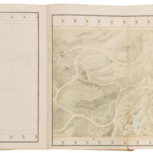
A set of seven panoramic views of San Francisco showing the utter destruction left by the 1906 earthquake.
[Group of 7] Panoramic views of the aftermath of the 1906 San Francisco earthquake.
Out of stock
Description
We are pleased to be able to offer this exciting and rare collection of seven panoramic photos of the destruction of San Francisco caused by the Great Earthquake of 1906. The San Francisco Examiner published all seven views during the immediate aftermath of this catastrophic event. The images were issued separately as supplements to the newspaper and came out gradually over the course of the summer months that year. Because of their independent publication, collections of the complete set of nine photomechanical prints are extremely rare. Our collection contains seven of the nine images published by the Examiner and is thus likely to be the most intact set of these images on the market.
The earthquake struck in the early morning of April 18, and mayhem and destruction ensued over the following days. A description of that fateful day and its consequences is found in the context section below. These panoramas were taken shortly after the event by different photographers and from different vantage points. The photos were then purchased by the San Francisco Examiner for publication in the newspaper.
The first image was issued on May 13th, less than a month after the earthquake, with a second following on the 27th of May. Both were bird’s eye views taken by the Chicago-based photography company R. Lawrence & Co. The nature of these images is such that a degree of distance is maintained between the photographer and the subject. The second photograph to be published was taken from the distant vantage point of Twin Peaks. Nevertheless, as time progressed and people got more accustomed to seeing the fall-out with their own eyes, the photographs get closer and closer to the epicenter of destruction.
On June 3rd, a double panorama of the city’s ruined waterfront was published. These two images show major roads that run perpendicular (either California or Market St) and parallel (possibly Kentucky St, today’s Third St) to the waterfront. A new photographer came into play only a week later when W.R. Hearst’s dramatic panorama from the dome of the wrecked City Hall was published. This image is more graphic than the preceding ones, unequivocally cementing the extent of the devastation.
Only five days later, a second graphic panorama by Hearst – this time taken from Russian Hill – shows an almost apocalyptic landscape in which nothing appears to have survived. By July, the work of a third photographer was added to the mix when the Examiner published two views by Theodore Kytka. On July 1st, a new apocalyptic landscape was provided in Kytka’s view of Chinatown seen from Telegraph Hill. Two weeks later, an equally disturbing view of the valley floor between Telegraph Hill and Russian Hill shows virtually nothing standing, hammering home the overwhelming scope of the destruction.
All of the photographs have been backed on archival paper for strength and stability. A few photographs contain minor blemishes due to age (please inspect the images for details), but the set is otherwise in excellent condition.
Below we have provided a list for an easy overview of the image in their correct chronological order.
| Publication date | Title | Photographer | Dimensions |
| 13 May 1906 | Bird’s eye view of the ruins of San Francisco | R. Lawrence & Co | 81.5 x 53.5 cm (32 x 21 in) |
| 27 May 1906 | Bird’s eye view of San Francisco from Twin Peaks | R. Lawrence & Co | 81.5 x 48.5 cm (32 x 19 in) |
| 3 June 1906 | Panoramic View of San Francisco from the Waterfront (double image) | R. Lawrence & Co | 81.5 x 56 cm (32 x 22 in) |
| 10 June 1906 | Birdseye View of San Francisco from top of Wrecked City Hall Dome | W.R. Hearst | 82 x 46 cm (32 x 18 in) |
| 24 June 1906 | In the Heart of the Ruins – Panorama taken from the Roof of the St Francis Hotel | W.R. Hearst | 117 x 41 cm (46 x 16 in) |
| 1 July 1906 | Ruins of Chinatown. Telephoto taken from Telegraph Hill by Theodore Kytka | Theodore Kytka | 81.5 x 58.5 cm (32 x 23 in) |
| 15 July 1906 | No. 2 – Panorama of the ruins in the valley that sweeps from Russian Hill to Telegraph Hill | Theodore Kytka | 82 x 46 cm (32 x 18 in) |
Census
These photomechanical prints of original photographs were issued individually in different editions of the daily newspaper San Francisco Examiner. Different examples can be found in various institutional archives and collections throughout the country. Having been issued individually, the OCLC includes both single examples, clusters, and the rare occasions in which a single institution holds the entire collection of nine photos. Providing the full range of reference numbers is, therefore, difficult. A good place to start is nevertheless the University of California at Berkeley’s complete collection of all nine prints (OCLC no. 214863936).
Context is Everything
Essentially, these are images of a city destroyed. They convey with uncompromising clarity the magnitude of the destruction and suffering the 1906 earthquake caused. Consequently, it might be helpful to provide a little background on the earthquake itself and on what it meant for the history and development of San Francisco.
The disaster struck in the early morning hours of April 18th, 1906. It preceded the Richter scale by which we measure earthquakes by three decades, but calculations have since shown that its force would have been equivalent to about 7.9 on the Richter scale or a Mercalli Intensity of XI (extreme). Soon after the tremors had abated, more than thirty fires broke out across the city, and these raged for days, consuming building after building, block after block. Most of the major fires were caused by ruptured gas mains, but in some cases, they were inadvertently started by local firefighters. The fires burned intensely hot, and since most residential buildings were built of timber and brick, entire neighborhoods were burnt to the ground. It is estimated that 90% of the destruction caused by the earthquake resulted from the fires.
When it was all over, more than 80% of the city had been destroyed, and more than 3000 people had lost their lives. The quake was felt as far away as in Nevada, Oregon, and Los Angeles. Modern seismologists still debate the exact epicenter, but most agree that it was just off the coast, northwest of the Golden Gate. The extent of the damage meant that two-thirds of the population became refugees overnight, and tents and shacks soon began to shoot up on the Presidio, Golden Gate Park, and North Beach. Eventually, many of the refugees moved across the Bay to Oakland and Berkeley. Important San Francisco landmarks were lost, including the famed Palace Hotel and the beautiful City Hall.
In addition to the immediate and short-term impact on the city, the earthquake also had long-term consequences. In 1906, San Francisco was not only the largest and most populous city on the West Coast but also the most important port and bridgehead for American mercantile interests in the Pacific. Much of this dynamism was lost due to the earthquake. The sheer destruction of basic infrastructure and the chaotic conditions to supply a work force made maritime engagements difficult.
As a result, much trade was diverted south to Los Angeles, with it followed by money and people. In effect, despite an impressively efficient rebuilding process, San Francisco lost its position as California’s major urban center to Los Angeles and would not regain it again. This marked shift has today characterized San Francisco, and most of its contemporary inhabitants would have it no other way. Yet it is a powerful reminder of how easily trajectories change.
The process of rebuilding the city was long and arduous. While civic leadership began planning the process immediately, finding the necessary funding proved difficult. There was only a single bank in San Francisco that was willing and able to provide the scope of funds needed for the extensive re-building plans. The Bank of Italy was founded by Amadeo Giannini, an Italian immigrant who had settled in North Beach. He became a great patron of the reborn San Francisco, providing the city itself with much-needed loans and paying for building materials from his own pocket. Years later, the bank would be renamed Bank of America, which it still is known as today.
Due to the nature of the devastation and the difficulties in acquiring both funds and materials for the rebuilding, the process took time. But by 1915, the city had recovered to such a degree that it hosted the Panama Pacific International Exposition, a world fair that celebrated the opening of the Panama Canal that summer – but also touted the resilience and renewal of San Francisco. The event showcased the city as a hub of modernity where one could experience the concrete results of technological advancement (incl. a cross-country phone line and the actual Liberty Bell). The exposition proved beyond any doubt that San Francisco had regained its former glory and perhaps now even outshone its old self. For the exposition, a glamorous and monumental neighborhood of representative pavilions was constructed along the northern waterfront. Only a few remain of this today, but to get a glimpse of just how impressive the new San Francisco would have been, we need only look to the Palace of Fine Arts: one of the most imposing exposition buildings and among the few still standing.
Cartographer(s):
Condition Description
All maps are backed on archival paper for strength and stability. Various blemishes; please refer to images.
Dimensions:
Panoramic view of San Francisco from the water front: 81.5 x 56 cm (32 x 22 in).
Ruins of Chinatown telephoto taken from Telegraph Hill by Theodore Kytka: 81.5 x 58.5 cm (32 x 23 in).
Birdseye view of San Francisco from the top of the wrecked city hall dome: 82 x 46 cm (32 x 18 in).
No. 2 - Panorama of the ruins in the valley that sweeps from Russian Hill to Telegraph Hill: 82 x 46 cm (32 x 18 in).
Birdseye view of the ruins of San Francisco: 81.5 x 53.5 cm (32 x 21 in).
Birdseye view of San Francisco from Twin Peaks: 81.5 x 48.5 cm (32 x 19 in).
In the heart of the ruins -- panorama taken from the roof of the St. Francis Hotel: 117 x 41 cm (46 x 16 in).
References
![[1906 EARTHQUAKE PANORAMA – FINANCIAL DISTRICT]](https://neatlinemaps.com/wp-content/uploads/2020/10/Screen-Shot-2023-02-06-at-6.55.56-PM-300x300.png)