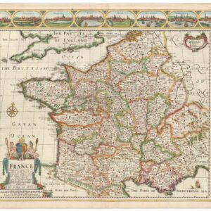
Stunning hand-colored 1730 map of Paris
Le Plan de Paris, ses Faubourgs et ses Environs / Platte Grond van Parys, zyn Voorburgen en Omleggende Plaatse
Out of stock
Description
Large-scale plan of Paris with surrounding faubourgs and environs, based on the work of Nicolas de Fer. A lettered key names and locates 23 important buildings.
Streets, churches, palaces, gardens, boat yards, orchards, hotels and much more are depicted on this superb plan. The plan is embellished with a large city coat-of-arms, a very nice compass rose, and four distance scales.
Title above map is in both French and Dutch.
Cartographer(s):
Covens & Mortier were a dynamic publishing duo working out of Amsterdam in the 18th century. Johannes Covens (1697-1774) was a Dutch geographic publisher based in the capital, whereas as Cornelis Mortier (1699-1783) was the Dutch-born son of a French cartographic publisher working out of Amsterdam.
Mortier’s father, Pierre Mortier the Elder (1661-1711) had in 1690 obtained the king’s privilege to distribute the works of French geographers in the Netherlands and subsequently settled in Amsterdam to build his business. Following his death, Cornelis took over his father’s business in 1719 and partnered up with his brother-in-law, Johannes Covens, a couple of years later. The pair soon began publishing maps and atlases under the name Covens & Mortier. Over the ensuing decades, the business passes from one generation to the next, effectively maintain the Covens & Mortier brand throughout the 18th century (but changing the name several times along the way).
As a result of Mortier Senior’s original privilege, the firm specialized in re-issuing iconic French geographers such as de l’Isles, Jaillot, and Sanson. But they did not limit themsleves to French products alone. In 1725, the duo reissued Frederik de Wit’s Atlas Maior from 1705, just as they issued their own pocket- and town atlases. They also purchased plates from other firms and mapmakers and modified them according to their commercial vision. Among the plates subsumed under the Covens & Mortier brand were those of Pieter van der Aa, which were acquired in 1730. This was also the heyday of the firm, when it supposedly owned the single largest collection of cartographic prints ever accumulated in the mapmaking city of Amsterdam.
The De L'Isle familyCondition Description
Expert high-quality framing -- whiskey veneer, scoop with gold embossing by Omega. Conservation Clear® acrylic. Excellent impression with superb color. Original map dimensions: 75.5 x 56.7 cm (29.7 x 22.3 in).
References
![Wehrmacht Sonderausgabe VI-1940: Einheitsblatt Nr. 29 [Caen] & Einheitsblatt Nr. 30 [Lisieux].](https://neatlinemaps.com/wp-content/uploads/2025/11/NL-01431_thumbnail-300x290.jpg)
![[LA ROCHELLE] Il vero sito della Rocella hora occupata da heretici et Ribelli di sua Maestà Christianissima della Quale sono Assediati.](https://neatlinemaps.com/wp-content/uploads/2022/11/NL-01639_thumbnail-scaled-300x300.jpg)
![[LA ROCHELLE] Il vero sito della Rocella hora occupata da heretici et Ribelli di sua Maestà Christianissima della Quale sono Assediati.](https://neatlinemaps.com/wp-content/uploads/2022/11/NL-01639_thumbnail-scaled.jpg)