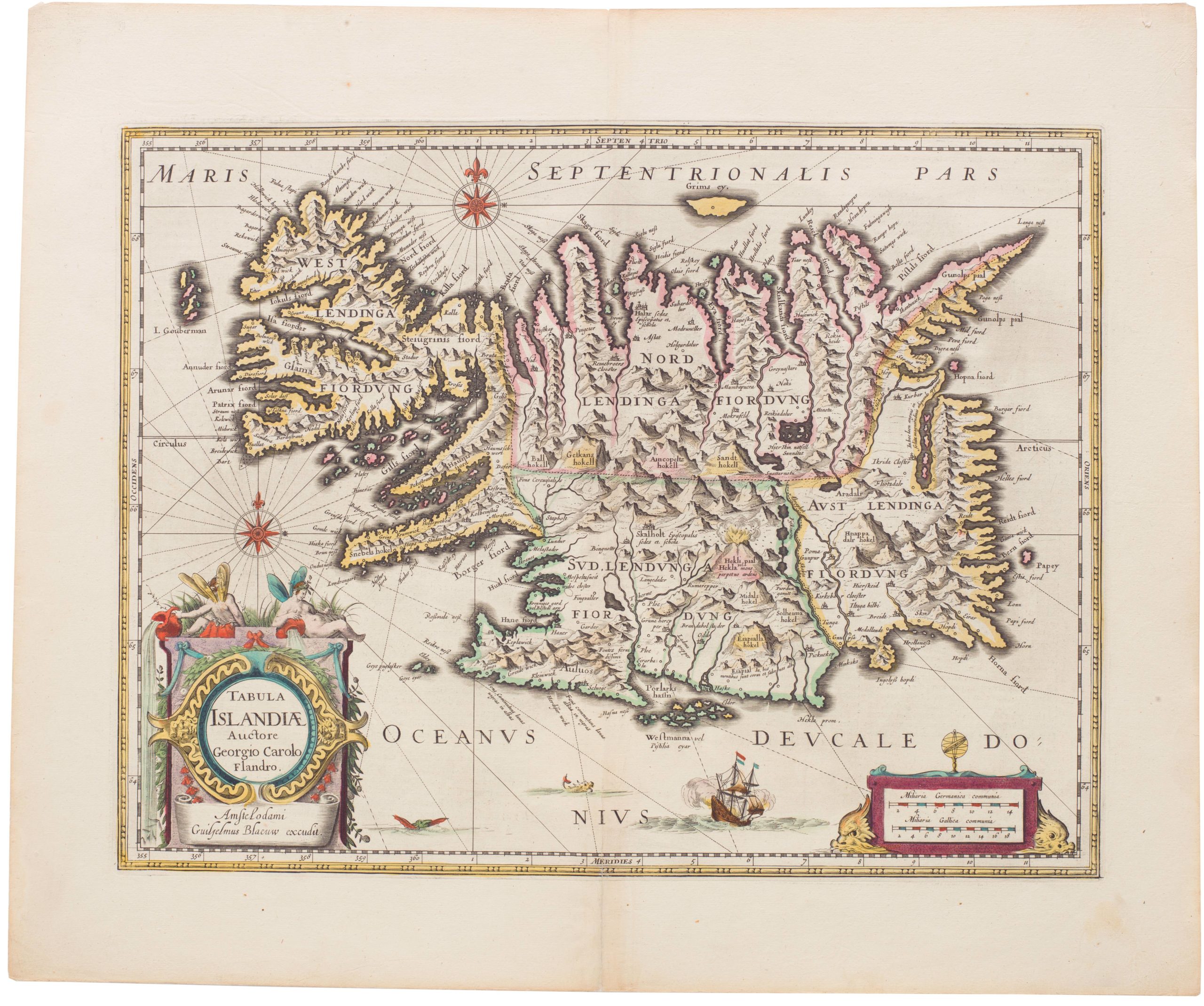
1609 Ortelius extraordinary map of Iceland with Spanish text on verso
Islandia
Out of stock
Description
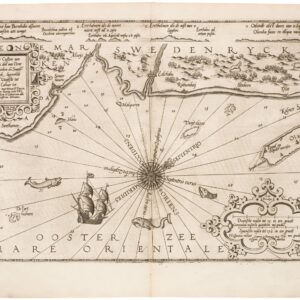
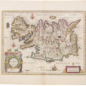
Perhaps the most famous map of Iceland, this example is from the Spanish text edition of Ortelius’s famous atlas, Theatrum Orbis Terrarum.
The map delightfully presents a variety of sea monsters, with a lettered key. The explanation is to be found on the verso of the map:
A. is a fish, commonly called NAHVAL. If anyone eats of this fish, he will die immediately. It has a tooth in the front part of its head standing out seven cubits. Divers have sold it as the Unicorn’s Horn. It is thought to be a good antidote and powerful medicine against poison. This monster is forty ells in length.
B. the Roider is a fish of one hundred and thirty ells in length, which has no teeth. The flesh of it is very good meat, wholesome and tasty. Its fat is good against many diseases.
C. The BURCHVALUR has a head bigger than its entire body. It has many very strong teeth, of which they make chess pieces. It is 60 cubites long.
D. The Hyena or sea hog is a monstrous kind of fish about which you may read in the 21st book of Olaus Magnus.
E. Ziphius, a horrible sea monster that swallows a black seal in one bite.
F. The English whale, thirty ells long. It has no teeth, but its tongue is seven ells in length.
G. HROSHUALUR, that is to say as much as Sea horse, with manes hanging down from its neck like a horse. It often causes great hurt and scare to fishermen.
H. The largest kind of Whale, which seldom shows itself. It is more like a small island than like a fish. It cannot follow or chase smaller fish because of its huge size and the weight of its body, yet it preys on many, which it catches by natural cunning and subtlety which it applies to get its food.
I. SKAUTUHVALUR. This fish is fully covered with bristles or bones. It is somewhat like a shark or skite, but infinitely bigger. When it appears, it is like an island, and with its fins it overturns boats and ships.
K. SEENAUT, sea cow of grey color. They sometimes come out of the sea and feed on the land in groups. They have a small bag hanging by their nose with the help of which they live in the water. If it is broken, they live altogether on the land, accompanied by other cows.
L. STEIPEREIDUR, a most gentle and tame kind of whale, which for the defense of fishermen fights against other kinds of whales. It is forbidden by Proclamation that any man should kill or hurt this kind of Whale. It has a length of at least 100 cubites.
M. STAUKUL. The Dutch call it Springual. It has been observed to stand for a whole day long upright on its tail. It derives its name from its leaping or skipping. It is a very dangerous enemy of seamen and fishermen, and greedily goes after human flesh.
N. ROSTUNGER (also called Rosmar) is somewhat like a sea calf. It goes to the bottom of the sea on all four of its feet, which are very short. Its skin can hardly be penetrated by any weapon. It sleeps for twelve hours on end, hanging on some rock or cliff by its two long teeth. Each of its teeth are at least one ell long and the length of its whole body is fourteen ells.
O. Spermaceti parmacitty or a simple kind of amber, commonly called HUALAMBUR.
P. Blocks and trunks of trees, by force of winds and violent tempests torn off by their roots
from the cliffs of Norway, tossed to and fro, and surviving many storms, finally cast upon and coming to rest at this shore.
Q. Huge and marvelously big heaps of ice, brought here by the tide from the frozen sea, making loud and terrible noises. Some pieces are often as big as forty cubits. On some of these, white bears sit together, watching the innocent fish play about in exercise.
Verso Text: Spanish.
Approximate number of copies printed: 325.
Cartographic sources: bishop Gudbrandur Thorlaksson (1542-1627) provided cartographic data to Anders Sörensen Vedel (1542-1616), sent to Ortelius, possibly via Heinrich von Ranzau (Meurer p. 260-1). Brandmair states that Vedel based himself directly on the Icelandic bishop Gudbrand.
Cartographer(s):
Abraham Ortelius (1527-1598) was born in Antwerp to Flemish parents in 1527. After studying Greek, Latin, and mathematics, he and his sister set up shop as book dealers and a ‘painter of maps.’ In his heart, Ortelius was, nevertheless, first and foremost a historian. He believed geography was the ‘eye of history,’ which explains why he collected maps and historical documents with such passion. Ortelius traveled widely in pursuit of his interests, building contacts with mapmakers and literati all over the European continent.
Ortelius reached a turning point in his career in 1564 with the publication of a World Map in eight sheets, of which only a single copy survives. In 1570, he published a comprehensive collection of maps titled Theatrum orbis terrarum (Theatre of the World). The Theatrum is conventionally considered the first modern-style atlas. It was compiled by collecting maps and charts from colleagues across the continent, which Ortelius then had engraved in a uniform size and style. The engraver for most of the maps in Theatrum was none other than the famous Frans Hogenberg, who also served as the main engraver for the 16th-century urban atlas Civitates Orbis Terrarum, published with Georg Braun in 1572.
Hogenberg’s re-drawn and standardized maps formed the basis of the first atlas in history (even though it was Mercator who was the first to use the term a few decades later). Unlike many of his contemporaries, Ortelius noted his sources openly and in the first edition, acknowledged no less than eighty-seven different European cartographers. This ‘catalogus auctorum tabularum geographicum‘ is one of the major innovations of his atlas. The list of contributing mapmakers was kept up-to-date for decades after Ortelius’ death. In the first edition of 1570, this list included 87 names, whereas the posthumous edition of 1603 contained no less than 183 names.
While compiled by Abraham Ortelius in the manner described above, the Theatrum was first printed by Gielis Coppens van Diest, an Antwerp printer experienced with cosmographical books. Van Diest was succeeded by his son Anthonis in 1573, who in turn was followed by Gillis van den Rade, who printed the 1575 edition of Ortelius’ atlas. From 1579, Christoffel Plantin took over, and his successors continued to print Theatrum until Ortelius’ heirs sold the copperplates and the publication rights to Jan Baptist Vrients in 1601. In 1612, shortly after Vrients’s death, the copperplates passed to the Moretus brothers.
Condition Description
Excellent. A few minor spots to map, centerfold with slight wear and with small repair to lower part, minor crease to the left part, some soiling and minor spotting to margins.
References
Van den Broecke 161.1 (with key letters added for the monsters), Koeman/Meurer: 121, Karrow: 1/172, van der Krogt AN: 1250:31. Spanish edition with page number 116 (325 copies printed).
