A Nautical Chart of San Francisco Bay Promoting the 1915 Panama-Pacific International Exposition.
San Francisco Entrance, Section of Chart No. 5532
Out of stock
Description
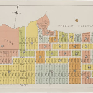
A wonderful 1915 color example of the US Coast & Geodetic Survey chart of the Golden Gate and the central part of San Francisco Bay, including Alcatraz Island, Angel Island, and Treasure Island (here as Goat Island). Soundings are provided throughout as well as areas of forbidden anchorage.
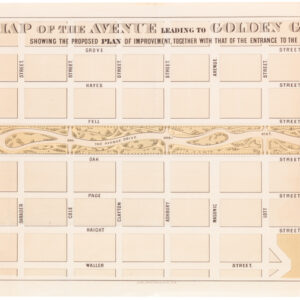
The inclusion of information on land is also noteworthy – we can see the development of the Richmond District reaching all the way to the Pacific, while the Sunset and the southwestern quadrant of the city remain mostly undeveloped. The verso includes a map of the Panama-Pacific International Exposition.
Cartographer(s):
The Office of Coast Survey is the official chartmaker of the United States. Set up in 1807, it is one of the U.S. government’s oldest scientific organizations. In 1878 it was given the name of Coast and Geodetic Survey (C&GS). In 1970 it became part of the National Oceanic and Atmospheric Administration (NOAA).
The agency was established in 1807 when President Thomas Jefferson signed the document entitled “An act to provide for surveying the coasts of the United States.” While the bill’s objective was specific—to produce nautical charts—it reflected larger issues of concern to the new nation: national boundaries, commerce, and defense.
Alexander Dallas Bache, great-grandson of Benjamin Franklin, was the second Coast Survey superintendent. Bache was a physicist, scientist, and surveyor who established the first magnetic observatory and served as the first president of the National Academy of Sciences. Under Bache, Coast Survey quickly applied its resources to the Union cause during the Civil War. In addition to setting up additional lithographic presses to produce the thousands of charts required by the Navy and other vessels, Bache made a critical decision to send Coast Survey parties to work with blockading squadrons and armies in the field, producing hundreds of maps and charts.
In 1871, Congress officially expanded the Coast Survey’s responsibilities to include geodetic surveys in the interior of the country, and one of its first major projects in the interior was to survey the 39th Parallel across the entire country. Between 1874 and 1877, the Coast Survey employed the naturalist and author John Muir as a guide and artist during the survey of the 39th Parallel in the Great Basin of Nevada and Utah. To reflect its acquisition of the mission of surveying the U.S. interior and the growing role of geodesy in its operations, the U.S. Coast Survey was renamed the United States Coast and Geodetic Survey (USC&GS) in 1878.
Condition Description
There is discoloration and residue on the verso, but the recto (front) is clean and in nice condition.
References