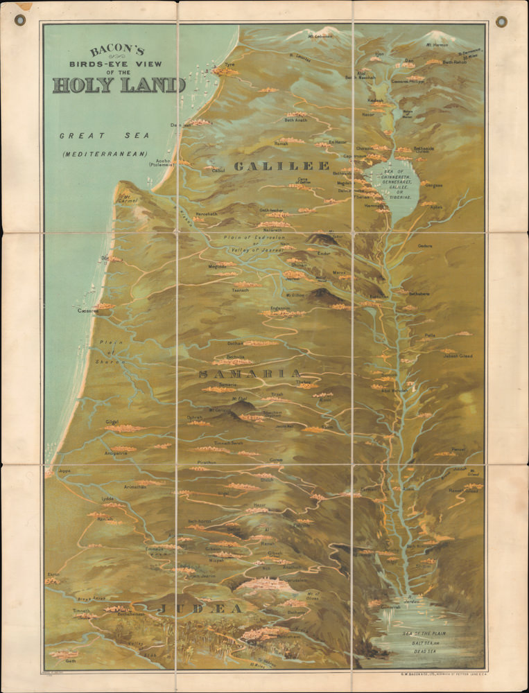
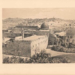
An ancient Jerusalem reservoir.
Pool of Mamillah, or Serpent’s Pool (according to Josephus), near the Monument of Herod on the west of the city.
Out of stock
Description
The Pool of Mamillah, also known as Birket Mamillah or the Serpent’s Pool, was one of the ancient stone reservoirs that provided potable water to the inhabitants of Jerusalem in antiquity. This pool is located just outside the walls of the Old City, approximately 650 meters (710 yards) northwest of the Jaffa Gate, in the center of the Islamic Mamilla Cemetery, which dates back to the Crusader Era.
The reservoir had a capacity of 30,000 cubic meters and was connected to Hezekiah’s Pool in the Christian Quarter of the Old City by an underground channel. In Pierotti’s day, and indeed for more than a century after that, it was thought that the Mamillah Pool received water from Solomon’s Pools by means of a nearby aqueduct. However, in 2010, archaeological excavations uncovered the aqueduct’s final segment at a much lower elevation near the Jaffa Gate, making it impossible to have been the feeding source for the Mamillah Pool.
In this gorgeous view, as in many of his other lithographed plates, Pierotti includes subtle labeling that refers back to a numbered legend on an accompanying sheet:
1. Mount Gihon, position of the buildings of the Prussian Mission.
2. Corner of the North-Western Wall of Jerusalem.
3. Wall of Jerusalem.
4. Mount of Olives.
5. Road to the Convent of the Holy Cross.
6. Ancient Mohammedan Cemetery.
7. Ancient Saracenic Monument.
8. Pool of Mamillah; “the Upper Pool.”
Publication information
In 1864, the same year that the first British Ordnance Survey of Jerusalem was commissioned, Italian engineer Ermete Pierotti published Jerusalem Explored, a seminal work on the history, archaeology, and architectural history of the ancient and holy city. This work included Pierotti’s notes and insights after years of surveying and mapping under Ottoman authority. The publication was divided into a text volume and a volume of plates. The latter included 63 lithographs showing everything from strategic views, across architectural plans and section profiles, to panoramic vistas of the Old City. Most of the lithographed plates were based either on photographs or drawings made by Pierotti and his team.
The plates were lithographed mainly by Thomas Picken of London and printed by the prominent British lithography firm William Day & Sons.
Cartographer(s):
Ermete Pierotti (1820-1880) was the oldest of nine siblings in a family from Pontardeto in Pieve Fosciana (the family built the Palazzo Pierotti, which has served as the town hall since 1877). Pierotti worked as a military engineer in Genoa and later served as a captain in the Engineering Corps of the Sardinian King. In 1849, he was accused of desertion and the theft of 3596 lire from the troop’s treasury, which resulted in a dishonorable discharge from the army. Pierotti then traveled to Jerusalem and Egypt, where he worked as an engineer. In Egypt, he discovered the foundations of the Alexandria Library while laying the foundations for a Greek church, but it was in Jerusalem that he would put his surveying and engineering skills to work.
Pierotti arrived in Jerusalem in 1854 as a consultant for the Franciscan Order, which had custody of many of the Christian holy sites in the city. During his time there, Pierotti was involved in the restoration of the Crusader Era Church of St. Anne, located in the Old City near the Pool of Bethesda. Working with Ottoman engineer Assad Effendi, he later contributed to the restoration of the Qanat as-Sabil, the main aqueduct that supplied Jerusalem with water, which involved repairing the aqueduct’s channels and cisterns. Other building projects included work on the Temple Mount itself and the construction of both the Austrian Hospice and the so-called Alexanderhof (HQ of the Kaiserlichen Orthodoxen Palästina-Gesellschaft) in the Christian Quarter of the Old City. And finally, he helped design the road from Jaffa to Jerusalem, a significant engineering feat at the time.
Pierotti became interested in the city’s history and archeology during his time in Jerusalem. He conducted several excavations in the Old City. He discovered several important artifacts, including an inscription in the Church of the Holy Sepulchre that proved the existence of a church on the site during the Byzantine period. Pierotti’s work in Jerusalem earned him a reputation as a skilled engineer and pioneering archeologist. He became known for his attention to detail and ability to work under challenging conditions. In addition to his many projects, Pierotti’s legacy consists of publishing his magnum opus: Jerusalem Explored. A Description of the Ancient and Modern City (1864), which included an entire volume of lithographed plates based on Pierotti’s plans and converted photographs.
Despite his many successes, Pierotti’s work and position annoyed the British, who increasingly sought to establish a scientific presence in the Holy City, if not a colonial one. When competition arose between Pierotti and Captain Charles Wilson’s team of English Royal Engineers conducting the first Ordnance Survey of Jerusalem and surroundings in 1864, Pierotti’s reputation was deliberately tarnished by the disclosure of his criminal past, and for the rest of his life, he struggled to regain recognition for his achievements.
Condition Description
Excellent.
References
![[ALEPPO] Toi qui te plains de l’infortune, Lève-toi et va vers… ALEP… Comme le malade épuisé. Soupire après la guérison.](https://neatlinemaps.com/wp-content/uploads/2024/05/NL-01445-cover_thumbnail-300x300.jpg)