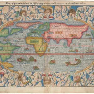
Statistical map of military, economic, and geopolitical resources during World War I.
Comparative Resources of the Belligerent Powers at the Outbreak of Hostilities.
$875
1 in stock
Description
This map is a variant of the World Map of War and Commerce that was published by the London Geographical Institute in British newspaper The Daily Mail in 1917. This example seems to have been issued by the American weekly newspaper Christian Herald (1887-2006), presumably following America’s entry into the war in April of that same year.
The map highlights the countries engaged in the conflict against the so-called Central Powers (i.e., Prussia and the Austro-Hungarian Empire). These include the British Empire and its vast colonial possessions, France and its colonies, the Russian Empire, Belgium and the Belgian Congo, Serbia and Montenegro, and the Japanese Empire. Conversely, the principal adversaries of the British Empire and its allies are Germany and Austria-Hungary.
On the North American continent, both the United States of America and Mexico are shown as neutral, a status they maintained until April 1917. This neutrality was later challenged by the infamous Zimmermann Telegram, in which Germany proposed an alliance with Mexico, offering territory such as Arizona, New Mexico, and Texas as incentives.
In addition to showing a world in the thralls of colonialism and “The Great War,” the map provides detailed insights into the war’s geopolitical and economic landscape. The viewer is offered a comprehensive overview of the belligerent powers, their military resources, population distributions, and economic status at the outbreak of hostilities in 1914.
Indexes of information
The map has considerable statistical information in various formats at the bottom. The “Naval and Military Resources” index in the lower left corner reveals significant disparities between the warring factions. The British Empire and its allies possessed nearly three times the number of effective fighting ships (1,238) that Germany and its allies commanded (442). Additionally, the allied forces boasted nearly double the armed personnel, with a combined strength of approximately 13 million against the 7.5 million of the Central Powers.
An analysis of the “Populations” index indicates stark differences in domestic versus colonial populations. The British Empire, for instance, had a relatively small population in the British Isles compared to its vast colonial territories. Similarly, the Russian Empire had a minimal population outside its core territories, while Belgium’s colonial population was significantly larger than its domestic populace. This index reflects the extensive reach and influence of European empires through their colonies.
The “Foreign Commerce” index highlights the United Kingdom as the country with the most significant total value of imports and exports at the outbreak of hostilities, underscoring its economic dominance. The United Kingdom also led in mercantile marine forces with 9,214 ships, followed by Germany, British Colonies, and France.
The “Food Supplies” index shows Russia in Europe as having the most extensive home acreage for cereals and potatoes, essential for sustaining wartime populations. In contrast, Japan had the smallest home acreage, relying more on imports and colonial supplies. The United States stood out as the largest producer of petroleum, a critical resource for the war effort. This further positioned it as an emerging global power despite its initial neutrality. The “War on German Trade” index provides insights into the economic warfare strategies, including the naval blockades that severely impacted German trade.
Cartographer(s):
George Philip (1800–1882) was a cartographer, map publisher and founder of the publishing house George Philip & Son Ltd.
Condition Description
References