A scarce 1930s Santa Barbara promotional booklet with two maps and an aerial photo fold-out.
Buenavista. Santa Barbara, California.
$975
1 in stock
Description
This is one of the most distinctive real estate booklets we have ever encountered. It was published around 1930 and promotes the proposed development of Buenavista in Santa Barbara, California. Buenavista is adjacent to Montecito, uphill from today’s Birnam Wood Golf Club.
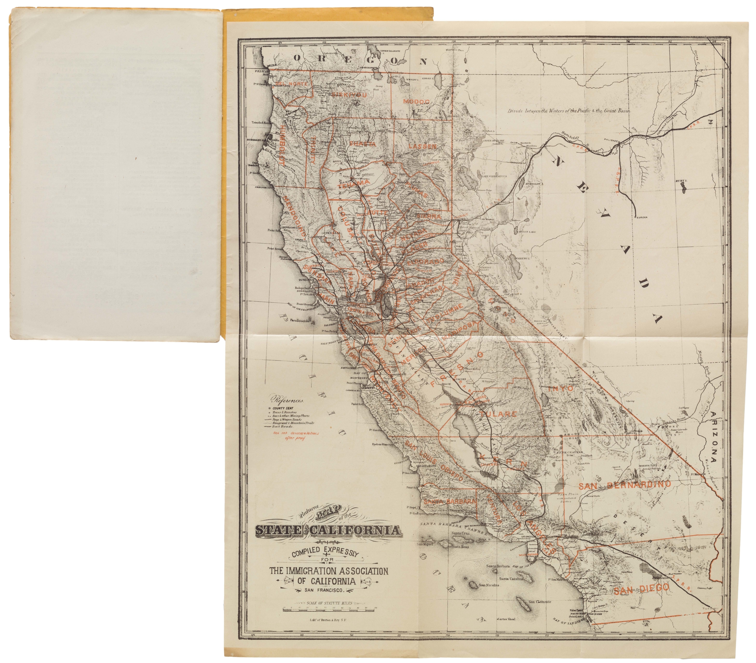
The booklet contains thirty-two pages, including two maps and one fold-out aerial photograph. In both the aerial photograph and the charming color view on the booklet’s cover, we get a sense of Santa Barbara’s bucolic, pre-development natural landscape.
One of the maps is City of Santa Barbara, California, showing Montecito and Hope Ranch Park, by Wallace Penfield. It depicts Santa Barbara in the style of an iconic early map, the Mercator-Hondius 17th-ntury map of Virginia. It features now-lost places like the Featherhill Ranch Zoo and the Cox Polo Field.
Census and rarity
This booklet was published by Owner’s Agents and Louis G. Dreyfus of Santa Barbara. It is a rare find, with no records on the private market and only three institutional holdings listed on OCLC (#82215427 & #725930707): California State Library, University of California, Santa Barbara, and Westmont College. The booklet is undated, but one of the maps is dated 1930.
Cartographer(s):
Louis G. Dreyfus was a prominent real estate developer in Santa Barbara during the late 19th and early 20th centuries. He played a significant role in the early development of the area, including the planning and selling of properties in Santa Barbara and Montecito. Dreyfus established his real estate business in Santa Barbara in the late 1800s and was instrumental in promoting the region as a desirable residential area. His work often involved mapping and developing large estates, particularly in Montecito, which helped shape the community into what it is today.
Wallace Clay PenfieldWallace Clay Penfield (1904-1975) was a notable mapmaker and surveyor in Santa Barbara who played a significant role in local development during the mid-20th century. He was the County Engineer in the 1940s and co-founded Penfield & Smith, a prominent civil engineering and surveying firm, in 1946. Penfield & Smith was responsible for numerous topographic, boundary, and planning surveys in Santa Barbara, Montecito, and the surrounding areas from the 1940s to the 1960s.
Condition Description
Very good. Some wear on the fold-out plate.
References