The Empire That Would Vanish in a Generation, Mapped at Its Height.
Schul-Wandkarte von dem Österreich-Ungarn [Politische Ausgabe].
$850
1 in stock
Description
This large school wall map of Austria-Hungary was designed by Vincenz von Haardt and produced by Eduard Hölzel’s geographical institute in Vienna, revised in 1893. It is the political edition of what was one of the standard classroom cartographic references for the Dual Monarchy, produced at a scale of 1:1,000,000 and intended to give students a comprehensive view of the empire and its neighbors at a moment when that empire still seemed permanent. Within a generation, the political boundaries it records would be erased entirely.
The Map in Detail
The map covers the entire Austro-Hungarian Empire from Bavaria and Silesia in the northwest to Bosnia-Herzegovina, Serbia, and the lower Danube in the southeast, with the Adriatic coast, Venice, and the Dalmatian shoreline visible in the lower left. The Hungarian plain is rendered in warm golden tones, the Alps and Carpathians in layered relief shading that gives the map considerable visual depth. The Danube and its tributaries are traced in blue throughout, forming the hydrographic spine of the composition. Cities are classified by population in the legend, from major centers of over 100,000 inhabitants down to towns of under 10,000, and roads, railways, and administrative boundaries are differentiated throughout. Vienna sits near the map’s center, its position reflecting both its geographic and political centrality to the empire it governed. The decorative border, a fine geometric pattern in the Viennese academic style, frames the composition on all four sides.
Historical Context
The Austro-Hungarian Empire of 1893 was a polyglot state of some fifty million people, encompassing Germans, Hungarians, Czechs, Poles, Slovaks, Slovenes, Croats, Serbs, Romanians, and Italians within a single political framework that had been stabilized by the Compromise of 1867. Vincenz von Haardt, one of the leading cartographers of the Viennese school and associated with the Imperial Military Geographical Institute, brought to this map the technical precision and geographic authority that had made Vienna one of the great centers of European cartography in the nineteenth century. Eduard Hölzel’s publishing house, founded in 1838 and specializing in educational materials, was the principal supplier of school atlases and wall maps to the empire’s educational system. Their collaboration produced classroom maps of exceptional quality, designed to instill in the empire’s students a legible image of the state they inhabited. The Bosnia-Herzegovina shown on this map had been occupied by Austria-Hungary since 1878 and would be formally annexed in 1908, a move that set in motion the chain of crises culminating in the assassination of Archduke Franz Ferdinand at Sarajevo in 1914 and the dissolution of the empire four years later. The world this map describes survived its revision date by barely twenty-five years.
Publication History and Census
This map was produced by Eduard Hölzel’s geographical institute in Vienna under the direction of Vincenz von Haardt, revised in 1893. It is dissected and mounted on linen in the standard format of the period’s school wall maps, intended for hanging in the classroom. Examples in sound condition are increasingly scarce, as the linen-backed format was subject to heavy use and the maps of dissolved empires were rarely preserved with care after 1918.
Cartographer(s):
Eduard Hölzel (1817–1885) was the founder of Vienna’s most important educational publishing house and geographical institute. Established in the 1840s, Hölzel’s firm became the principal supplier of school atlases, wall maps, and geographical reference works to the educational institutions of the Austro-Hungarian Empire, combining the technical resources of a professional geographical institute with a distribution network that reached classrooms across the monarchy. His most ambitious publication was the Physikalisch-Statistischer Hand-Atlas von Österreich-Ungarn, a landmark work of thematic cartography comprising forty maps of the empire across twenty-five plates. Hölzel died in 1885, but the firm he founded continued under his name through the remainder of the imperial period and well into the twentieth century, remaining one of the central institutions of Viennese cartographic publishing.
Vincenz von HaardtCondition Description
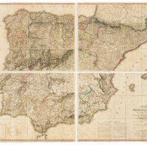
Very good. 16 folio sheets laid on linen. Some foxing. Staining along the edge.
References
Related products
-
-
Add to cart


- Europe, Italy, Bird's-eye-views
Venetia.
- $3,500
-
-
-