Mitchell’s iconic mid-19th century wall map of the United States
Mitchell’s New National Map Exhibiting the United States with the North American British Provinces, Sandwich Islands, Mexico and Central America, Together with Cuba and other West India Islands
Out of stock
Description
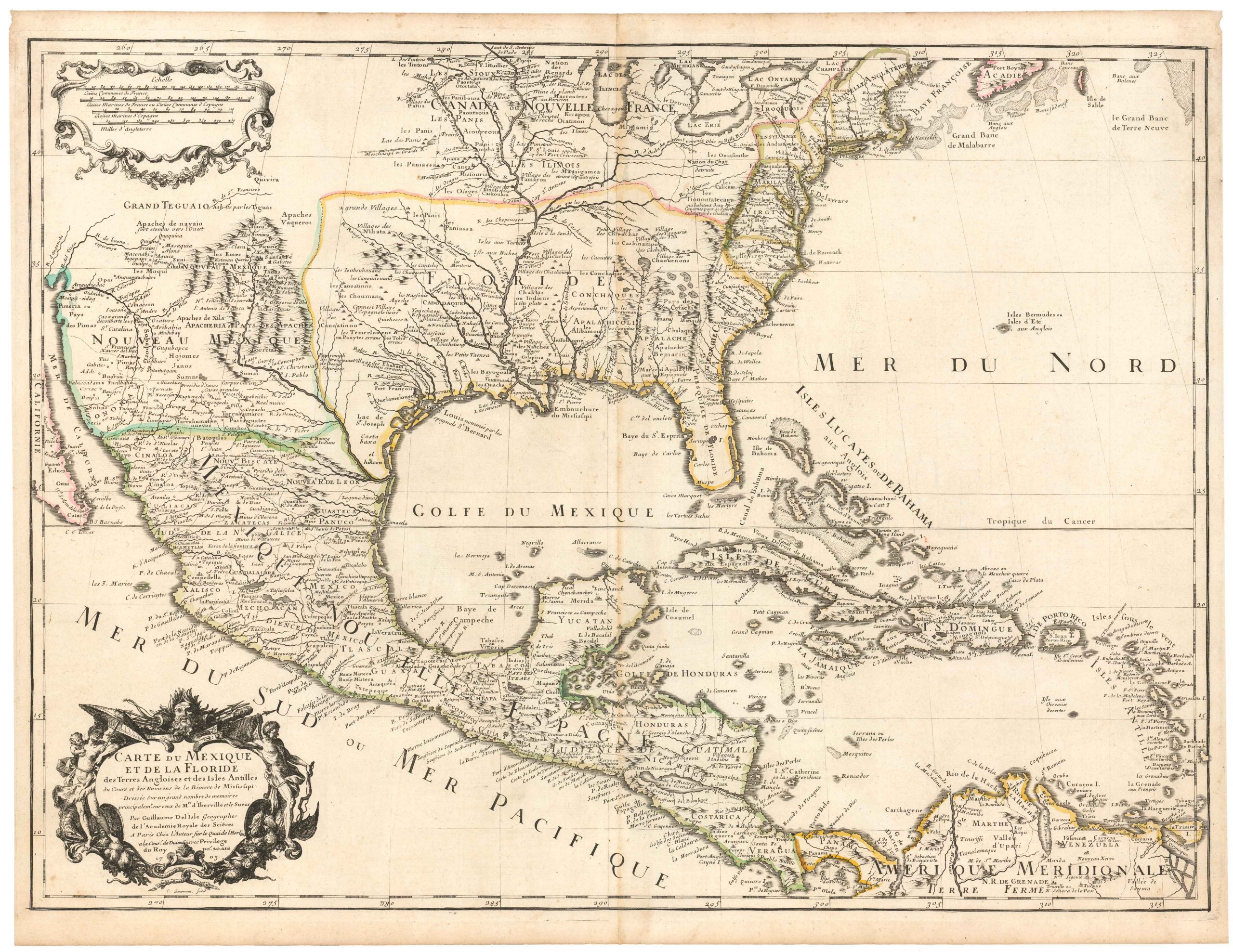
Beautiful large wall map of the U.S. extending through South America, with two inset maps of the world (double-hemisphere and Mercator’s projection), an inset of the Hawaiian islands, distance and population tables, and more. The map is framed by wide ornate floral borders and features four finely-engraved vignettes, thematic expressions of both the historical legacy and growing spirit of an expanding — as emphasized by the population tables — and powerful nation:
1) Landing of the Pilgrims Dec. 22nd. 1620
2) American Steamship Crossing the Atlantic
3) Columbus Ship Discovery of America Oct. 12th 1492
4) Clipper Ship Flying Cloud (which in 1854 set the world’s sailing record for the fastest passage between New York and San Francisco at 89 days 8 hours).
The map presents a compelling picture of an evolving West, capturing pre-Civil War territorial boundaries. The United States is now in a new phase of westward expansion. With the Treaty of Guadalupe, the Gadsen Purchase, and the creation of Oregon Territory all in the past, the years around the publication of this map were characterized by the drawing of territorial boundaries, the creation of new states, continued campaigns against native peoples, and the rise and fall of small-scale territorial rebellions.
New Mexico takes its well-known late 1850s form, with a lower strip (in the general area of the Gadsen Purchase), labeled Arizona. The same year as the publication of this map, the New Mexico territorial legislature adopted a resolution in favor of the creation of the Arizona Territory. The north-south border was to be defined along the 32nd meridian west from Washington, D.C. (which today defines the western boundaries of the State of Colorado and the State of New Mexico and the eastern boundaries of the State of Utah and the State of Arizona). A few years later, this area would be caught up in the broader U.S. Civil War, with the claiming of Arizona by the Confederacy and the mobilization of Union troops to the region.
Colorado is divided up between huge Utah and Kansas Territories; Utah also includes much of Nevada (Nevada Territory was not formally created until March 2, 1861).
In 1848, Oregon Territory was created out of the vast Pacific Northwest region disputed by British and French fur traders, and American settlers. Then Washington Territory was separated off in 1853. In our map, these extend east to the Continental Divide to meet a mega-Nebraska, which itself extends east to Dacotah, featuring an area near the Canadian border labeled Buffalo Region.
Engraved on four sheets.
Cartographer(s):
Samuel Augustus Mitchell (1790 – 1868) was an American geographer and bookseller. During the middle of the 19th century, he became the dominant commercial publisher of geographic materials in America.
Mitchell worked as a teacher of geography before turning to publishing, but he found the materials available to students both antiquated and lacking, so he decided to abandon teaching in favor of producing geographic textbooks and maps. He quickly became one of America’s greatest cartographic publishers and played a decisive role in making Americans aware of their country’s geography.
Condition Description
Some yellowing and light rubbing to map, fairly light staining at top and bottom portions and in margins. Subtle consolidation work applied by the experts at Zukor Art Conservation in Oakland, CA, including: repair to losses, and frayed edges with long strips of toned Japanese paper applied to edges without dowels, adhered with starch paste. These mends serve as a preventative measure to reduce further deterioration along exposed edges.
References