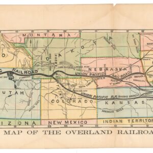
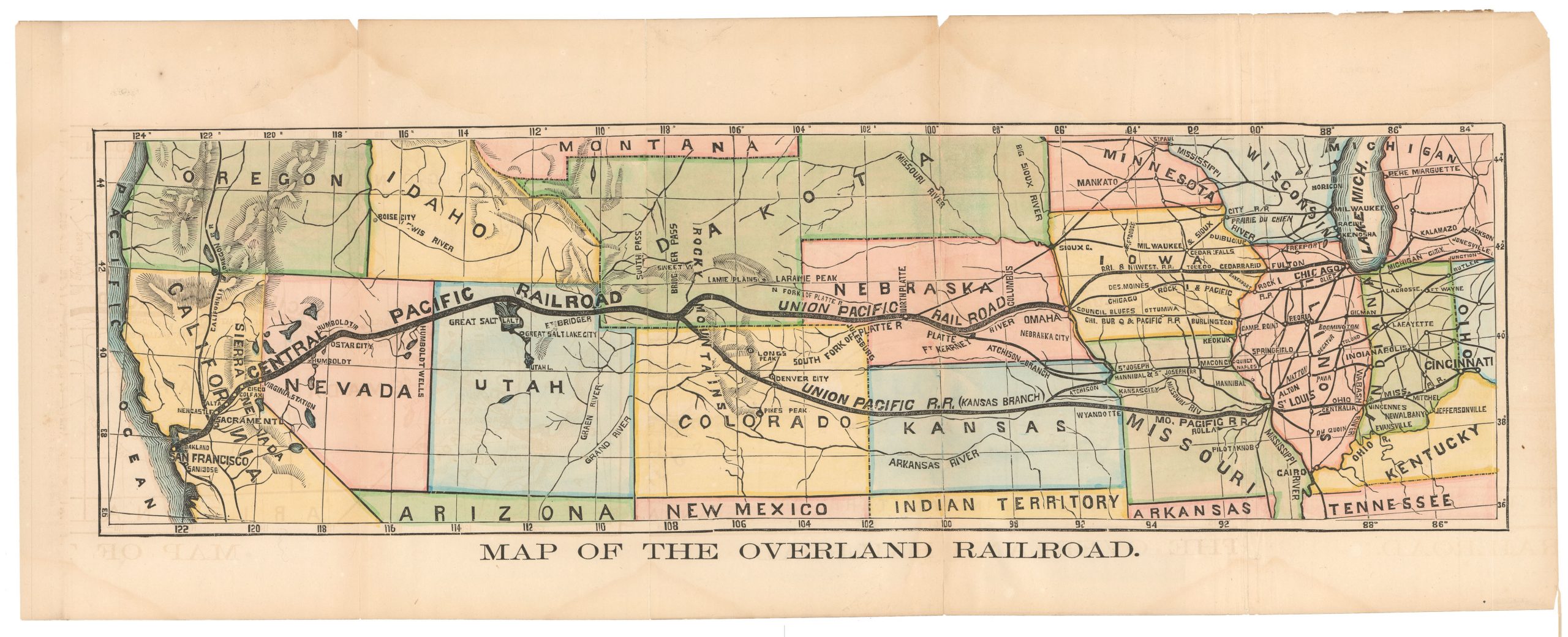
Stanford’s rare, monumental 1873 map of the U.S. with detailed, ephemeral geography of the West.
Stanford’s Map of the United States and Part of the Dominion of Canada
$1,400
1 in stock
Description
This is Edward Stanford’s large-format, hand-colored 1873 folding map of the United States and the southern portion of Canada.
The map, folding out to nearly 3′ x 5′, provides a tremendous level of detail on the two countries, both rapidly expanding westwards thanks, in large part, to expanding railway networks (traced in red), including the Transcontinental Railroad (Central Pacific and Union Pacific; a second American and first Canadian transcontinental route would not be completed until the 1880s, demonstrating the tremendous difficulties involved in constructing such a route, even with generous governmental support). These railroads were of special interest to a London audience as the City’s financiers held large quantities of the stock of many railroads abroad, including in the United States.
Many western states remain here as territories, including an undivided Dakotah Territory. Ephemeral territorial arrangements are also evident, such as the northern portion of Idaho being split between Washington and Montana, and the northwestern border of Wyoming extending further than its ultimate extent (Yellowstone National Park had been founded the year before, but is not reflected here). Some unconventional placenames appear as well, such as the “Hippewayan Chain” of the Rocky Mountains in Montana, while many short-lived mining boomtowns are marked in the American West. Other interesting details and explanatory notes appear in the West, including one about ‘the Desert’ west of the Great Salt Lake (derived from Howard Stansbury’s seminal map of the Utah Territory). There is a large inset of Nova Scotia and Newfoundland at right, below which the Bahamas are displayed prominently.
The map is a beautifully hand-colored lithograph, produced in the years just before chromolithography became widespread. It is dissected and laid on linen for folding into an original cloth slipcase with the publisher’s paper label attached. Stanford produced this map in several editions between 1870 and 1875. We have been unable to locate any other examples of this February 1873 edition, while the David Rumsey Historical Map Collection/Stanford University and the State Historical Society of North Dakota State Archives hold examples from 1875 and Yale University’s Beinecke Library holds an 1870 example.
Cartographer(s):
Edward Stanford (1827-1904) was a prominent British cartographer and entrepreneur who founded Stanford’s, a map-selling business that became one of the most significant map publishing companies in the 19th and 20th centuries. Established in 1853, his London-based shop was renowned for its extensive range of topographic and thematic maps.
Stanford’s attention to detail and dedication to producing accurate, up-to-date maps made his firm the official map supplier to the British government during several notable expeditions. In addition to supplying explorers, the general public, and various institutions with reliable maps, Stanford’s legacy also includes the notable “Stanford’s Library Map of London and its Suburbs,” which was acclaimed for its precision. The brand he founded remains respected in the cartographic world and has also expanded into travel books and accessories.
Condition Description
Slipcase faded with some rubbing; map with ink smudge at right edge, near fine.
References