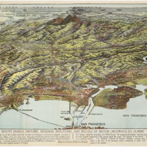
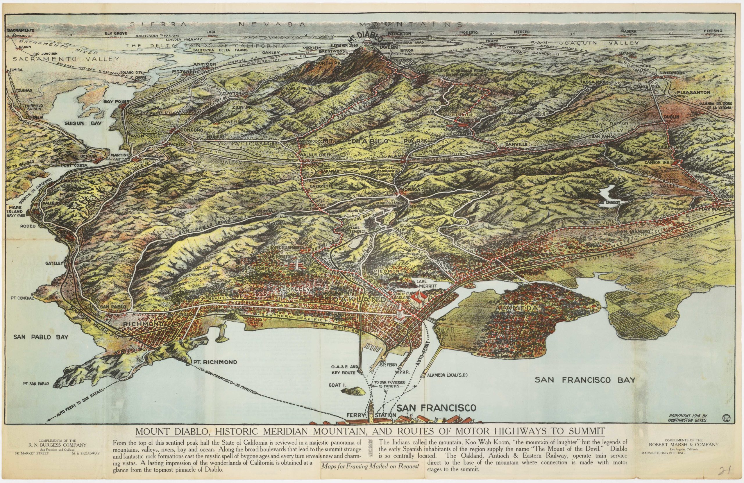
1857 United States Coast Survey map of old San Antonio Creek watershed and Oakland.
San Antonio Creek California
Out of stock
Description
United States Coast Survey chart showing depths in the San Francisco Bay, the cities of Oakland and Brooklyn, and the road to San Jose.
San Antonio Creek is, these days, more commonly called Oakland Estuary, or just the Oakland Inner Harbor. The northeast shore of Alameda also drains into San Antonio Creek. But, because Alameda is built on a sand dune, the soil is so porous that there were never any creeks in Alameda. The historic portions of West Oakland are also built on a dune and were devoid of creeks.
The triangulation for this chart was accomplished by R. D. Cutts. The topography is the work A. F. Rodgers. The Hydrography was completed by a party under the command of James Alden. The entire work was produced in 1857 under the direction of A. D. Bache, superintendent of the United States Coast Survey.
Cartographer(s):
The Office of Coast Survey is the official chartmaker of the United States. Set up in 1807, it is one of the U.S. government’s oldest scientific organizations. In 1878 it was given the name of Coast and Geodetic Survey (C&GS). In 1970 it became part of the National Oceanic and Atmospheric Administration (NOAA).
The agency was established in 1807 when President Thomas Jefferson signed the document entitled “An act to provide for surveying the coasts of the United States.” While the bill’s objective was specific—to produce nautical charts—it reflected larger issues of concern to the new nation: national boundaries, commerce, and defense.
Alexander Dallas Bache, great-grandson of Benjamin Franklin, was the second Coast Survey superintendent. Bache was a physicist, scientist, and surveyor who established the first magnetic observatory and served as the first president of the National Academy of Sciences. Under Bache, Coast Survey quickly applied its resources to the Union cause during the Civil War. In addition to setting up additional lithographic presses to produce the thousands of charts required by the Navy and other vessels, Bache made a critical decision to send Coast Survey parties to work with blockading squadrons and armies in the field, producing hundreds of maps and charts.
In 1871, Congress officially expanded the Coast Survey’s responsibilities to include geodetic surveys in the interior of the country, and one of its first major projects in the interior was to survey the 39th Parallel across the entire country. Between 1874 and 1877, the Coast Survey employed the naturalist and author John Muir as a guide and artist during the survey of the 39th Parallel in the Great Basin of Nevada and Utah. To reflect its acquisition of the mission of surveying the U.S. interior and the growing role of geodesy in its operations, the U.S. Coast Survey was renamed the United States Coast and Geodetic Survey (USC&GS) in 1878.
Condition Description
A little darkening along folds, a small hole at fold intersection, very good.
References