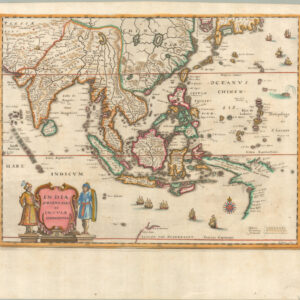
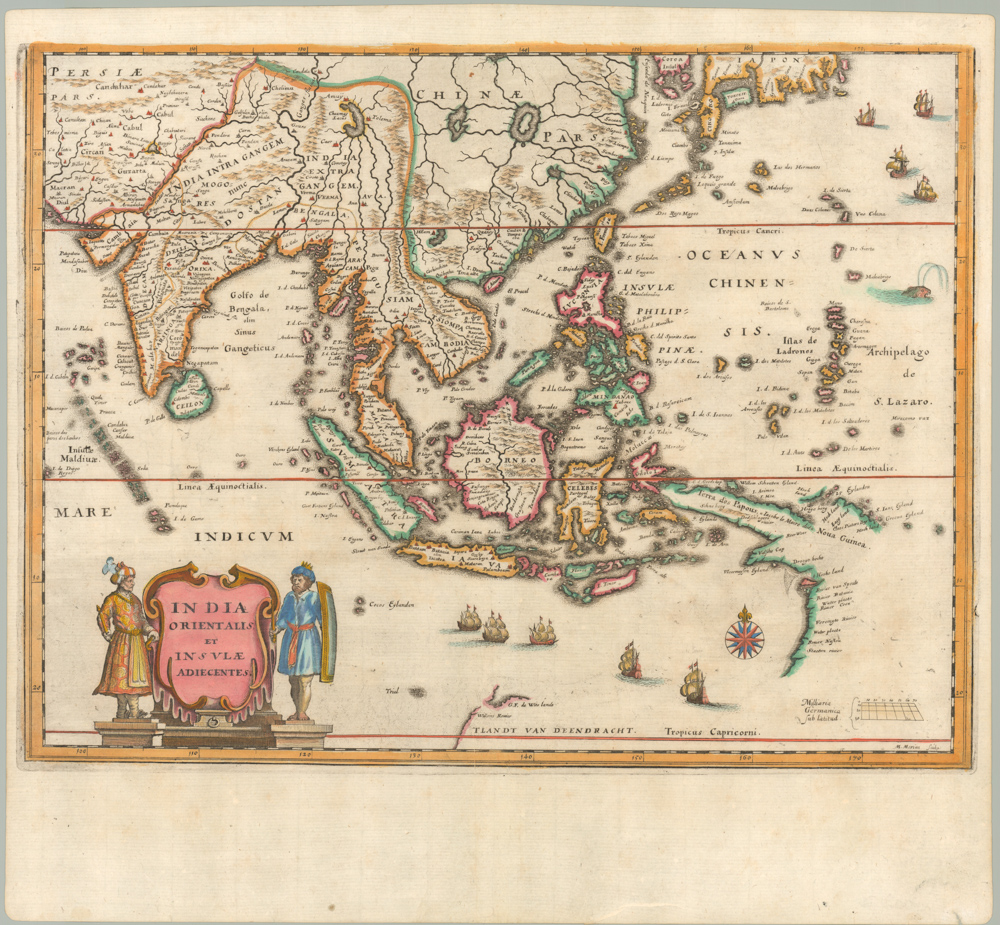
1590 Ortelius map of Southeast Asia in original colors
Indiae Orientalis, Insularumque Adiacentium Typus
Out of stock
Description
Fine example of Ortelius’s map of southeast Asia, Japan, and the Philippines. The map includes Beach and other information drawn from Marco Polo, as well as portions of the west coast of North America, including several mythical names in California. It is based upon Mercator’s world map of 1569. Sumatra and Java are heavily oversized, and the Philippines are incomplete and without the Northern island of Luzon. The mermaids are based on those occurring on Diego Gutierrez map of America.
Cartographer(s):
Abraham Ortelius (1527-1598) was born in Antwerp to Flemish parents in 1527. After studying Greek, Latin, and mathematics, he and his sister set up shop as book dealers and a ‘painter of maps.’ In his heart, Ortelius was, nevertheless, first and foremost a historian. He believed geography was the ‘eye of history,’ which explains why he collected maps and historical documents with such passion. Ortelius traveled widely in pursuit of his interests, building contacts with mapmakers and literati all over the European continent.
Ortelius reached a turning point in his career in 1564 with the publication of a World Map in eight sheets, of which only a single copy survives. In 1570, he published a comprehensive collection of maps titled Theatrum orbis terrarum (Theatre of the World). The Theatrum is conventionally considered the first modern-style atlas. It was compiled by collecting maps and charts from colleagues across the continent, which Ortelius then had engraved in a uniform size and style. The engraver for most of the maps in Theatrum was none other than the famous Frans Hogenberg, who also served as the main engraver for the 16th-century urban atlas Civitates Orbis Terrarum, published with Georg Braun in 1572.
Hogenberg’s re-drawn and standardized maps formed the basis of the first atlas in history (even though it was Mercator who was the first to use the term a few decades later). Unlike many of his contemporaries, Ortelius noted his sources openly and in the first edition, acknowledged no less than eighty-seven different European cartographers. This ‘catalogus auctorum tabularum geographicum‘ is one of the major innovations of his atlas. The list of contributing mapmakers was kept up-to-date for decades after Ortelius’ death. In the first edition of 1570, this list included 87 names, whereas the posthumous edition of 1603 contained no less than 183 names.
While compiled by Abraham Ortelius in the manner described above, the Theatrum was first printed by Gielis Coppens van Diest, an Antwerp printer experienced with cosmographical books. Van Diest was succeeded by his son Anthonis in 1573, who in turn was followed by Gillis van den Rade, who printed the 1575 edition of Ortelius’ atlas. From 1579, Christoffel Plantin took over, and his successors continued to print Theatrum until Ortelius’ heirs sold the copperplates and the publication rights to Jan Baptist Vrients in 1601. In 1612, shortly after Vrients’s death, the copperplates passed to the Moretus brothers.
Condition Description
Good condition, with restoration to some small marginal tears and a longitudinal tear.
References
Broecke, Marcel Van den. Ortelius Atlas Maps: an illustrated guide. Houten: Hes & de Graaf, 2011, p. 166.
Related products
-
-
Add to cart
- Asia, Pictorial maps
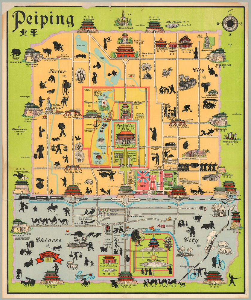
Peiping
- $1,250
-
-
-