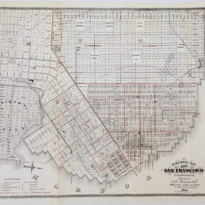
The 1851 Ringgold chart of the Sacramento River with Sacramento-Boston inset.
Chart of the Sacramento River From Suisun City to the American River California
Out of stock
Description
Gold Rush era chart of the important transportation network to mining regions extending from Suisun City to Sacramento, with extensive detail along the Sacramento River — even the names of early land owners are plotted.
The map features large inset plans of Sacramento and Boston, Suisun City, and the confluence of the Middle and West Forks of the river, as well as three profile views with sailing vessels from the Sacramento River.
Cartographer(s):
Cadwalader Ringgold (August 20, 1802 – April 29, 1867) was an officer in the United States Navy who served in the United States Exploring Expedition, later headed an expedition to the Pacific Northwest and, after initially retiring, returned to service during the Civil War. During 1838–42, he was third in command of the United States Exploring Expedition in the Pacific, commanding Porpoise from 1840 at the invitation of the head of the project, Charles Wilkes. He carried out surveys of Antarctica, the South American coast, the Tuamotu Islands, Tonga, New Zealand and the Northwest Pacific coast of North America.
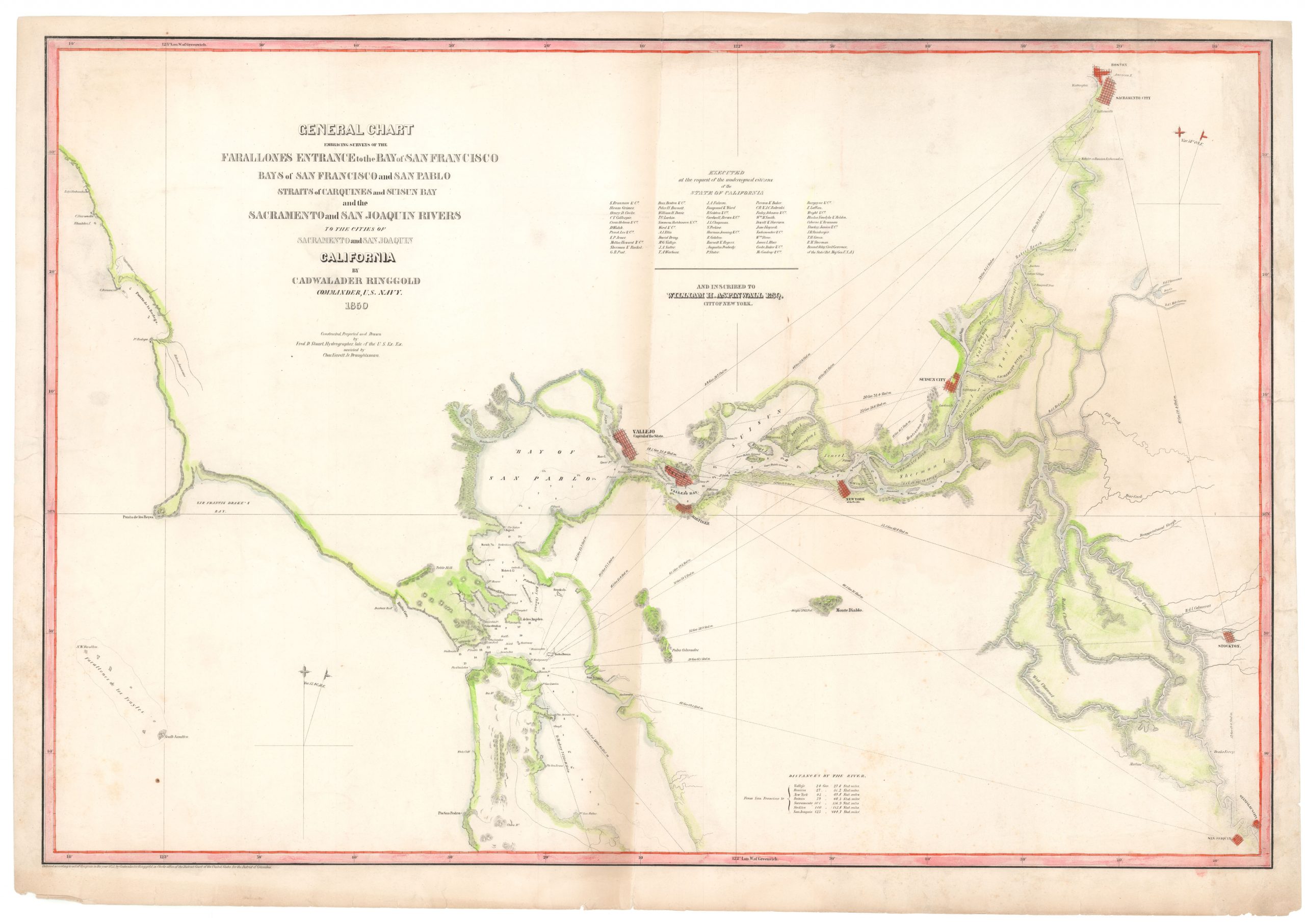
Ringgold was promoted to commander on July 16, 1849 and began the definitive survey of the San Francisco Bay region, suddenly important because of the discovery of gold in the area. Ringgold both built on previous surveys, most notably Frederick Beechey’s 1833 chart, and undertook a new series of triangulation and azimuth efforts, beginning at modern-day Pittsburgh, CA (then known as the ‘New York of the Pacific’). After the California surveys, Ringgold helped Navy officials choose a location for a dockyard for the Navy’s Pacific station. It later became the Mare Island Navy Yard.
In 1851, Ringgold published a series of charts, views, and sailing directions for the entrance to San Francisco Bay and the inland waterways of gold rush California. The charts paint an important picture of the region during a time of tremendous change.
Condition Description
Expertly backed, with left margin completed.
References
Woodbridge, p. 42-4; Cowan p.533; Howes R303; Kurutz 536e; Streeter 2679 (1st ed).