Extensively detailed map of San Francisco and the East Bay
San Francisco Quadrangle (Topography)
Out of stock
Description
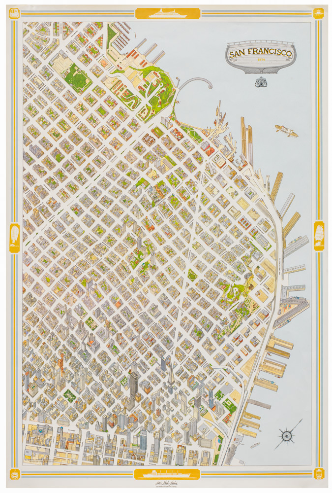
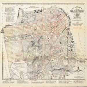
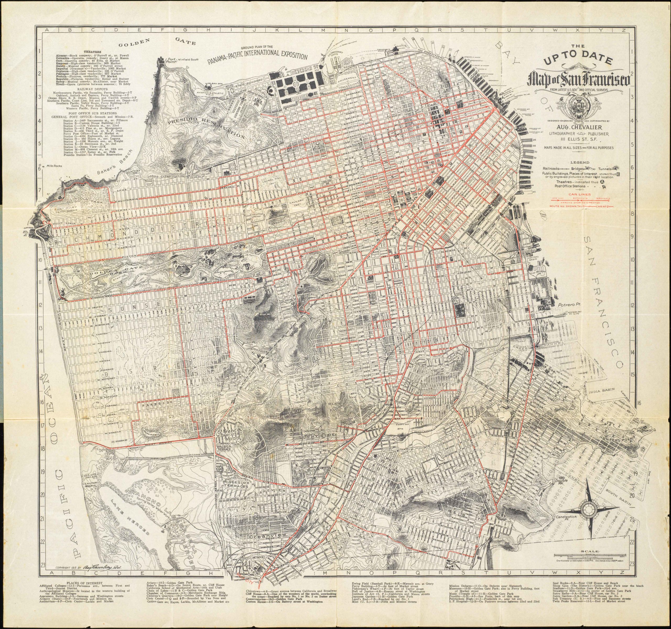
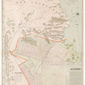
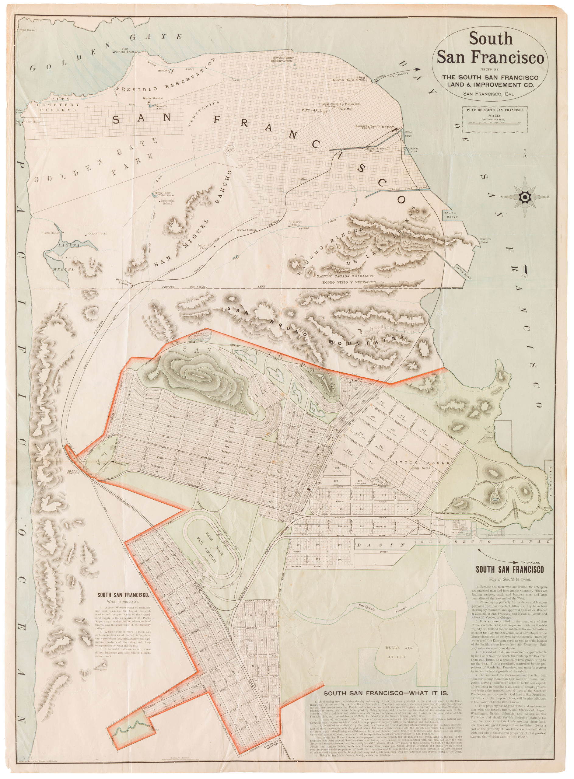
Nice, detailed map of San Francisco and the East Bay, extending north to San Pablo Bay. San Francisco, Oakland, Berkeley, and Alameda are all plotted down to the street and building level. Railroad and ferry lines are shown.
Because the cartographic data dates to the year 1899, the map offers a pre-1906 Earthquake representation of San Francisco.
This map is part of the USGS’s 15 Minute Quadrangle series, produced from the 1890s to the 1950s in order to provide a detailed topographic map coverage of the entire United States at the same scale.
Cartographer(s):
Created by an act of Congress in 1879, the United States Geological Survey (USGS) is a scientific agency under the U.S. government whose purpose is to investigate, survey, and map the United States territory, including natural resources and any potential threats to the depicted habitat. The organization has evolved over time, gradually adapting to the progress of science and technology.
The USGS is the only science-based agency under the Department of the Interior, and its responsibilities fall within the disciplines of biology, geography, geology, and hydrology. The USGS is considered the best authority on domestic questions relating to these subjects, and often their maps will cover several or all of these themes in the same chart.
Condition Description
Wear and discoloration along fold lines.
References