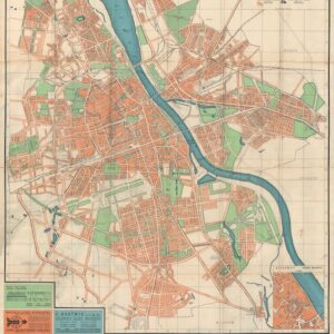
A fine overview of the history of Poland’s boundaries in the second half of the 18th century.
A New Map Of The Kingdom of Poland with its Dismembered Provinces and the Kingdm. Of Prussia
Out of stock
Description
This is a fine map of Poland, showing the provinces stripped from its control at the end of the 18th century. It was drawn by Thomas Kitchin and was published by Laurie and Whittle in London one year before the Third Partition of Poland, the last in a series of the Partitions of Poland and the land of the Polish–Lithuanian Commonwealth among Prussia, the Austrian Empire, and the Russian Empire which effectively ended Polish–Lithuanian national sovereignty until 1918.
The map covers an area from Brandenburg to Russia, and from the Gulf of Livonia to Moldova and Hungary, covering all of Poland and the Grand Duchy of Lithuania, and portions of Prussia, Russia, Livonia, Hungary, Germany and Austria.
Cartographer(s):
Robert Laurie (c. 1755–1836) was an Anglo-Scottish mezzotint engraver and publisher. Early in 1794, in partnership with James Whittle, he succeeded to the business carried on by Robert Sayer at the Golden Buck in Fleet Street, London as a publisher of engravings, maps, charts, and nautical works.
Condition Description
General wear, some soiling along the centerfold.
References


![[PRAGUE] Wahrhaffte Contrafactur der Weit Berühmbten Königlichen Haupt Statt Prag in Böhmen, Wie Solche Jetziger Zeit im Wesen Steht / Praga.](https://neatlinemaps.com/wp-content/uploads/2023/03/NL-01567_thumbnail-300x300.jpg)
![[Title in Russian] Russian Empire in the 18th Century (European Section)](https://neatlinemaps.com/wp-content/uploads/2020/04/NL-00822_Thumbnail-300x300.jpg)
![[Title in Russian] Russian Empire in the 18th Century (European Section)](https://neatlinemaps.com/wp-content/uploads/2020/04/NL-00822-scaled.jpg)
![[Title in Russian] Russian Empire in the 18th Century (European Section)](https://neatlinemaps.com/wp-content/uploads/2020/04/NL-00822-scaled-300x300.jpg)