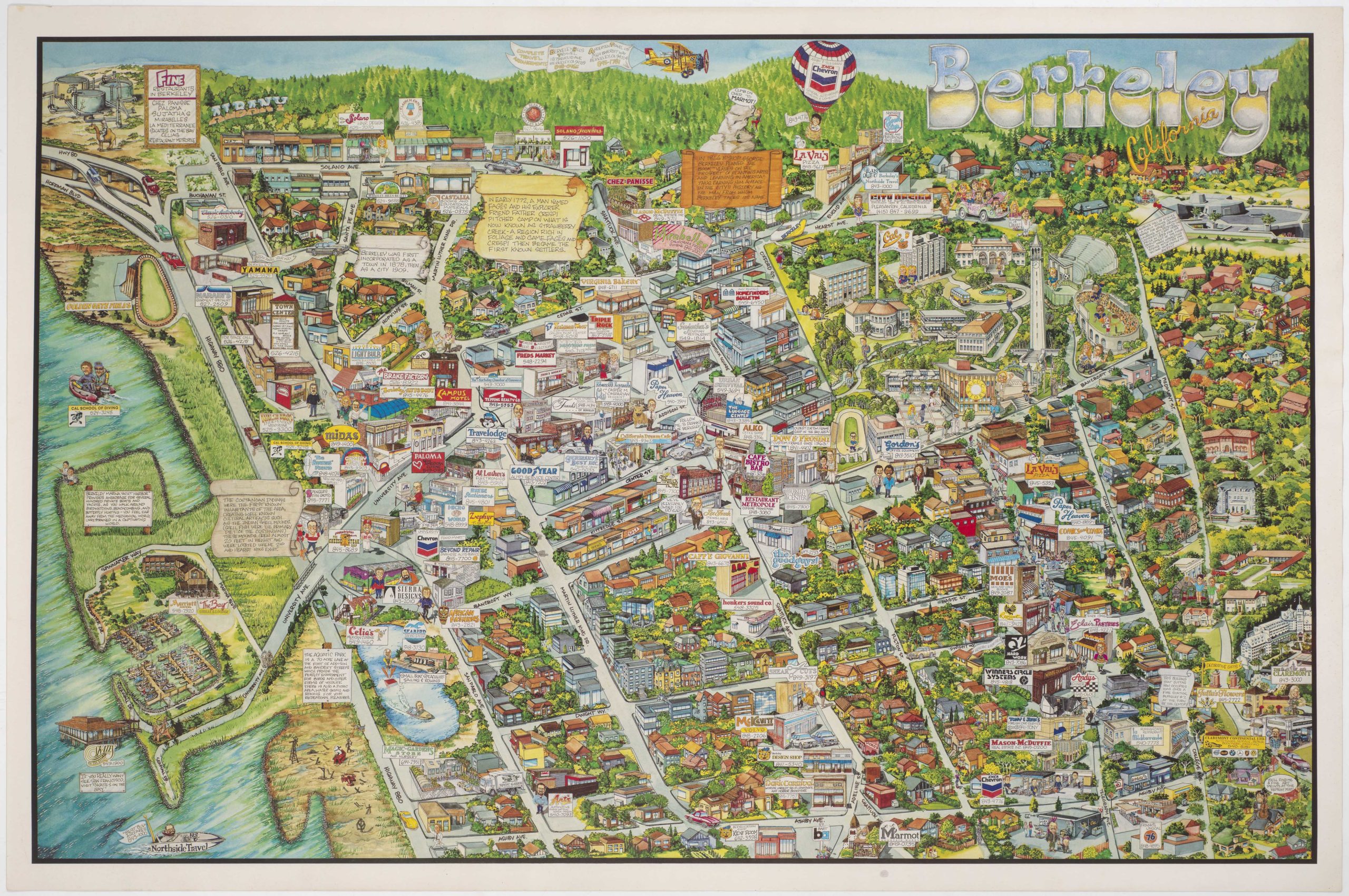
1990 Alameda business map with illustrations of individual owners — perhaps you know someone on the map?
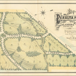
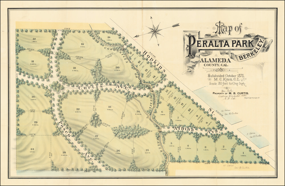
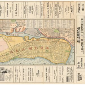
Alameda
$545
1 in stock
Description
This promotional map of Alameda features a clever distortion of perspective to fill the majority of the map with Alameda Island. The viewer looks west; beyond Alameda San Francisco Bay is reduced in size and shape such that the Bay and Golden Gate Bridges are almost on top of each other. This cartographic trick allows for a detailed presentation of business and professional services.
Maps promoting local commercial interests became popular in the 1980s and 1990s, but this is the rare map that also has caricatures of the business owners themselves. Check it out and enjoy!
Alameda is a city in Alameda County, California, United States. It is located on Alameda Island and Bay Farm Island. It is adjacent to and south of Oakland and east of San Francisco across the San Francisco Bay.
Alameda occupies what was originally a peninsula connected to Oakland. Much of it was low-lying and marshy. The higher ground nearby and adjacent parts of what is now downtown Oakland were the site of one of the largest coastal oak forests in the world. Alameda is Spanish for “grove of poplar trees,” or “tree-lined avenue.” It was chosen as the name of the city in 1853 by popular vote.
Cartographer(s):
Condition Description
Wear along the edges.
References
![The Original Silicon Valley Map & Calendar [1994]](https://neatlinemaps.com/wp-content/uploads/2021/06/NL-00909_Thumbnail-300x300.jpg)
![The Original Silicon Valley Map & Calendar [1994]](https://neatlinemaps.com/wp-content/uploads/2021/06/NL-00909_Thumbnail.jpg)