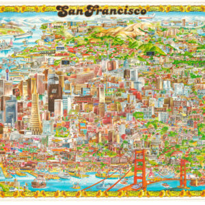
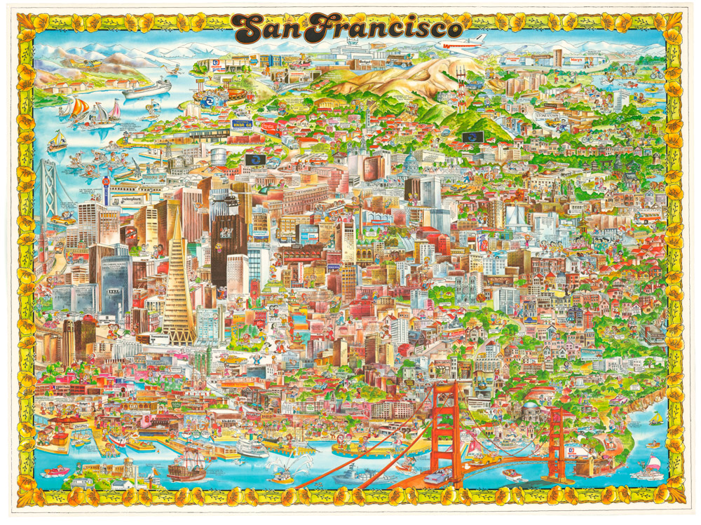
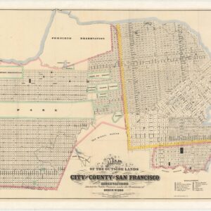
A Pillsbury Picture Company panorama highlighting the 1906 destruction of San Francisco’s City Hall.
[1906 EARTHQUAKE PANORAMA – CITY HALL]
Out of stock
Description
This deeply melancholic panorama photograph encapsulates the physical destruction of San Francisco in the 1906 earthquake. We see an extensive ruin field interspersed with the skeletal remains from standing facades. Many recognizable San Francisco landmarks are depicted, including the prominent ruins of City Hall.
Old City Hall was located at 8th and Market Street, the present-day site of the main branch of the San Francisco Public Library. The post-Earthquake image of the empty shell of this building quickly became world famous, both because it represented the destruction of a great city and the inability of authorities to mitigate this disaster, but also because of the picturesque way in which the building had collapsed; it’s splendid dome still balancing in place on its steel scaffolding, creating a dramatic scene that embodied what the city had gone through and lost.
The central tower is surrounded by utter destruction and collapse. The only part of the original complex that survived more or less intact was the lower domed rotunda east of the main hall, known as the Hall of Records. This building was largely unscathed by the earthquake itself, but was badly damaged by the subsequent fires. When plans were made to rebuild City Hall in a slightly different spot (two blocks down), the Hall of Records was demolished along with the rest of the complex. City Hall was of course rebuilt. The building in use today was completed in time for the 1915 opening of the Panama Pacific International Exposition and was modeled on the United States Capitol. On the site of the original town hall stands the San Francisco Public Library.
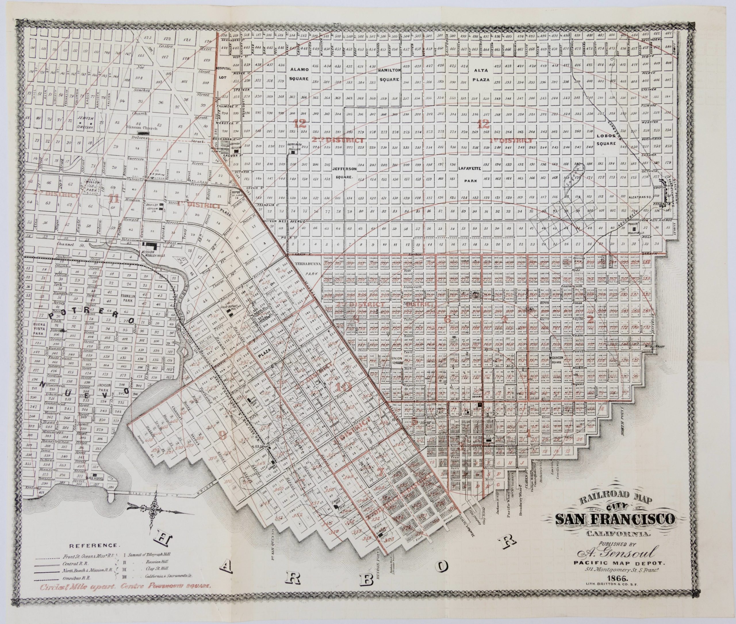
With the ruins of City Hall so prominent in the image, it is easier to identify exactly what the rest of the scene constitutes. Being a panoramic image, orientation is of course somewhat distorted. Nevertheless, it is clear from the image (and confirmed by an annotation at the bottom of the image) that the vantage point for this photograph was from the roof of a building on Market Street itself, probably near 7th street and quite possibly from the Grant Building, as this was a favored location for photographers trying to capture the cataclysmic atmosphere of post-earthquake San Francisco.
The bustle and commotion of Market Street is clear along its eastern extension in the right side of the panorama. Looking east along this axis, one sees the Call Tower’s iconic dome in the distance, indicating Union Square. Immediately to the right of this, along a street that runs perpendicular to Market Street, we find a clear depiction of the Old Mint and its double chimneys in the courtyard.
Background
Essentially, this is an image of a city destroyed. It conveys with uncompromising clarity the magnitude of destruction and suffering following the 1906 earthquake. Consequently, it might be helpful to provide a little background on the earthquake meant and what it meant for the history of San Francisco.
The San Francisco earthquake struck in the early morning hours of April 18th 1906. It preceded the Richter scale by which we measure earthquakes today by three decades, but calculations have since shown that its force would have been equivalent to about 7.9 on the Richter scale and a Mercali Intensity of XI (extreme). Soon after the tremors had abated, more than thirty fires broke out across the city and raged for four days. Most of these were caused by the raptured gas mains, but in some cases they were inadvertently started by local firefighters. The fires burned intensely hot and since most residential buildings were built of timber and brick, entire neighborhoods burned completely to the ground. It has been estimated that 90% of the total destruction caused by the earthquake resulted from the fires.
When it was all over, more than 80% of the city had been destroyed and more than 3000 people had lost their lives. The quake was felt as far away as Nevada, Oregon, and Los Angeles. Modern seismologists still debate the exact epicenter, but most agree that it was just off the coast, northwest of the Golden Gate. The extent of the damage meant that two thirds of the population became refugees overnight, and tents and shacks soon began to shoot up in the Presidio, Golden Gate Park, and North Beach. Eventually, many of the refugees moved across the Bay to Oakland and Berkeley. Important San Francisco landmarks were lost, including the famed Palace Hotel and old City Hall.
In addition to the immediate and short-term impact on the city, the earthquake also had long-term consequences. In 1906, San Francisco was not only the largest and most populous city on the West Coast, but it was also the most important port and bridgehead for American mercantile interests in the Pacific and Asia. Much of this dynamism was lost due to the earthquake. The sheer destruction of basic infrastructure and the chaotic conditions to supply a work force made maritime engagements difficult. As a result, a lot of trade was diverted south to Los Angeles, and with it followed money and people. In effect, and despite an impressively efficient rebuilding process, San Francisco lost its position as California’s major urban center to Los Angeles, and would not regain it again. This shift has come to characterize San Francisco and most of its contemporary inhabitants would have it no other way. Yet it is a powerful reminder of how easily trajectories change.
The process of rebuilding the city was a long and arduous one. While civic leadership began planning the process immediately, finding the necessary funding proved extremely difficult. There was only a single bank in San Francisco that was willing and able to provide the scope of funds needed for the extensive re-building plans. The Bank of Italy had been founded by Amadeo Giannini, an Italian immigrant who had settled in North Beach. He became a great patron of the reborn San Francisco, providing the city itself with much-needed loans and paying for building materials from his own pocket. Years later, the bank would be renamed Bank of America, which it still is known as today.
Due to the nature of the devastation and the difficulties in acquiring both funds and materials for the rebuilding, the process took time. But by 1915 the city had recovered to such a degree that it hosted the Panama Pacific International Exposition; a world fair that celebrated the opening of the Panama Canal that summer. This event showcased the city as a hub of modernity where one could experience the concrete results of technological advancement (incl. a cross-country phone line and the actual Liberty Bell). The exposition proved beyond any doubt that San Francisco had regained its former glory and perhaps now even outshone its former self. For the occasion of the exposition, a glamorous and monumental neighborhood of representative pavilions was constructed along the northern waterfront. Not much remains today, so to get a glimpse of just how impressive the new San Francisco would have been, we are relegated to the Palace of Fine Arts, the most important and imposing of the exposition buildings still standing.
Cartographer(s):
The Pillsbury Picture Company was founded in the spring of 1906, just a month before the earthquake hit. Its serendipitous timing propelled the company to fame and made the Pillsbury stock relevant across America and the world. It was founded by Arthur C. Pillsbury, a disgruntled photojournalist, after he quit his job with the San Francisco Examiner. Pillsbury was renowned for his innovative approach to photography and visual communication. Part of Pillsbury’s success in the wake of the catastrophe was that the company was based in his Oakland home. Here he had set up equipment and darkrooms and could run the entire operation. Because his company, unlike most official press outlets, was not based in San Francisco proper, Pillsbury was quickly able to corner the market. His innovative approach to photography no doubt helped him cement that position.
Pillsbury became famous through his images, but locally he had also won recognition as an uncompromising and innovative photographer. He had made his way into the city admits the ongoing aftershocks and was consequently able to circulate some of the earliest images of the calamity. Pillsbury made a significant amount of money on his earthquake images; in particular his early photos were highly sought after by newspapers around the world. The money he earned from these photographs was spent building his new Three Arrows studio in Yosemite.
Over time, the Pillsbury Picture Company became the largest distributor of post cards on the west coast and later went into film production as well (including the first time-lapse and underwater films). Pillsbury also went on to develop his own cameras, often refusing to patent innovations, because he wanted his inventions to benefit all photographers. In general, Arthur C. Pillsbury was one of the most innovative and productive geniuses in America when it comes to photography and film. His legacy is one of accomplishment, and since it all began with the 1906 earthquake, he has come to represent the resilience and greatness of San Francisco and her people.
Condition Description
Good. On photographic paper. Lower edge marginally trimmed. Some spotting and soiling due to old framing. Left side, small spot of damage on border. Some discolorations on left side. Overall, a striking image.
Newspaper fragments recovered when we unframed the map suggest it was framed and displayed just weeks after the earthquake.
References