The greatest and grandest pictorial map of San Francisco, representing the best of Roaring Twenties cartographic wit and optimism.
Map of San Francisco Showing Principal Streets and Places of Interest
Out of stock
Description
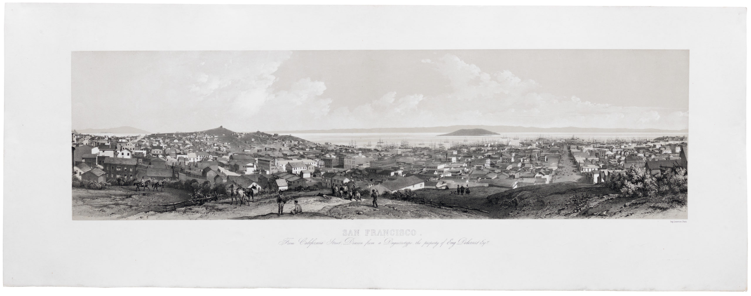
Charming and amusing pictorial map of San Francisco in the 1920’s. One of the most attractive cartographs of San Francisco, which is touted as “The City That Knows How” and “The Ideal Convention City.”
Godwin’s map is perhaps the largest and most profusely illustrated of all pictorial maps of San Francisco, with comic characters depicting different aspects of the city, a cowboy getting bucked off a horse, a couple dancing an exaggerated Charleston, dozens of whimsical vignettes with explanation text, illustrating both the modern city of San Francisco and its early history, including the 1906 San Francisco earthquake and fire.
The streets, parks, local churches, schools, and government buildings are drawn to show the visitor. Includes figures and information related to population, industry, products and postal services, and lists of banks and theaters.
This post, from the Richmond District Blog, explores some of the details on the map:
At the northwestern edge of the city, a group of men are lined up to play the Lincoln Golf Course, and the shipwrecks off of Land’s End are marked (steamships Lyman Stewart in 1922 and Coos Bay in 1927). The map also shows the Mile Rock lighthouse, complete with the caretaker’s residence on top of it.
The Lurline Pier, which used to carry water from the Pacific all the way to downtown saltwater pools, is pictured on the north end of Ocean Beach with divers jumping off it. And a tourist is perched atop Sutro Heights Park taking pictures over the Cliff House. A man waves his arm atop a rollercoaster at Playland. There are wonderful details in Golden Gate Park, including bison, a pole vaulter at the Polo Fields, a man picking fruit on Stow Lake’s Strawberry Hill, and various figures reclining around the park reading or snoozing.
Not far from what is now the Landmark Apartments just inside the 15th Avenue Presidio gate is a Blimp Hangar. This alludes to a short-lived experiment by the Coast Artillery to send spotters up in tethered balloons to communicate with the shore batteries about how accurate their projectiles landed in the water during target practice. The westerly winds and bobbing gondolas made the spotters sea sick and led the project to be abandoned. The balloons were stored in a hanger at the open lot off Lincoln Blvd., east of the 25th Ave. entrance, later converted to the army motor pool.
The Schmidt Lithography Co. was once the largest printing company on the West Coast.
Cartographer(s):
Harrison Godwin (1899 – 1984) was an American cartoonist and map illustrator active in California during the first half of the 20th century.
Schmidt Label & Litho. Co.The Schmidt Label & Lithography Company was an American publishing house based in San Francisco and which specialized in the printing of labels (although separate prints also were issued). It was founded in 1873 by a German immigrant, Max Schmidt. Schmidt was one of the first West Coast printers to use the lithographic technique, giving him a distinct advantage over his competitors and cementing his success. By the 1890s, he ran a factory in the city as well as branches in Portland and Seattle. Despite facing severe set backs, including several fires and the complete destruction of his plant in the 1906 earthquake, Schmidt was an extremely resilient and innovative businessman. Within a few years of the 1906 devastation, the Schmidt Company had become one of the largest printing houses on the West Coast.
Condition Description
Professionally backed on poster linen for preservation and display. General wear.
References
Rumsey 8102.000.
![5-sheet set showing San Francisco’s post-1906 earthquake water supply [SF’s first fireboat!]](https://neatlinemaps.com/wp-content/uploads/2022/03/NL-01375-sheet-4_thumbnail-scaled-300x300.jpg)
![5-sheet set showing San Francisco's post-1906 earthquake water supply [SF's first fireboat!]](https://neatlinemaps.com/wp-content/uploads/2022/03/NL-01375-sheet-4_thumbnail-scaled.jpg)
![PORT OF SAN FRANCISCO. WHERE THE FAR EAST BEGINS [Japanese language version]](https://neatlinemaps.com/wp-content/uploads/2021/01/NL-00879_Thumbnail-300x300.jpg)
![PORT OF SAN FRANCISCO. WHERE THE FAR EAST BEGINS [Japanese language version]](https://neatlinemaps.com/wp-content/uploads/2021/01/NL-00879_Thumbnail.jpg)