The first systematic mapping of the geology of Long Island.
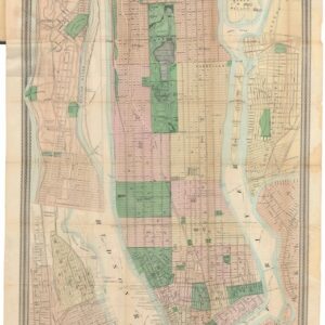
Geological map of Long & Staten islands with the environs of New York
$1,700
1 in stock
Description
A beautiful geological map of Long Island, Staten Island, and surroundings, with an inset of Manhattan at bottom-right. It was prepared by W.W. Mather, Geologist of the First District of New York, based on topographical surveys by John Calvin Smith, and lithographed by Endicott and Company, a prominent firm in New York City. The distinctive topography of the city, with higher elevations in Uptown Manhattan and the Bronx, is immediately apparent, even as the built-up parts of Manhattan and Brooklyn were confined to a small area relative to their ultimate size. The legend includes symbols indicating different types of sands, terrain, and rock.
Aside from topography and geology, the course of railroads, canals, and roads are shown. Of particular importance is the Long Island Railroad, which had been founded in 1834, building off the foundation of the Brooklyn and Jamaica Railroad (1832), the first railroad on Long Island. The train line would be built out to Greenport, towards top-right, through mostly uninhabited land on Long Island, to allow for a ferry connection to Connecticut and onwards to Boston via existing railroads. In all, the trip between New York City and Boston was drastically reduced to 11 hours by this method. Eventually, railroads were built through Connecticut, making the ferry crossing unnecessary and the original railroad became unviable. The old tracks were repurposed for use by the growing population of Brooklyn and Long Island, a population boom that the railroad itself helped facilitate. The line shown here still serves as the basis for several branches of the Long Island Railroad.
Many place names remain the same, but others have been subsequently changed, as with Blackwells Island (now Roosevelt Island) and New Utrecht (now the neighborhoods of Bay Ridge, Bensonhurst, Fort Hamilton, and Dyker Heights), which was annexed by Brooklyn in 1894. The area noted as ‘Boundary of the alluvial salt marsh formerly called Stuyvesant meadows’ today is the neighborhoods of Stuyvesant Town and Alphabet City.
Cartographer(s):
John Calvin Smith (1809 – 1890) was an American surveyor and cartographer who was involved in the production of maps of New York City and State as well as maps of the American Midwest, Texas, California, and the entire United States of America.
Condition Description
Good. Folding map on thick paper. Some discoloration and foxing at right and in margins.
References
OCLC #23046374.


![[AMERICAN REVOLUTION] Boston, George Washington, Franklin, Philadelphia, Washington, D.C.](https://neatlinemaps.com/wp-content/uploads/2024/05/NL-02090a_thumbnail-300x300.jpg)