A little-known but nearly-realized plan to completely reshape the Bay Area.
San Francisco Bay Project, John Reber
Out of stock
Description
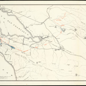
This map depicts the scheme devised by John Reber, an Ohio-born actor, writer, and stage director, to completely reshape the San Francisco Bay into a form that would be unrecognizable today. What Reber lacked in knowledge of engineering and urban planning he made up for with ambition, conviction, and show business panache. His charisma and long career managing theatrical performances throughout California allowed him to rub elbows with the rich and powerful, who he consistently won over to his plan.
As early as the 1920s, Reber proposed building two massive dams in the San Francisco Bay, creating two large freshwater lakes over an area of 280,000 acres, with ample space for ground transportation corridors atop the dams, including but not limited to a 32-lane or 36-lane freeway. The two lakes would be linked by a channel running through filled-in land near the shoreline of Alameda that was fed by the Sacramento and San Joaquin Rivers and could even be linked up with waterways and aqueducts leading to water-starved Southern California.
Although the scheme seems fanciful today, Reber correctly recognized that California would face perennial water shortages without drastic action and that urban planning in the mid-20th century would be primarily concerned with facilitating automobile and air transportation. The opening of the Bay Bridge in 1936 only showed the need for more such transbay connections, as it was immediately jammed with traffic on a regular basis. In the 1930s-1950s, Reber elaborated his plan (officially the “San Francisco Bay Project”) continuously and added features that the military would find enticing, which explains the abundance of airfields and naval bases seen here.
Reber spent the latter part of his life (and all of his money) promoting the plan full-time; writing letters, attending government meetings, and lobbying politicians. He faced significant headwinds, from the Great Depression and World War II to being preempted or upstaged by other large public works projects that seemingly solved many of the problems Reber sought to address with his plan in the first place. Still, Reber pressed on, gaining converts and supporters, including the San Francisco Board of Supervisors, Mayor Angelo Rossi, and former President Herbert Hoover (deeply unpopular nationally but less so in California, where he had strong personal ties). Eventually, the U.S. Senate held committee meetings considering the proposal, and the U.S. Army Corps of Engineers was allocated a month to conduct a years-long study of the proposal.
But the California state government was dead-set against the plan, as it would cause great economic harm to Oakland and the East Bay, and various state agencies determined the project was technically unfeasible. After thirteen years of study, including building an acre-and-a-half scale model of the plan, the Amry Corps of Engineers also concluded that the plan was unworkable. In the meantime, Reber had died, and a nascent conservationist movement arose that would work to codify environmental protections into law, preventing any future development plan of similar scope for the Bay. The public was also turning against urban freeways and looking to preserve the character of urban spaces, while the opening of the Bay Area Rapid Transit (BART) system obviated the need for more freeways, resulting in several abandoned freeway projects in the Bay Area.
The improbable story of this would-be Robert Moses of the Bay Area is characteristically Californian, combining entrepreneurialism, showmanship, and a heady disregard for the natural environment in the interest of economic development.
The scale model of the Reber Plan built by the Army Corps of Engineers is now on public display at the Bay Model Visitor Center in Sausalito.
Census
The provenance of this map is unknown. It may have been related to a 1946 publication by Reber titled, The Reber plan, it would create billions! (OCLC 611974260 ), only known to be held by the University of California Riverside, which credits Alex Hunt with the drawing of accompanying maps. But it is unlikely that this large, linen-backed map could have accompanied such a publication. The University of California Berkeley holds a map titled “San Francisco Bay project: the Reber Plan” but it is cataloged as being far smaller than the present map. It is more likely that this map was prepared for one of Reber’s many meetings with government officials, which is also suggested by the punch holes at the bottom-right. There are no other known examples of this map.
Cartographer(s):
Condition Description
Old water stains in various places. Some fraying. Holes punched on right bottom side. Overall good.
References
Wollenberg, Charles, “The Man Who Helped Save the Bay by Trying to Destroy It,” Boom: A Journal of California, April 14, 2015.

![Oakland [1993 calendar map]](https://neatlinemaps.com/wp-content/uploads/2021/02/NL-00892_Thumbnail-300x300.jpg)

