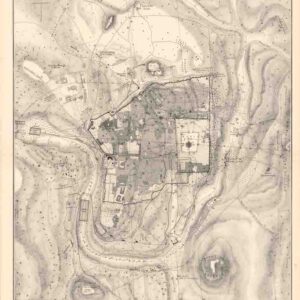
Illustrating the last days of Jesus in Jerusalem: a magnificent 1588 plan of the city in the Second Temple Period.
Ierusalem, et suburbia eius, sicut tempore Christi floruit…
Out of stock
Description
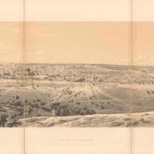
A beautiful example, with rich original color, of one of the most minutely-detailed, graphic reconstructions of early Jerusalem. It is an expansion of Christian Van Adrichom’s 1584 plan of ancient Jerusalem, which was the first to record the ancient city in detail. Adrichom, a Catholic priest and theologian working in Cologne, published his map as part of his book on the antiquities and history of the Holy Land. Braun and Hogenberg have shifted the layout of their map, creating a dramatic vertical view of the city on two sheets (it is only one of three double-sheet plans that appeared in the Civitates orbis terrarum).
The first thing to keep in mind is that at the time this map was published, Jerusalem was part of the Ottoman Empire and had been under Muslim rule for centuries. This fact helps to explain why the mapmakers have imbued it with nostalgic themes of biblical history and geography. More than a city plan, what we have here is the idea of Jerusalem, a delightful mix of historical eras, scenes, and architecture. Camped around the city are various conquering armies – Assyrian, Chaldean, and Roman – out of the main focus of the map, but looming as a reminder that Jerusalem has been a prized urban center for millennia.
Above all, the view illustrates the final days of the life of Jesus Christ, the events that played out in Jerusalem. These include:
Jesus enters Jerusalem on a donkey.

The Last Supper (6), the final meal that Jesus shared with his apostles in Jerusalem, during which he predicted his betrayal by one them.

Jesus is tried on accusations of claiming to be the King of the Jews at Antonia Fortress and Pontius Pilate’s praetorium; Pilate declares: “Crucifige!”

Part of the Via Dolorosa, the processional route in the Old City of Jerusalem, believed to be the path that Jesus walked on the way to his crucifixion.

Crucification and resurrection.

Cartographer(s):
Georg Braun (1541–1622) was a German geographer, publisher, and the canon of the Cologne chapter of St. Maria ad Gradus. From 1572, he edited the Civitates orbis terrarum, which contains 546 prospects, bird’s-eye views, and maps of cities from all around the world. As the principal editor, Braun acquired the tables, hired the various artists and contributors, and wrote the texts. He oversaw the project from its inception until its completion in 1617.
The main engraver for volumes I-IV of the Civitates orbis terrarum was Frans Hogenberg (1535–1590), a Flemish painter, engraver, and mapmaker, born in Mechelen and later established in Cologne. Hogenberg was a Protestant exile from the Spanish Netherlands who had worked with Abraham Ortelius on his iconic Theatrum Orbis Terrarum. His detailed depictions of architecture, figures, and heraldry helped define the genre of the Renaissance bird’s-eye view. By the time of his death in 1590, Hogenberg had secured his reputation as one of the era’s foremost cartographic artists.
Condition Description
Two sheets joined. Wear at junctures of folds with some loss and creasing. Remnants of hanging tape on verso. Some in-fill along the centerfold.
References
Nebenzahl, K. Maps of the Holy Land, pl. 33; Laor, E. Maps of the Holy Land, no. 1041.
![[ALEPPO] Toi qui te plains de l’infortune, Lève-toi et va vers… ALEP… Comme le malade épuisé. Soupire après la guérison.](https://neatlinemaps.com/wp-content/uploads/2024/05/NL-01445-cover_thumbnail-300x300.jpg)