Decorative late 16th century woodcut map of the Holy Land
Beschreibung des heiligen Landes Canaan
Out of stock
Description
Decorative woodcut map of the Holy Land depicting coastline from Sidon to Gaza, south of Sodom. Many Biblical locations are plotted, including Jericho, Givon, Mt. Tabor, and more, with Jerusalem is noted by alternative names Shalem and Jebus.
The eastern Mediterranean sea is decorated with a swan and two sea monsters.
Cartographer(s):
Henrich Bünting was a Protestant theologian and teacher from Hannover who is most renowned for his influential work on Biblical geography. His Itinerarium Sacrae Scripturae, first published in 1581, became very popular due to its comprehensive summary of Biblical geography through travel narratives and commentary. The book contained Bünting’s own unique woodcut maps, including imaginative representations of the continents as a Clover Leaf, Europe personified as a crowned woman, and Asia depicted as the winged horse Pegasus.
With over sixty editions published between 1581 and 1757, Heinrich Bünting’s Itinerarium Sacrae Scripturae remains a significant contribution to the history of Biblical geography.
Condition Description
Tears along the left edge; typical condition for Bünting maps.
References
Laor 140, Loewenhardt 23.
Related products
-
-
Add to cart

- Eastern Mediterranean - Holy Land
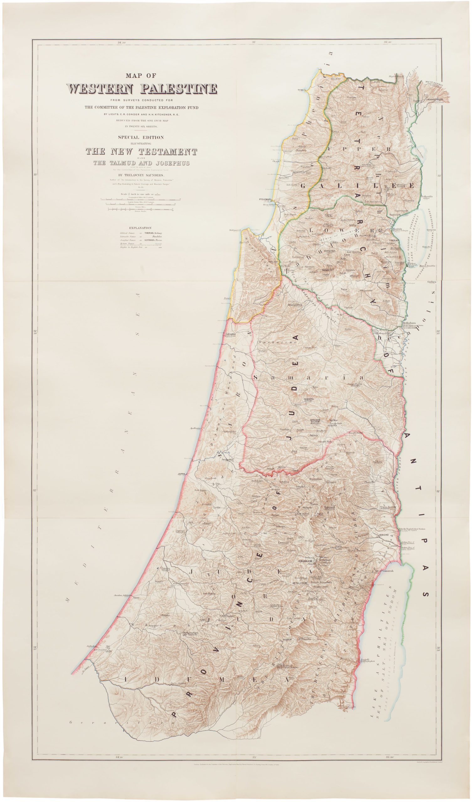
Map of Western Palestine from surveys conducted for The Committee of the Palestine Exploration Fund. By Lieuts. C. R. Conder and H. H. Kitchener, R. E. Reduced from the one inch map in twenty six sheets. Special Edition Illustrating The New Testament also The Talmud and Josephus (after the birth of Jesus)…
- $1,000
-
-
-