The majestic Dome of the Rock.
North-eastern view of Kubbet es-Sakharah, and of Kubbet es-Silsileh.
$425
1 in stock
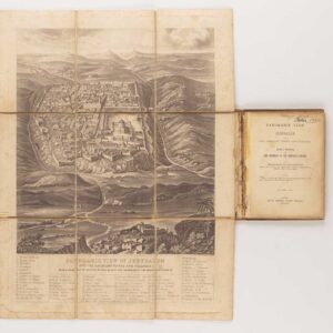
Description
This is one of Pierotti’s magnificent views of the Dome of the Rock (Kubbet es-Sakharah), located atop the Temple Mount. This and the Aqsa mosque are undoubtedly the most iconic Islamic monuments within the Haram al-Sharif, and thus in Jerusalem in general. Since its initial construction in the late 7th century, the Dome of the Rock has, with its spectacular golden dome, served as the signature landmark in views of the Old City of Jerusalem. The octagonal building was constructed as part of the larger sacred precinct (Haram al-Sharif), but it is quite possible that the Muslim builders already found the octagonal foundations for a Byzantine martyrium church in place and simply expanded on those.
While Pierotti and others often refer to it as a mosque, the Dome of the Rock is, in fact, more a place of holy veneration. Muslims believe that the protruding natural rock around which the complex was built constitutes the very same rock upon which Abraham was ready to sacrifice his only son to God. Islamic tradition also claims that it was from this rock that the Prophet Mohammad set off on his ‘Night Flight’ to the heavens.
Looking at the facade of the building, the view includes several subsidiary buildings, including an adjacent pavilion known as the Kubbet es-Silsileh or Dome of the Chain (also used for prayer). Being a keen architectural analyst, Pierotti identifies all of these surrounding features by means of a numbered legend accompanying the lithograph:
1. Mosque Kubbet es-Sakharah.
2. Ladder used by Pierotti for his observations.
3. Minaret of Kadhi.
4. Kubbet es-Silsileh, Dome of the Chain.
5. Bâb el-Daûd, David’s Gate.
6. Cistern (the Place of the Ashes).
7. Bâb el-Jenni, Gate of Paradise.
8. Mount Moriah (anciently the Threshing-floor of Araunah).
Publication information
In 1864, the same year that the first British Ordnance Survey of Jerusalem was commissioned, Italian engineer Ermete Pierotti published Jerusalem Explored, a seminal work on the history, archaeology, and architectural history of the ancient and holy city. This work included Pierotti’s notes and insights after years of surveying and mapping under Ottoman authority. The publication was divided into a text volume and a volume of plates. The latter included 63 lithographs showing everything from strategic views, across architectural plans and section profiles, to panoramic vistas of the Old City. Most of the lithographed plates were based either on photographs or drawings made by Pierotti and his team.
The plates were lithographed mainly by Thomas Picken of London and printed by the prominent British lithography firm William Day & Sons.
Cartographer(s):
Ermete Pierotti (1820-1880) was the oldest of nine siblings in a family from Pontardeto in Pieve Fosciana (the family built the Palazzo Pierotti, which has served as the town hall since 1877). Pierotti worked as a military engineer in Genoa and later served as a captain in the Engineering Corps of the Sardinian King. In 1849, he was accused of desertion and the theft of 3596 lire from the troop’s treasury, which resulted in a dishonorable discharge from the army. Pierotti then traveled to Jerusalem and Egypt, where he worked as an engineer. In Egypt, he discovered the foundations of the Alexandria Library while laying the foundations for a Greek church, but it was in Jerusalem that he would put his surveying and engineering skills to work.
Pierotti arrived in Jerusalem in 1854 as a consultant for the Franciscan Order, which had custody of many of the Christian holy sites in the city. During his time there, Pierotti was involved in the restoration of the Crusader Era Church of St. Anne, located in the Old City near the Pool of Bethesda. Working with Ottoman engineer Assad Effendi, he later contributed to the restoration of the Qanat as-Sabil, the main aqueduct that supplied Jerusalem with water, which involved repairing the aqueduct’s channels and cisterns. Other building projects included work on the Temple Mount itself and the construction of both the Austrian Hospice and the so-called Alexanderhof (HQ of the Kaiserlichen Orthodoxen Palästina-Gesellschaft) in the Christian Quarter of the Old City. And finally, he helped design the road from Jaffa to Jerusalem, a significant engineering feat at the time.
Pierotti became interested in the city’s history and archeology during his time in Jerusalem. He conducted several excavations in the Old City. He discovered several important artifacts, including an inscription in the Church of the Holy Sepulchre that proved the existence of a church on the site during the Byzantine period. Pierotti’s work in Jerusalem earned him a reputation as a skilled engineer and pioneering archeologist. He became known for his attention to detail and ability to work under challenging conditions. In addition to his many projects, Pierotti’s legacy consists of publishing his magnum opus: Jerusalem Explored. A Description of the Ancient and Modern City (1864), which included an entire volume of lithographed plates based on Pierotti’s plans and converted photographs.
Despite his many successes, Pierotti’s work and position annoyed the British, who increasingly sought to establish a scientific presence in the Holy City, if not a colonial one. When competition arose between Pierotti and Captain Charles Wilson’s team of English Royal Engineers conducting the first Ordnance Survey of Jerusalem and surroundings in 1864, Pierotti’s reputation was deliberately tarnished by the disclosure of his criminal past, and for the rest of his life, he struggled to regain recognition for his achievements.
Condition Description
Excellent.
References
Related products
-
-
Add to cart

- Eastern Mediterranean - Holy Land
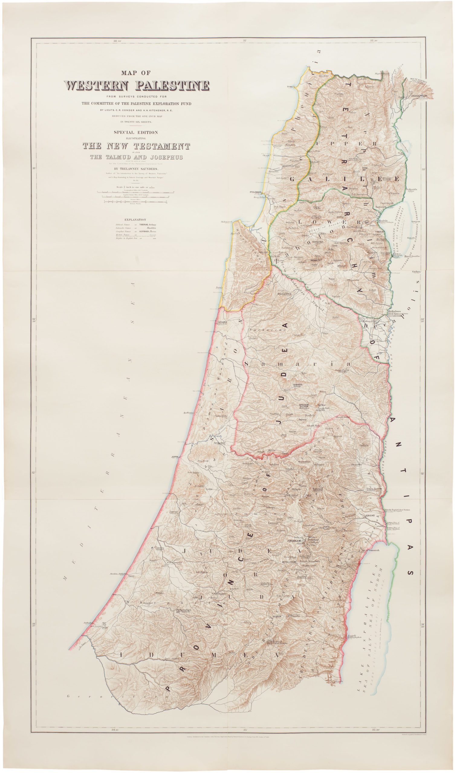
Map of Western Palestine from surveys conducted for The Committee of the Palestine Exploration Fund. By Lieuts. C. R. Conder and H. H. Kitchener, R. E. Reduced from the one inch map in twenty six sheets. Special Edition Illustrating The New Testament also The Talmud and Josephus (after the birth of Jesus)…
- $1,000
-
-
-