One of the most ambitious and spectacular maps of the Holy Land, produced at the height of the Baroque struggle to win the hearts and minds of Europe’s faithful.
Chorographia Terrae Sanctae in Angustiorem Formam Redacta, et ex Variis Auctoribus a Multis Erroribus Expurgata.
Out of stock
Description
This extraordinary map of the Holy Land, crafted in the early 1630s by the Jesuit monk Jacobus Tirinus, offers viewers a captivating journey to the sun-scorched landscapes of the Levant. Oriented to the east, the scope of the map covers a vast area from Tyre and the Syrian border in the north to the Sinai and Egypt in the south. As such, it encompasses almost all the lands mentioned in the Bible.
Exploring the map, one quickly encounters variations of prominent and well-known landmarks. Examples include the oddly conical pyramids near Memphis and the famed city of Tanis, believed to be the resting place of the Ark of the Covenant. Just south of Tanis, we note the city of Ramesse (Pi-Ramesses), which not only was the new capital built by Ramses II but, more importantly, marks the starting point of the Exodus and the Hebrews’ journey through the desert. Tantalizingly, the route of this mythological journey is marked on the map, including the place of the miraculous crossing of the Red Sea, where Pharaoh’s forces were crushed by the waters Moses had parted. Continuing into the Sinai, we trace the footsteps of the Hebrews to Mount Sinai (Sinai Mons), where God revealed the Law to Moses, and he dramatically breaks the tablets upon which the Law was inscribed.
While the configuration of this map can be confusing at first, one must remember that this map is a schematic representation of Biblical geography. It is a vision more than an up-to-date map of the region. However, there are fascinating geographic inclusions that elevate this map above its contemporaries, such as the presence of the ancient Nabatean capital of Petra centuries before its official ‘discovery’ by Swiss adventurer Johan Burckhardt in 1812. Among the elements that make its identification credible is the fact that the map indicates that, just as today, the Tomb of Aron is located on a mountaintop just outside Petra. Moving further north, the map meticulously delineates the territories claimed by the various tribes of Israel, showcasing major cities, camps, roads, and trade routes, not to mention significant parts of the Biblical narrative.
Being a product of the Baroque’s wonderful combination of artistic excess and religious fervor, the Mediterranean is artfully decorated with different sailing ships, a highly decorative compass rose, and an elaborate scale bar sporting the mapmaker’s main instrument.
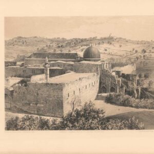
Located in the center of the map, as if floating in the Mediterranean, we find a large oval in which an oblique aerial view of the Holy City of Jerusalem. While maps and bird’s-eye views of Jerusalem were not unheard of at this stage of cartographic history, Tirinus’ outline is remarkably accurate, with many of the town’s landmarks being easily recognizable. The plan, which was based on the works of Spanish biblical geographer Juan Bautista Villalpando, is so rich in detail that a small legend is necessary to identify the many buildings and features represented in this inset.
In addition to serving a concrete cartographic purpose, the view of Jerusalem also functions as the crowning image in a series of 19 exquisite vignettes that surround the map on three sides. Most of the images are of Biblical objects, with examples including the Arc of the Covenant, Israelite coins, Roman antiquities, a Menorah, angels, and a plan of the Temple. But it is the view of Jerusalem that pulls the composition of vignettes together to form a gorgeous pictorial border for the map.
Despite being a product of the early Baroque, Tirinus’ map remains one of the most attractive representations of the Holy Land ever created, offering a timeless and captivating glimpse into the region’s historical and religious significance.
Census
This map was originally prepared for Jacobus Tirinus’ renowned study Commentarius Vestus et Novum Testamentum Tomis Tribus Comprehensus (Commentary on the New and Old Testament), but ended up in his Holy Land chorography (descriptive geography), which was published around 1632. The map was most likely engraved by Cornelius Galle and printed in Antwerp by Martinus Nutius. Quickly attaining popularity, the work was printed multiple times from several places over the following 20 years, making exact identification difficult.
Examples of the map are held in a number of institutional collections, including Yale University, the Osher MapLibrary, and the University of Michigan (OCLC no. 68145537). Examples of the commentary in which the map was published are held by the Biblioteca Nacional de España, the Bodleian Library at Oxford University, and the University of St Louis (OCLC no. 43131281).
Cartographer(s):
Jacobus Tirini/Tirinus (1580–1636) was a Jesuit monk and theologian from Antwerp in Belgium. After being admitted into the Jesuit Order, he became a recognized Biblical scholar and was assigned as ”First Superior” to the Jesuit House in Antwerp and Director of the Mission in Holland, one of the primary loci in the 17th-century struggle for religious dominance.
Tirini is perhaps best known for his Commentarius Vestus et Novum Testamentum Tomis Tribus Comprehensus (also entitled Commentarius in Sacram Scripturam) – a Bible commentary produced at the height of Europe’s religious wars, which is still referenced today (published 1645). For map aficionados, he perhaps is better known for his earlier Chorographia Terrae Sanctae in Angustiorem Formam Redacta (c. 1632), which included his seminal map of the Holy Land.
Condition Description
Very good.
References
Related products
-
-
Add to cart

- Eastern Mediterranean - Holy Land, Wall maps
Map of Western Palestine from surveys conducted for The Committee of the Palestine Exploration Fund. By Lieuts. C. R. Conder and H. H. Kitchener, R. E. Reduced from the one inch map in twenty six sheets. Special Edition Illustrating The New Testament also The Talmud and Josephus (after the birth of Jesus)…
- $1,000
-
-
-
![Jerusalem [Old City].](https://neatlinemaps.com/wp-content/uploads/2024/05/NL-01944_thumbnail-300x300.jpg)