One of the most iconic 19th-century maps of San Francisco.
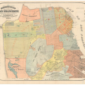
Bancroft’s Official Guide Map of the City and County of San Francisco, Compiled from Official Maps in Surveyor’s Office.
$1,800
1 in stock
Description
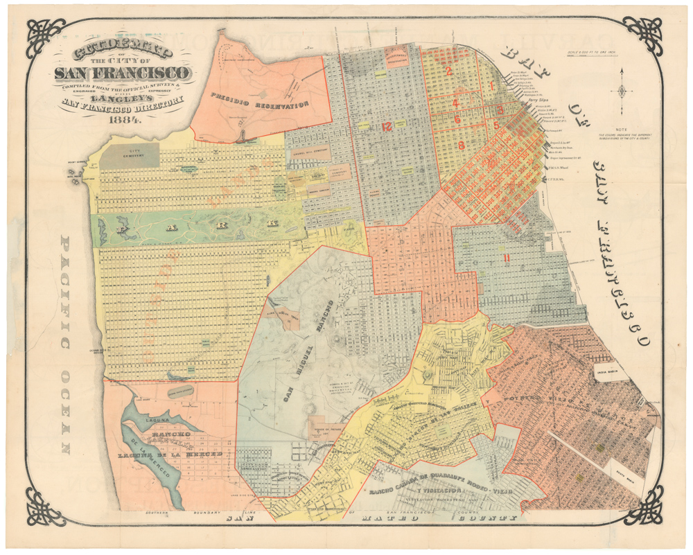
Handsome, iconic map of San Francisco before the 1906 earthquake. Includes an inset of the Bay Area; in Marin County, Sausalito is labeled with an old town spelling Saucelito. The natural shoreline, well inland from the current Embarcadero sea wall, is marked in blue. The city was expanded by infilling beginning in the Gold Rush period to reach deeper waters, create new space, and rebuild after the numerous fires that devastated San Francisco in its early years.
This map is a treasure trove of detail, with a comprehensive key along the bottom that pinpoints hundreds of points of interest. The majority of the city is meticulously laid out, with the exception of the area occupied by San Miguel Rancho. The occupied blocks are shaded, providing a clear visual of the city’s development, which at the time, was only a third to half complete.
Delve into late 19th-century San Francisco with this map, which showcases a wealth of historical features. These include the cemeteries at Lone Mountain, the Southern Pacific Railroad lines originating from the southern peninsula, the Alms House Tract (known today as Laguna Honda Hospital), the Spring Valley Water Company reservoir, and much more. Each feature is a window into the city’s past, offering a fascinating glimpse into its history.
Circles radiate outward from the Ferry Building one mile apart, reflecting the importance of ferry travel in the Bay Area decades before the Golden Gate and Bay Bridges.
Several spurious street names are shown in the Marina District, including Tonguin and Lewis. These were planned to be on landfill but were never actually created; Tonguin Street is instead Marina Boulevard, and Lewis is Marina Green Drive.
Cartographer(s):
Hubert Howe Bancroft (May 5, 1832 – March 2, 1918) was an American historian and ethnologist who wrote, published and collected works concerning the western United States, Texas, California, Alaska, Mexico, Central America and British Columbia.
In March 1852, Bancroft was provided with an inventory of books to sell and was sent to the booming California city of San Francisco to set up a West Coast regional office of the firm. Bancroft was successful in building his company, entering the world of publishing in the process. He also became a serious collector of books, building a collection numbering into the tens of thousands of volumes.
In 1868, he resigned from his business in favor of his brother, A. L. Bancroft. He had accumulated a great library of historical material and abandoned business to devote himself entirely to writing and publishing history.
Condition Description
Scattered marks and wear.
References
Related products
-
-
Add to cart
- San Francisco
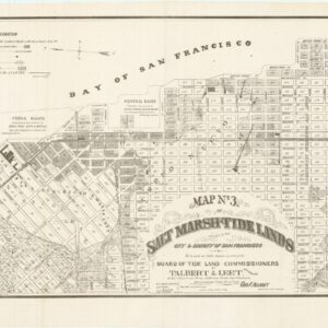
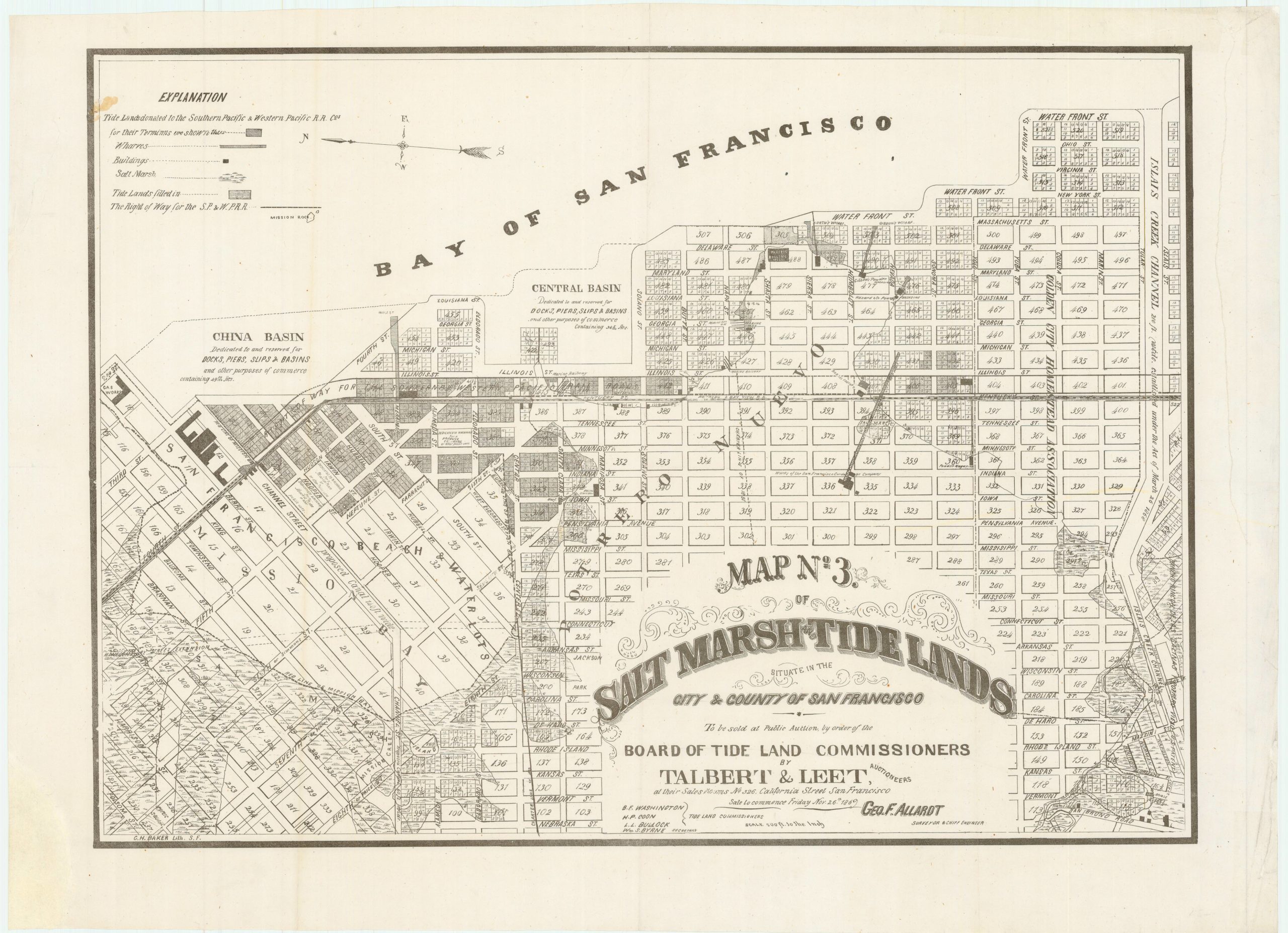
Map no. 3. Salt marsh and tide lands situate in the city and county of San Francisco. To be sold at public auction by order of the Board of Tide Land Commissioners by Talbert & Leet, auctioneers, at their sales rooms no. 526 California Street, San Francisco. Sale to commence Friday Nov. 26th, 1869.
- $3,400
-
-
-
![PORT OF SAN FRANCISCO. WHERE THE FAR EAST BEGINS [Japanese language version]](https://neatlinemaps.com/wp-content/uploads/2021/01/NL-00879_Thumbnail-300x300.jpg)
![PORT OF SAN FRANCISCO. WHERE THE FAR EAST BEGINS [Japanese language version]](https://neatlinemaps.com/wp-content/uploads/2021/01/NL-00879_Thumbnail.jpg)