A fantastic pre-1906 earthquake map of San Francisco.
Crocker’s Guide Map of the City of San Francisco.
$1,600
1 in stock
Description
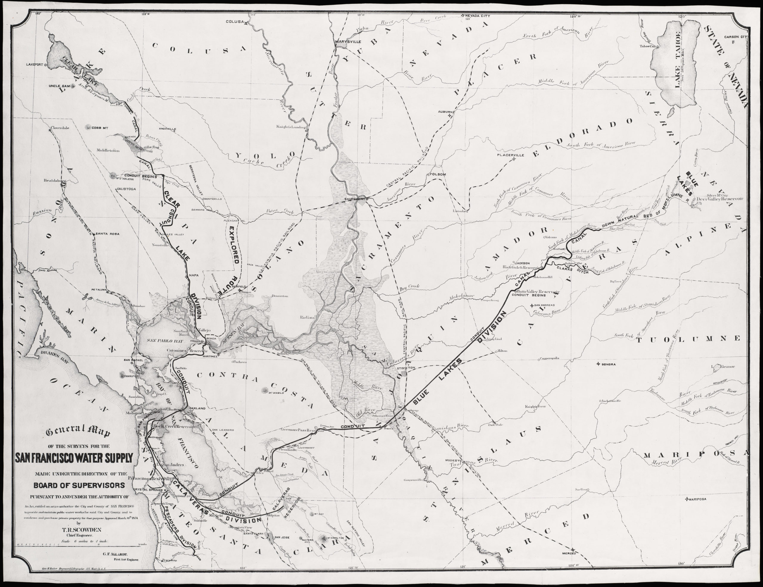
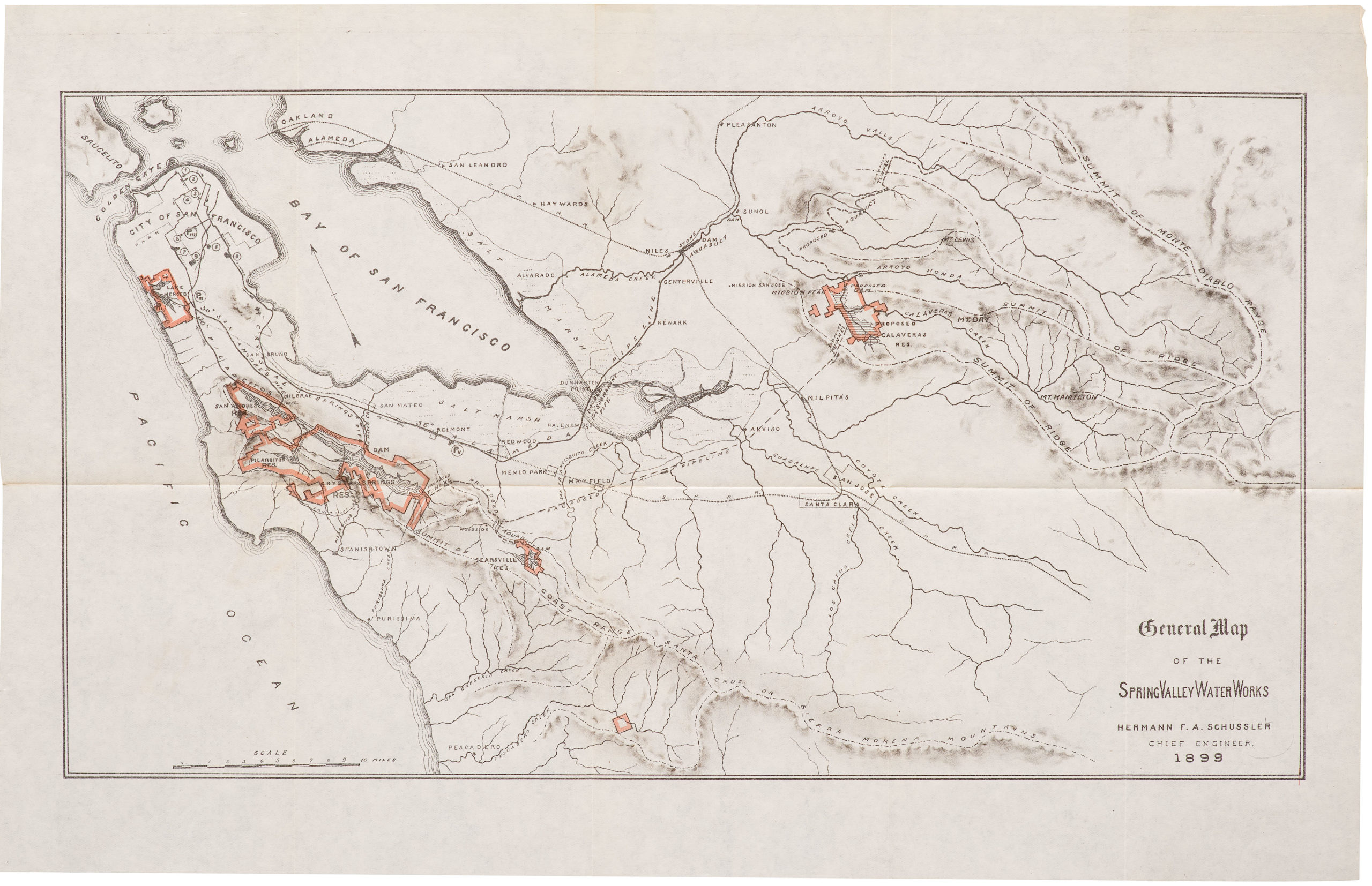
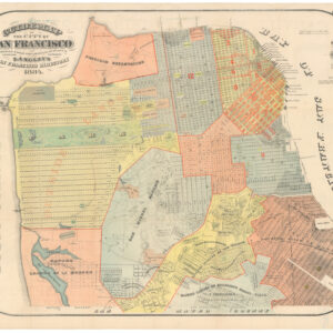
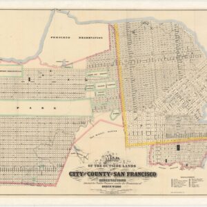
This is a 1901 map of San Francisco published for the Crocker-Langley official city directory. It features a stylish design and a striking red-print advertisement for the George H. Tay Company around the map in the margins.
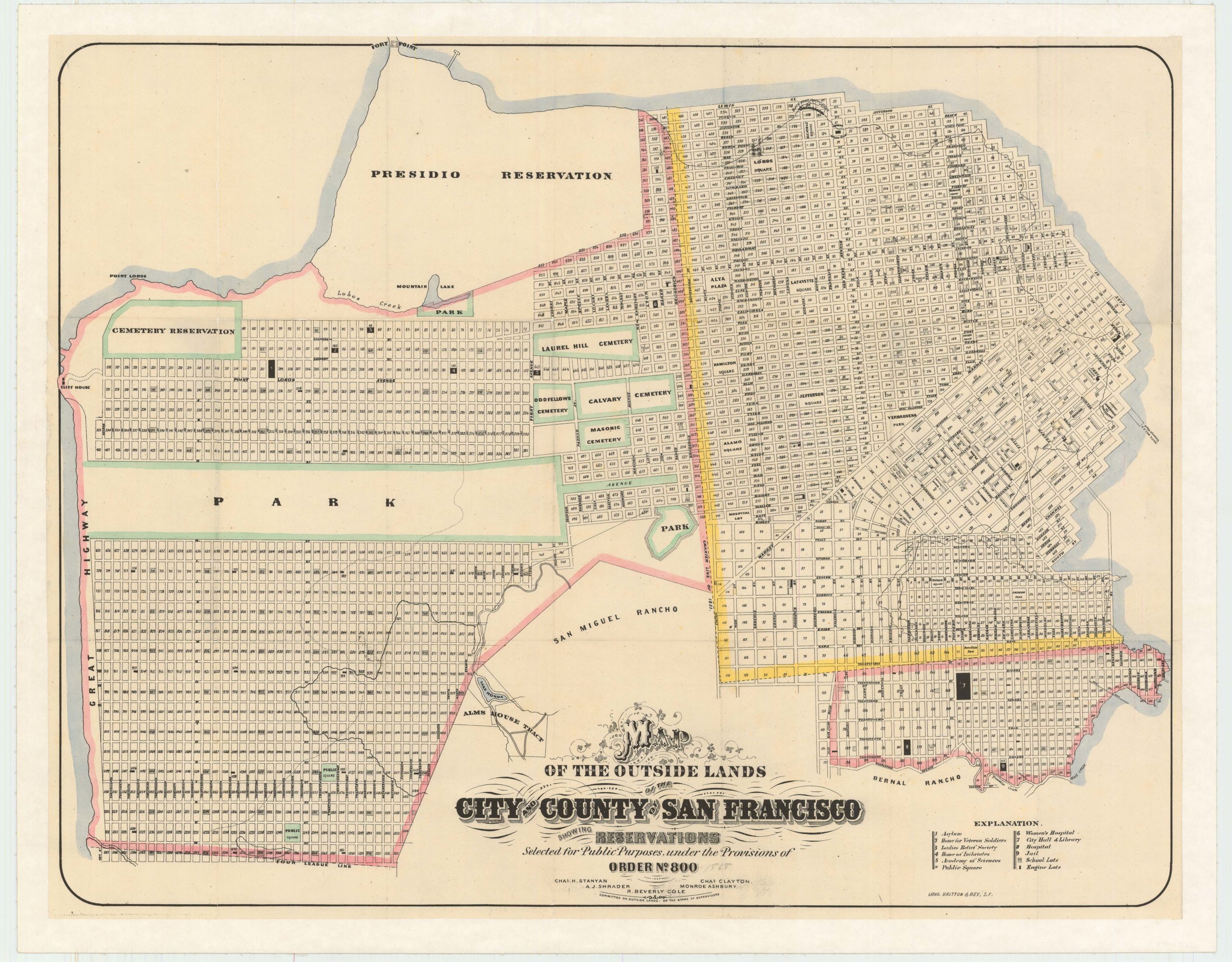
The map depicts many interesting 19th-century features of the city, including Sutro Baths and Heights, the railway at today’s Land’s End, old rancho designations, waterworks, new land developments, the Lone Mountain cemeteries, and more.
In 1901, San Francisco had an extensive network of cable cars and horse-drawn streetcars for public transportation. The city’s cable car system was a unique feature, allowing residents and visitors to traverse its hilly terrain efficiently.
Several spurious street names are shown in the Marina, including Tonguin and Lewis. These were planned to be on landfill but were never actually created; Tonguin street is instead Marina Boulevard and Lewis is Marina Green Drive.
Context is everything
In 1901, San Francisco was a vibrant and rapidly growing city on the west coast of the United States. It was a key port city and a hub of economic, cultural, and technological developments during that time. Its economy was primarily driven by trade, shipping, and manufacturing. The city’s strategic location along the Pacific Coast made it a vital gateway for international trade with Asia and other parts of the world.
The population of San Francisco in 1901 was around 340,000 people. The city attracted a diverse mix of immigrants from different countries, including China, Japan, Italy, and Ireland, contributing to its cultural richness.
Overall, San Francisco in 1901 was a bustling and dynamic city, with a diverse population, a strong economy, and a rich cultural scene. The city’s fortunes changed drastically only five years after this map was published: the major earthquake that struck on April 18, 1906, caused widespread devastation, resulting in significant loss of life and property damage. The long-term consequence of the disaster was that Los Angeles supplanted San Francisco as California’s most important urban center.
Cartographer(s):
The H. S. Crocker Company was an engraving and publishing house based in San Francisco.
Henry G. LangleyHenry G. Langley was a prominent figure in 19th-century San Francisco, best known for his role in publishing city directories. Starting in the 1850s, his “Langley’s San Francisco Directory” became an essential resource, chronicling the city’s evolution.
These directories, which are precursors to today’s phone books, listed information about residents, their professions, addresses, and also showcased ads from local businesses. They also contained comprehensive details about the city’s streets, government entities, churches, schools, and more.
With San Francisco undergoing rapid growth due to the California Gold Rush, Langley’s directories offer an invaluable snapshot of its transformation into a major American city. As the city expanded, so did the scope of Langley’s work, with directories eventually encompassing not just San Francisco’s core, but also its surrounding areas. With the advent of the telephone and subsequent telephone directories, the significance of city directories like Langley’s dwindled. Nevertheless, his contributions remain an integral part of San Francisco’s historical fabric. Many of these directories have since been digitized, offering a window into the city’s storied past for anyone with an interest.
Condition Description
Minor blemishes.
References