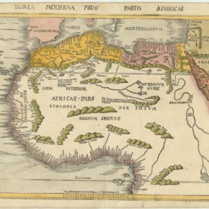
A group of 3 beautiful Chatelain Egypt plates: Cairo, the Pyramids, and the Nile.
Vue de la ville du Grand Caire…[and] Description des piramides d’Egypt…[and] Description du Nil, de ses sources….
Out of stock
Description
The early European fascination with Egyptian Antiquity.
Chatelain’s three Egypt plates were published in his Atlas Historique in the early 18th century. As with most of his output, the aesthetic qualities of the engraving are held to the highest standards.
1. Cairo and the Nile View: An antique engraved depiction of Cairo, highlighting the city’s proximity to the River Nile. The scene features lush palms and boats along the river, presenting a picturesque view of the area.
2 . Pyramids and Sphinx Compilation: A detailed engraving with five vignettes showcasing the pyramids and the Sphinx. The central image focuses on the Sphinx with visitors exploring its massive structure, while the surrounding engravings provide an overview of the Giza Plateau and close-ups of individual pyramids, including one with an entrance marked by a large hole.
3. Map of the Nile and Giza: A detailed map tracing the Nile’s course from the southern cataracts to Cairo and Giza. It includes a depiction of a pyramid, marked as 1400 pieds (feet) tall, and additional imagery of the Nile River Valley’s natural and cultural landmarks.
Context is everything
In the early 18th century, Egypt was under the rule of the Ottoman Empire, having been subjugated in the early 16th century. A lot of power, nevertheless, still lay with the Mamluks, a military caste that had originally been enslaved soldiers but had risen to significant political and military prominence. The Ottoman sultans relied heavily on the Mamluks to maintain control over Egypt, which also meant that the Mamluks wielded substantial autonomy and influence. This dynamic created a complex political situation where the Ottoman-appointed governor, or “Pasha,” had to navigate the intricate power struggles between various Mamluk factions and the central Ottoman authority. Egypt’s power shifts and internal conflicts marked the early 18th century. These weakened the overall governance of Egypt and made it difficult for the Ottoman Pasha to enforce central authority.
Externally, Egypt’s geopolitical significance as a gateway between the Mediterranean and the Red Sea made it a focal point of interest for European powers, notably the French and the British. The early 18th century saw increasing European involvement in the region, primarily through trade and diplomacy. This foreign interest added another layer of complexity to Egypt’s political landscape. European powers often sought to exploit the internal divisions within Egypt to their advantage, further complicating the political reality. Chatelain’s depiction of the pyramids was produced within this context of early European interest.
As Egypt navigated internal and external pressures, the stage was set for the significant changes that would come with Napoleon’s invasion in 1798. This event would shape Egypt’s political trajectory and instigate a scientific fascination with Ancient Egypt in Europe that still thrives to this day.
Cartographer(s):
Henri Abraham Chatelain (1684 – 1743) was a Protestant pastor (Huguenot) from Paris who, due to his faith, was forced to flee his native France. He settled first in London and later in Holland, where he worked from both The Hague and Amsterdam during the early 18th century. While his primary calling was as a preacher, his Atlas Historique became a huge success, partly due to the vivacious decoration and abundance of information on his charts.
Condition Description
Very good. Two of the maps with repaired tears.
References


