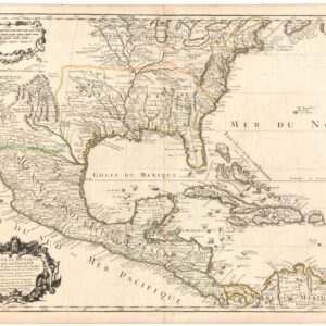
Dezauche’s 1782 map of colonial America: a map that blends Delisle’s celebrated achievements with new features for the Revolutionary War.
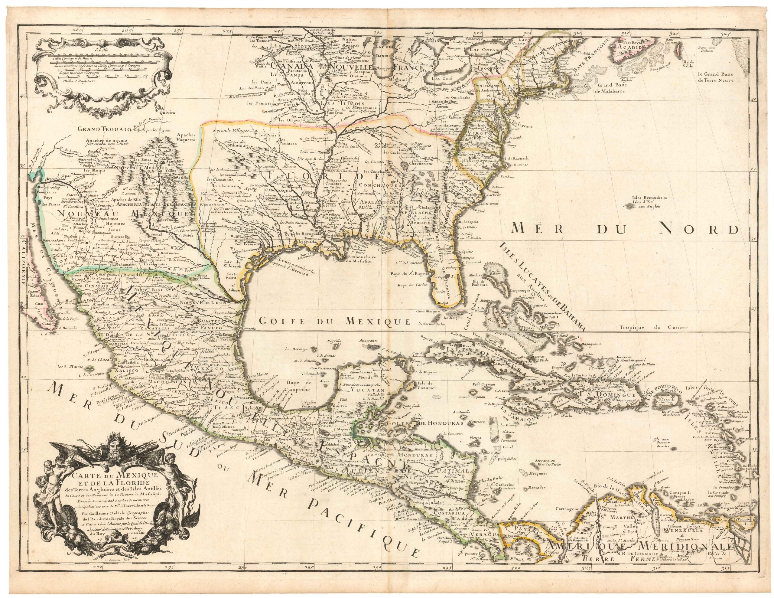
Carte De La Louisiane Et Du Cours Du Mississipi Avec Les Colonies Anglaises.
$1,200
1 in stock
Description
Jean Claude Dezauche’s reissue of Guillaume Delisle’s landmark 1718 map, with an extensively updated Eastern Seaboard. A comparison of the two maps tells the fascinating story of a shifting political landscape and the proliferation of settlements along the American East Coast.
Delisle’s map contained a plethora of “firsts” and important achievements; it was the first map to name New Orleans, the first accurate map of the lower Mississippi, the first appearance of the name ‘Texas’ on a printed map, and more. So formative was the 1718 map that it was copied by mapmakers throughout the remainder of the 18th century. But the dramatic events of the American Revolutionary War (1775-83) created the need for new charts, and it was in this context that Dezauche published this map.
There are many similarities between Delisle’s and Dezauche’s versions, including the geographical scope. Both charts extend from the Atlantic Seaboard west to Santa Fe, south to include Florida and much of the Gulf Coast, and north to the Great Lakes (only part of Lake Superior is shown). Dezauche has retained many of the groundbreaking features mentioned above. Thus, we find a notation along the Trinity River that reads: “Mission de los Teijas [or Teyas] etablie en 1716” — the famous naming and locating of Texas. New Orleans is there as well. And Dezauche, following Delisle, has plotted the routes of famous explorers like De Soto and Moscoso.
The first differences between the two maps reveal themselves in the political landscape. Delisle’s chart portrays the broad early 18th century divisions between the great colonial powers of the era: Spain, Great Britain, and France. It is perhaps not surprising that Delisle, official royal cartographer to the King of France, pays little attention to internal borders between British colonies; this is simply territory held by a competing nation. More notable is that he includes Caroline in the area of French possessions, along with a notation that this land was discovered by French explorers and named in honor of Charles IX. Likewise, Florida is depicted ambiguously as part of French Louisiane.
Dezauche’s additions
Circumstances changed substantially from 1718 to 1782. Dezauche has split the Carolinas and added Georgia Colony. The combination of dotted lines and original outline color clearly delineates each of the visible colonies from each other; in addition to Georgia and the two Carolinas, we find Virginia, Maryland, Pennsylvania, New Jersey, and New York (Delaware has been ignored and the rest of the colonies are outside the map’s extents). The mapmaker also separates Florida, which would return to the Spanish Crown the year after this map was published, as part of the 1783 Peace of Paris, the set of treaties that concluded the Revolutionary War.
Along with the updated political landscape, Dezauche has completely reworked the settlement landscape along the East Coast to reflect the substantial population growth there in the decades preceding the Revolution. The changes are especially notable along the Hudson River, which is now dotted with towns not found on Delisle’s map, including Albany. Pennsylvania has expanded to the west, and now includes roads and many more towns. We see that the Carolinas have undergone a significant transformation as well, and the mapmaker plots a network of roads and cities connecting the coast and its hinterland. In Georgia colony, we now find Savannah and other new towns and forts.
In conclusion, this is a map that combines the most exciting elements of Delisle’s landmark map with a significantly updated Colonial America, and was published in the midst of the Revolutionary War.
Cartographer(s):
Jean-Claude Dezauche was a well-known Paris map publisher who set up his shop around 1770. The foundation for the business was his acquisition of the archives of Guillaume De l’Isle and Philipe Buache, two of the most highly-renowned royal French cartographers.
Among Dezauche’s many lucrative contracts was a monopoly on selling the maps produced by the national Dèpôt de la Marine. When his son, Jean André Dezauche, took over the family business upon his father’s death, he inherited this contract.
Condition Description
Old stains, mostly in the margins. Map image itself very good. Original outline color.
References