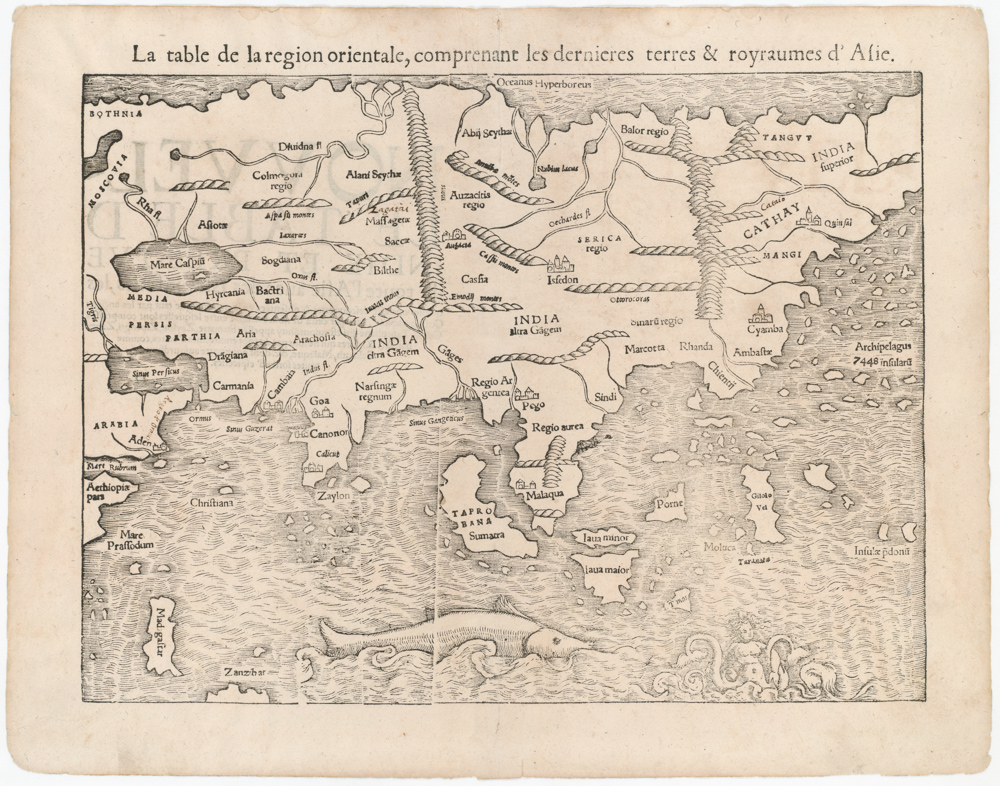
1541 woodcut Ptolemaic map of India and Southeast Asia.
Tabula nova utriusque Indiae
Out of stock
Description
Wonderful Ptolemaic map based on Waldseemüller’s first “modern” map of Asia, published in the 1541 edition of Geographia, edited by Laurent Fries and Michael Servertus. Waldseemüller’s cartography is followed without change but an interesting array of vignettes purporting to depict the cultures of the region have been added. The most interesting of these is a scene in Northern India of a goat-like man setting fire to a young woman.
The map covers from the Horn of Africa through the Malaysian peninsula and cartographically is a great improvement over medieval maps of the region. Both Sri Lanka and Sumatra are labeled Taprobana, reflecting the confusion between the two islands on early maps.
Verso is blank.
Cartographer(s):
Laurent/Lorenz Fries (ca. 1485-1532) was born in Alsace circa 1490 and studied medicine and mathematics at a number of European universities. He was trained as a physician but was also keenly interested in cartography and medical publications. From 1518-19 Fries is mainly based in Strasbourg, where he was commissioned to compile the first edition of Waldseemüller’s atlas after his death in 1520.
Condition Description
A few scattered fox marks and slight soiling.
References
![[Pair of views] Rade et Ville de Sincapour & Rade de Sincapour prise de la maison du Gouverneur](https://neatlinemaps.com/wp-content/uploads/2021/03/NL-00896-harbor_Thumbnail-300x300.jpg)
![[Pair of views] Rade et Ville de Sincapour & Rade de Sincapour prise de la maison du Gouverneur](https://neatlinemaps.com/wp-content/uploads/2021/03/NL-00896-harbor_Thumbnail.jpg)