A fabulous pictorial map of Sausalito by the late beloved local cartoonist Phil Frank.
Sausalito…a city of many neighborhoods
Out of stock
Description
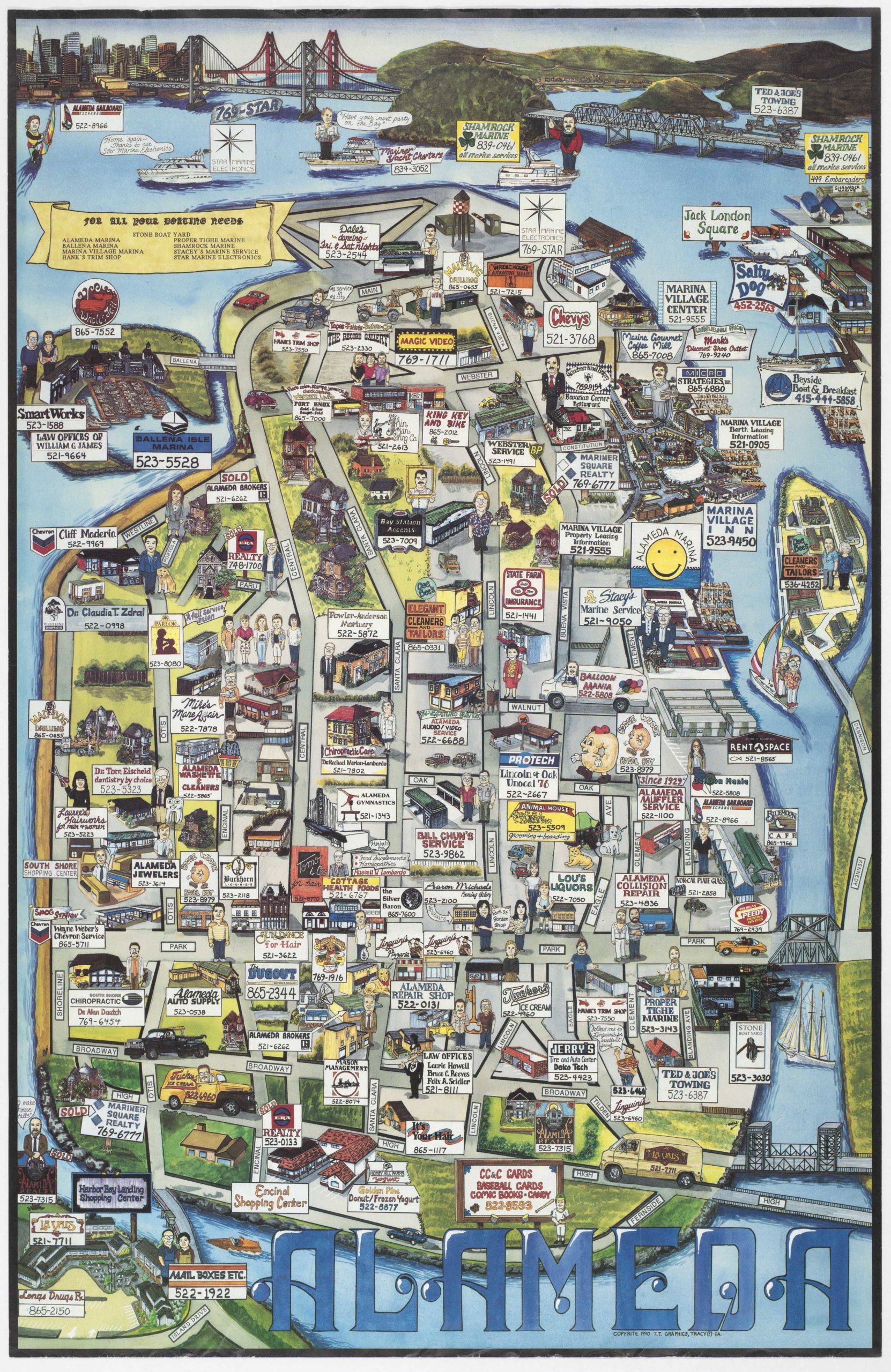
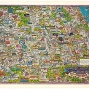
It comes as no surprise that this wonderful bird’s-eye-view of the town of Sausalito in Marin County is imbued with hyper-local details and knowledge. It is, after all, the work of Phil Frank, noted cartoonist and local resident, who served for many years as the president of the Sausalito Historical Society. As the title relates, Frank sets out to map the various micro-neighborhoods of Sausalito, including Eden Rock, Cypress Ridge, New Town, the Banana Belt, Old Town, and Hurricane Gulch, just to name a few.
Frank’s love of his hometown jumps off the page in his classic artistic style, complimented by a lovely color palette. We see the city’s natural layout, with a detailed presentation of the waterfront (including the area of houseboats, where Frank himself lived) and various piers. The city slopes up towards Wolf Grade, and the Marin Headlands and Pt. Bonita Lighthouse linger in the distance. And Frank slips one bit of humor onto the map, packing the approach to the Golden Gate Bridge with morning commute traffic.
Cartographer(s):
Phil Frank (1943 – 2007) was a prolific cartoonist who created two comic strips, Farley and The Elderberries. He lived in Marin County. Frank had a keen interest in history and served as the president of the Sausalito Historical Society.
Condition Description
Excellent.
References


![Flag Map of California [Signed in pencil by W.J. Goodacre]](https://neatlinemaps.com/wp-content/uploads/2022/01/NL-01134_thumbnail-scaled-300x300.jpg)
![Flag Map of California [Signed in pencil by W.J. Goodacre]](https://neatlinemaps.com/wp-content/uploads/2022/01/NL-01134_thumbnail-scaled.jpg)