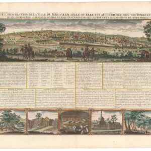
The British Ordnance Survey of 1864-65 was the first scientific attempt to map Jerusalem and its environs, a watershed survey that saw two of the finest Victorian maps ever created.
[Two maps sold together] The First Ordnance Surveys of Jerusalem. By Captain Charles W. Wilson R.E. Under The Direction of Colonel Sir Henry James, R.E. F.R.S. & C. Director of the Ordnance Survey. 1864-5.
Out of stock
Description
The 1864-65 ordnance survey of Jerusalem and its surroundings, conducted by the British Army’s Corps of Royal Engineers, was the first truly scientific mapping of the greater Jerusalem area. The survey lasted for nine full months and produced two iconic wall maps of different scales and sizes. It is a privilege for Neatline to be able to offer both of these seminal maps as a single lot.
The first is a topographical landscape survey with Jerusalem at its center. This measures 49.5 x 49 cm (19.5 x 19 in) and was drawn at a scale of 1:10,000. The second map is significantly larger at 72 by 117 cm (28 x 46 in). This is a more detailed architectural plan of the Old City and its immediate surroundings, compiled at a scale of 1:2,500. Both maps were originally published as supplements to the official Ordnance Survey report issued by Her Majesty’s Treasury in 1865.
Context is everything
The Ordnance Survey of Jerusalem took place over the course of nine months between 1864 and 1865. It was the first time that a formal British Ordnance Survey was undertaken outside of the United Kingdom, and it also constituted the first scientific mapping of Ottoman Jerusalem and her environs. While it would hardly be misleading to ascribe imperial or colonial motives to the undertaking, the primary reason for initiating the survey was to ensure a clean and stable water supply to a city that increasingly was receiving European visitors – be they pilgrims, religious immigrants, or Victorian travelers. The survey was conducted by the Royal Engineers, who over the past decade had been incorporated into the British Army following the allocation of the Ordnance Survey to the War Department in 1855.
The project was primarily a private initiative, set in motion through an efficient collaboration between Lord Shaftesbury, Alexander McCaul of the London Jews’ Society, and James Finn, a former British consul in Jerusalem. Together they formed the Water Relief Fund in 1864 and began lobbying wealthy and influential socialites to fund a group of Royal Engineers to survey the ancient city. A 28-year-old engineer and officer, Charles William Wilson, was appointed to lead a team of six Royal Engineers (all listed on the map). Work began in early October 1864, and the survey was finally completed just under a year later, in June of 1865.
Despite being the survey’s primary objective, the team found no new sources of potable water. It is not entirely clear whether it was the paucity of new water sources that stimulated a shift in interest to more political matters or it was the other way around. However, what is clear was that by the end of the survey, it had developed entirely different aims than when it started. Instead of the noble goal of supplying pious pilgrims with clean water, the survey now constituted part of an information-gathering exercise that eventually could lead to a more permanent British presence in the Holy Land, and perhaps even a complete take-over, should circumstances allow it.
Despite such imperial ambitions lurking in the background, the survey created the most comprehensive and accurate map of Jerusalem produced to date. Unlike Pierotti, who had gotten access to the Haram al-Sharif at a time when only Muslims were allowed, the British survey team managed to win access to the unexplored subterranean features of the Temple Mount. These investigations led to numerous discoveries, including an arch that once had supported a medieval bridge into the Haram al-Sharif complex. This arch can still be seen above the Western (or Wailing) Wall and still carries Wilson’s name. In addition to creating the first scientifically anchored map of Jerusalem and locating these ancient features of profound symbolic importance, the survey was also the first to ascertain the exact distinction between Mediterranean Sea levels and the Dead Sea depression.
Topographical mapping and architectural planning
Moving on to the two maps, we first note that they accomplish entirely different goals. Whereas the smaller map, at a scale of 1:10,000, illuminates the landscape in intricate topographical detail and covers a significant portion of Jerusalem’s hinterland, the larger map focuses more on features and infrastructure in or immediately connected to the Old City. Dominating the majority of both maps is the outline of the walled town, but it is quite clear that the environs are the more critical element in the topographical map.
In the dedicated town plan, most of the built-up areas are kept in a clean and featureless grey. Jerusalem, at this time, was part of the Ottoman Empire, and privately owned buildings were rarely accessible to the British surveyors, disallowing individual units to be endowed with any degree of detail. The meticulousness of the British surveyors is nevertheless evident from the careful rendition of publicly accessible landmarks and monuments, which are shown in considerable detail. There are depictions of everything from the city walls and Mamluk fortifications to some of the holiest sites in Judaism, Christianity, and Islam.
Unlike most Victorian maps of Jerusalem, the Ordnance Survey maps use local instead of English place names. Thus al-Aqsa is referred to as a masjed (Arabic for mosque), and the Dome of the Rock is identified by its Arabic name, Khubbat as-Sahkra. The use of local toponyms was largely the achievement of missionary Carl Sandreczki, who supplied the survey team with a general orthography of the city by compiling a long list of place names in local languages. These lists included streets and roads, buildings, and many historical and religious landmarks, all of which the survey team incorporated onto the map.
There are differences as to what the two maps label within the city of Jerusalem. The scale and sheet size variance obviously allows the larger map to include considerably more detail. Yet, unlike its topographical counterpart, the plan does not subdivide the city into religious or ethnic quarters. In that sense, the larger plan map is more neutral in its composition.
Another striking contrast between the two maps, which lies at the core of how they were conceptualized, is that the larger plan map has replaced most of the topographic detail with qualitative features of the landscape. Thus roads, reservoirs (birket), fields, orchards, and cemeteries have all been carefully drawn in and labeled, while only the most dominant wadis surrounding the city retain topographical characteristics.
In both maps, we note the large compound labeled “Russian Property” northwest of the Old City. This complex was built between 1860 and 1864 by the Imperial Orthodox Palestine Society and had only just been completed as a massive site for Russian pilgrimage when Wilson and his team were surveying this area. That the British looked upon this compound and the strong Russian presence with a combination of awe and concern is reflected in the fact that once the Ottoman Empire collapsed and Palestine came under British Mandate (following World War I), the Russian facilities were quickly converted into the seat of the Mandate administration.
Conclusion
In the end, the survey became the primary impetus for founding the Palestine Exploration Fund, which over the coming decades would survey and map extensive tracts of the Middle East, in part searching for evidence to verify the Biblical narrative. The PEF first convened in June of 1865, only weeks after the survey had been completed. At its head stood Charles Wilson. The PEF continues to be a decisive scientific presence in Israel/Palestine today.
Census
The report of the 1864-65 Ordnance Survey exists in a number of institutional libraries, including the university libraries of London, Glasgow, Göttingen, and Leipzig (OCLC no. 712253661), as well as in the Rijksmuseum in Amsterdam, and the National Libraries of Scotland, Denmark (OCLC no. 643578663), and Israel (Call no. L-IAA-ARC-044120).
In 1980, Israeli scholar Dan Bahat issued a facsimile edition of the report, which included all of the photographs and plans but not the large-scale maps printed separately.
Examples of the original large-format maps are increasingly difficult to find, especially both together as offered here. Institutional holdings are listed in the National Library of Israel (unverified) and at the Hebrew University on Mt Scopus (System no. 990020177550203701).
Cartographer(s):
The Ordnance Survey was, and still is, the official National Mapping Agency in Great Britain. Founded in 1791 as the cartographic arm of the British Army, The Ordnance Survey was primarily responsible for mapping Great Britain itself. Yet as the British Empire expanded its holdings militarily, Ordnance Surveys were instigated at key locations throughout the world, often in collaboration with other governmental or semi-governmental bodies.
Condition Description
Larger map: Very good. Dissected and laid on linen. Minor split to one seam. Attached to cover boards ('Letts Son & Co., 8 Royal Exchange, agents by appointment to Her Majesty's Board of Ordnance'). 72 x 117 cm (28 x 46 in)
Smaller map: Segmented and laid on linen. Old German Library library stamp and shelf cancellation at bottom right. 49.5 x 49 cm (19.5 x 19 in)
References
Bahat, Dan 1980 "Introduction: The Ordnance Survey and its contribution to the study of Jerusalem” in Ordnance Survey of Jerusalem (Facsimile ed.). Ariel Publishing House: Chicago.
Foliard, Daniel 2017 Dislocating the Orient: British Maps and the Making of the Middle East, 1854-1921. University of Chicago Press: Chicago.
Glatt, Benjamin 2016 "Surveying Jerusalem" The Jerusalem Post (25 October 2016).
Schelhaas, Bruno, Jutta Faehndrich & Haim Goren 2017 Mapping the Holy Land: The Foundation of a Scientific Cartography of Palestine. Bloomsbury: London & New York.
![[Map of Medaba]](https://neatlinemaps.com/wp-content/uploads/2025/03/NL-02342_thumbnail-300x300.jpg)