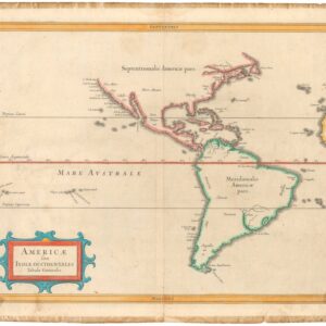
Exciting map of the Americas filled with place names along the coastlines, an uncommon feature for this region in the mid-16th century
Brevis, Exactaq. Totius Novi Orbis, et Peruviae Regionis Descriptio, Recens Edita
Out of stock
Description
Jean Bellère first printed this small map for Lopez de Gomara’s La Historia General de las Indias in 1554, and then for LEVINUS APOLLONIUS’s, De Peruviae, regionis, inter Novi Orbis provincias celeberrimae, inventione. Antverpiae: apud Joannem Bellerum sub Aquila Aurea, 1567. The map is separate, but this book is included.
The depiction of North America is one of the first to report on the explorations of Lucas Vazquez de Ayllon, Estevao Gomes, who had mutinied from under the command of Magellan, and later led an expedition in search of the Northwest Passage; and Joao Alvares Fagundes, who had explored the coasts of Newfoundland and Nova Scotia.
Ayllon led a failed 1526 expedition that was the first European attempt to set up a permanent colony in North America. Gomes had piloted one of the ships on Magellan’s 1519 circumnavigation expedition but mutinied and returned to Spain, where he was imprisoned until the rest of Magellan’s expedition returned. He was then entrusted with command of a 1521 expedition in search of the Northwest Passage. Fagundes had explored the coasts of Newfoundland and Nova Scotia in the 1520s.
The map is particularly unusual for its use of many place names along the east coast of North America, and along east and west coasts of South America. The east coast of the Americas is fully depicted for one of the first times in an European map.
Compared to the coasts, the interiors of the Americas have minimal detail. South America shows a mountain range that roughly corresponds to the Andes, though located centrally, rather than on the west coast. The Amazon is depicted in having its source far to the south. The interior also includes a depiction of three llamas. The interior of North America shows only a scattering of mountains.
The lower left corner is decorated with a double-headed eagle holding the coat of arms of Castile and Leon and flanked by the pillars of Hercules, several ships and sea monsters, and four wind heads.
This is the second state of the map, on which the word “Peru” is written horizontally.
Cartographer(s):
Jean Bellère (1526-1595) was a Flemish publisher and well-known music composer.
Condition Description
Original margins. Brown spots, a few small worm holes, worn bottom edge; issued folding.
References
Sabin, 1761; Leclerc; Palau 13928; Adams, A-1318
