East Africa on the eve of World War II: the Italian gambit.
Colonie Dell’Africa Orientale Italiana e Abissinia
Out of stock
Description
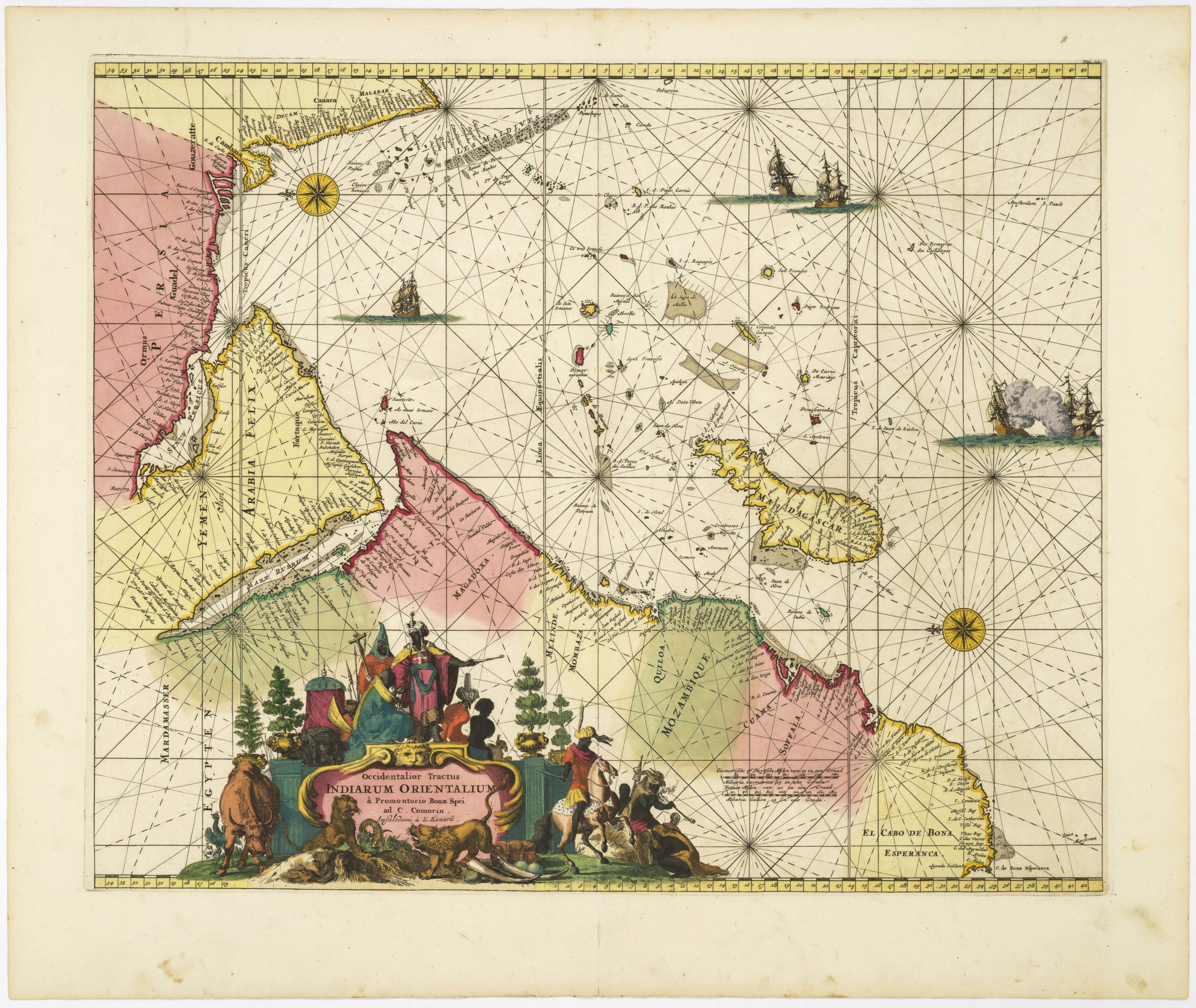
This attractive map of East Africa presents the political situation of the region just prior to World War II. It was published following the Second Italo-Ethiopian War, also referred to as the Second Italo-Abyssinian War, fought between October 1935 and February 1937. British and French Somaliland are shown, before the Italian invasion during the 1940 East Africa Campaign.
Italian East Africa was an Italian colony in the Horn of Africa. It was formed in 1936 through the merger of Italian Somaliland, Italian Eritrea, and the newly occupied Ethiopian Empire which became Italian Ethiopia. The map captures the apex of Italian influence in the region; the loss of World War II would mean the end of Italian power in East Africa. In January 1942, with the final official surrender of the Italians, the British, under American pressure, signed an interim Anglo-Ethiopian Agreement with Selassie, acknowledging Ethiopian sovereignty. In the peace treaty of February 1947, Italy officially renounced sovereignty over its African colonies.
An interesting and uncommon feature of this map is the illustration of flags corresponding to political territories, including the variant flag of the Kingdom of Italy, with the vertical tricolore of green, white, and red, along with the arms of Savoy.
Cartographer(s):
Condition Description
Folding map; excellent.
References


![[3-Sheet Biodiversity Map of Madagascar] Carte Internationale du Tapis Végétal et des Conditions Écologiques.](https://neatlinemaps.com/wp-content/uploads/2024/05/NL-01035-middle_thumbnail-300x300.jpg)