An excellent example of the Vaugondy-Santini map of Southeast Asia.
Archipel des Indes orientales qui comprend les isles de la Sonde, Moluques et Philippines
Out of stock
Description
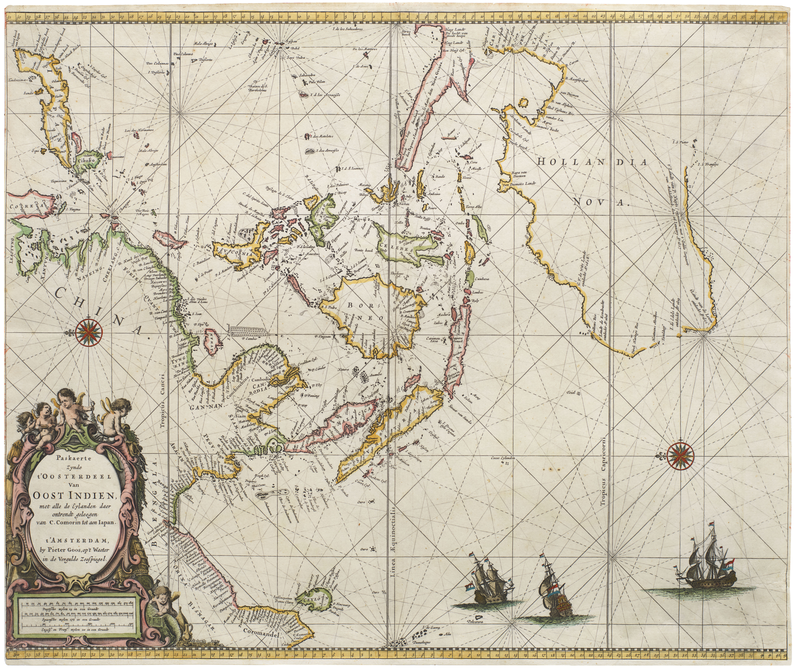
A sumptuous map of Southeast Asia, with hand color and wide margins. Published in Venice in the year 1778, the map stretches from Vietnam, Malaysia, and Sumatra in the west to parts of Australia (still called ‘New Holland’ at this point) and Papa New Guinea in the east. Between these we find the Philippines, Borneo, Java, Indonesia, and more.
By the 18th century, this region had already long been the desire of European powers, and the target destination for history’s greatest explorers of the era. Mariners from the Dutch East India Company, in particular, had contributed significantly to the cartographic understanding of the complex coastlines and archipelagos found there. But this map was published at a fascinating time of transition, which saw a rise in British regional power. It was published just after Cook’s famous third voyage shed light on the shape of Australia, and just a few decades before Thomas Stamford Raffles founded modern Singapore. Singapore itself is labeled on the map, but there is little indication that it would someday become a nexus of British might in Southeast Asia.
Cartographer(s):
Paolo Santini (1729-1793), an esteemed cartographer from Venice, was actively producing maps during the mid to late 18th century. He gained acclaim for his “Atlas Universel,” a comprehensive collection showcasing all known regions of the world. Each map within the atlas stood out for its intricate engraving, seamlessly melding artistic elegance with up-to-date geographical data. Often, Santini would adapt and refine the works of his contemporaries, a prevalent practice of the era, ensuring the latest knowledge was readily available to his audience.
Condition Description
Optimal.
References
![[Political broadside] Solidarity with the People and Students of the DPR of Korea.](https://neatlinemaps.com/wp-content/uploads/2022/10/NL-01603_thumbnail-1-300x300.jpg)
![[Political broadside] Solidarity with the People and Students of the DPR of Korea.](https://neatlinemaps.com/wp-content/uploads/2022/10/NL-01603_thumbnail-scaled.jpg)
![[Political broadside] Solidarity with the People and Students of the DPR of Korea.](https://neatlinemaps.com/wp-content/uploads/2022/10/NL-01603_thumbnail-scaled-300x300.jpg)