Fries’ 1535 map of the Holy Land, based on the unobtainable Vesconte manuscript Crusade map.
Tabula Terre Sanctae.
$1,900
1 in stock
Description
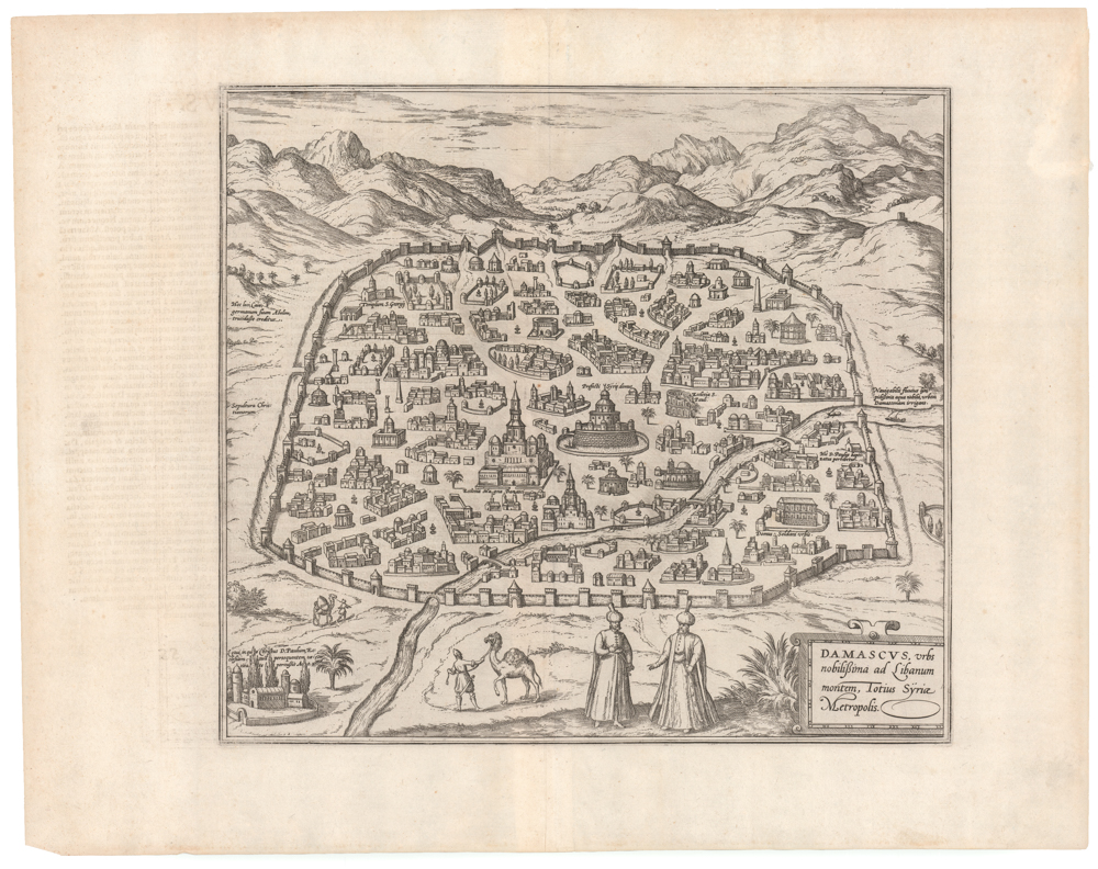
Laurent Fries’ map of the Holy Land, created in 1522, is among the earliest printed maps of this region and a significant milestone in the historical mapping of Palestine. Fries based his map on Pietro Vesconte’s 14th-century manuscript map of the region, originally designed as part of Marino Sanudo’s letters advocating for a new crusade (ca. 1320). The map presents the region in its Biblical context – including delineating territories belonging to the different Tribes of Israel – making it one of the earliest maps to actively encourage a European military intervention in the Holy Land.
Despite not adhering to the predominant Ptolemaic tradition, emulations of Vesconte’s map appeared in many printed editions of Ptolemy’s Geographia, including Martin Waldsemmüller’s. Nicolaus Donnus Germanus, a vital editor and contributor to the first Ptolemaic atlases, had encountered and copied Vesconte’s map in the early 15th century. He would integrate the Vesconte map so firmly in the emerging paradigm of Ptolemaic atlases that it soon became accepted as a part of the Ptolemaic canon. Vesconte and Danish cartographer Claudius Clavus were the only medieval mapmakers to achieve this status in the early 16th century.
Like Vesconte’s original, Fries orients his version to the southeast so the Mediterranean coastline faces downwards. In scope, the map stretches from Sidon in the north to Gaza in the south. To the north and east, the Holy Land is bounded by schematic mountain ranges framing and separating Palestine from Arabia Deserta. Compared to Vesconte’s original, Fries draws these ranges far more coherently and wall-like. Within the Holy Land, we find an abundance of toponyms and physiographic attributes. Well-known landscape features, such as the Jordan River, the Dead Sea (labeled Sea of Sodom), Lake Tiberias, and the Sea of Galilee, are prominently displayed and labeled on the Fries map.
The map abounds in place names, recognizable from the Biblical narrative or their continued existence today. Jerusalem, Bethlehem, and Hebron are but a few examples. Also included, sometimes even as pictograms, are Biblical landmarks such as Rachel’s Tomb. As with Vesconte’s original, Fries’ map depicts isolated mountains in a ‘bread loaf’ form and divides the region between the Tribes of Israel.
Fries’ map is an essential milestone in the history of Holy Land cartography. It provided a foundation for the depiction of Greater Palestine that persisted until the 18th century, making it one of the most influential maps of the age.
Census
Vesconte’s 14th-century manuscript lacks a clear precursor, drawing primarily on ancient descriptions by Josephus and medieval reports by Burchard of Mount Sion. Burchard’s firsthand accounts of Jerusalem, written before it fell to Sultan al-Ashraf Khalil in 1291, were of particular interest to Marino Sanudo. The Vesconte map was part of a strategic plan by Sanudo to persuade Pope John XXII and King Charles IV of France of the necessity for a new crusade. The original manuscript was included in Sanudo’s detailed proposal: Liber secretorum fidelium crucis (Book of Secrets for True Crusaders). This encouraged the new crusade by highlighting which Biblical places the proposed endeavor would recapture.
Lorenz Fries’ map first appeared in his 1522 Strasbourg edition of Ptolemy’s Geographia (Claudii Ptolemaei Geographicae enarrationis libri octo). Subsequent editions were published in 1525, 1535, and 1541.
The 1535 edition, which was edited by Michael Villanovus (Servetus) and from which this particular sheet comes, is rare due to the editor’s execution for heresy and the subsequent burning of his works, as ordered by Calvin.
Cartographer(s):
Laurent/Lorenz Fries (ca. 1485-1532) was born in Alsace circa 1490 and studied medicine and mathematics at a number of European universities. He was trained as a physician but was also keenly interested in cartography and medical publications. From 1518-19 Fries is mainly based in Strasbourg, where he was commissioned to compile the first edition of Waldseemüller’s atlas after his death in 1520.
Marino SanudoMarino Sanudo (c. 1270 – 1343) was a Venetian statesman and geographer best known for his efforts to revive the Crusades. His Liber secretorum fidelium crucis, intended to encourage a new crusade, included Pietro Vesconte’s famous manuscript map of the Holy Land.
Pietro VescontePietro Vesconte (died ca.1330) was an early 14th-century Genoese cartographer and a pioneer in creating accurate nautical charts. His maps, including those for Marino Sanudo’s manuscripts, were among the earliest to accurately depict the Mediterranean and Black Sea regions.
Condition Description
Very good and sharp wood cut map. Wide margins. Manuscript writing at top center ‘oriens,’ at bottom center ‘occidens,’ and at left 'septentrio' (east, west, north, respectively).
References
Related products
-
-
Add to cart

- Eastern Mediterranean - Holy Land
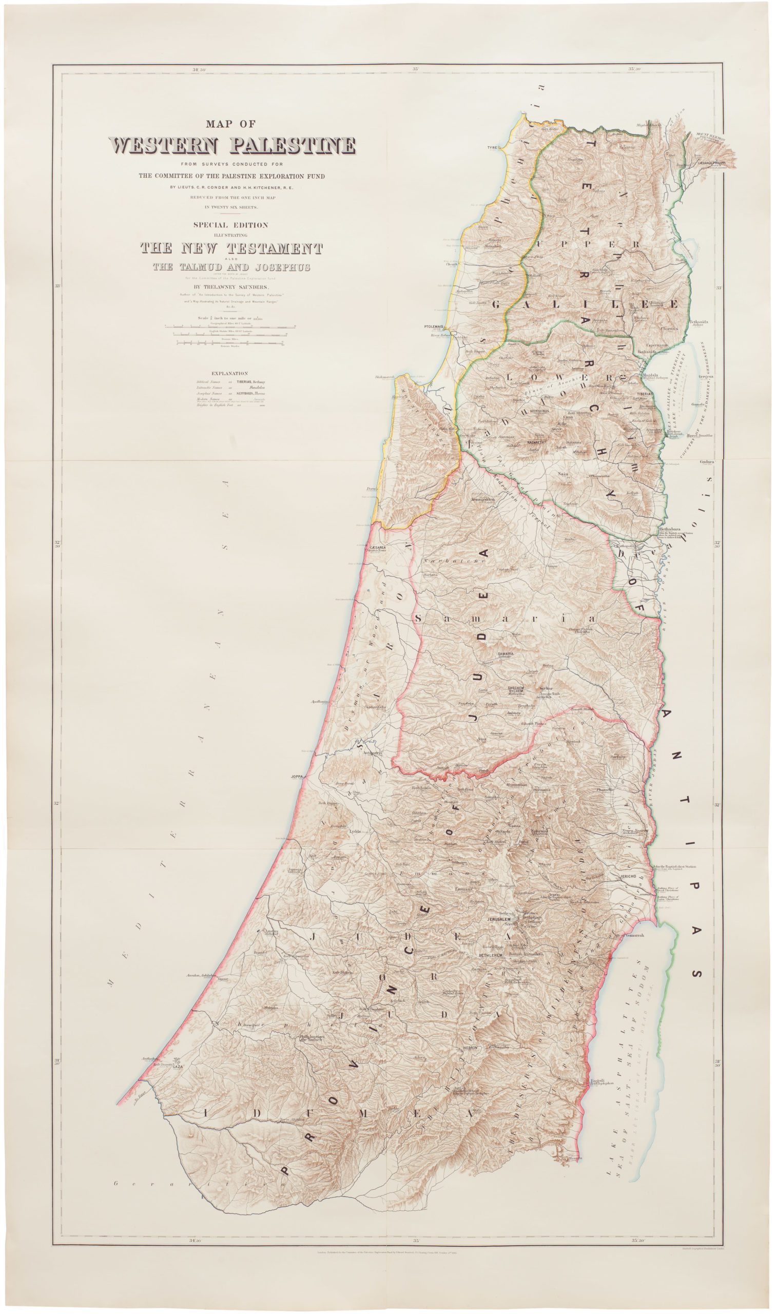
Map of Western Palestine from surveys conducted for The Committee of the Palestine Exploration Fund. By Lieuts. C. R. Conder and H. H. Kitchener, R. E. Reduced from the one inch map in twenty six sheets. Special Edition Illustrating The New Testament also The Talmud and Josephus (after the birth of Jesus)…
- $1,000
-
-
-