Speed’s stunning map of France, produced at the height of religious war in Europe.
France revised and augmented the attires of the French and Situations of their Cheifest cityes observed.
$2,200
1 in stock
Description
By far the finest example we have ever seen.
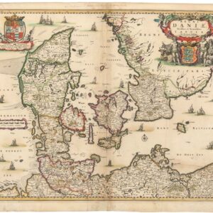
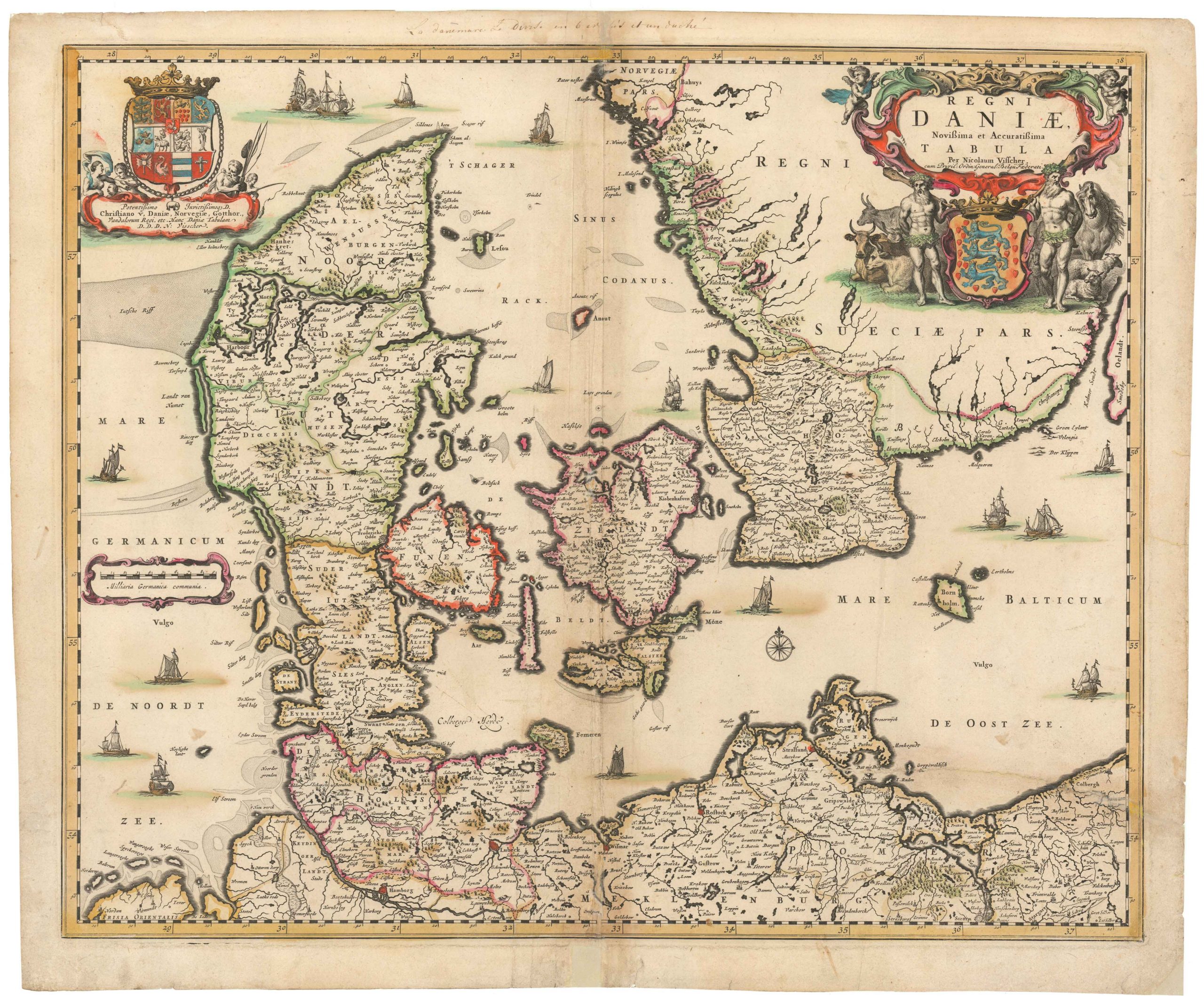
English cartographer John Speed’s early 17th-century maps are highly desired among collectors for their accuracy, design, and wealth of details. Speed combined the latest geographical information with visualizations of cities and peoples in the depicted region, making his maps distinct from those of his peers. Speed applied this compositional design regardless of whether he was rendering a smaller nation, Denmark, or an entire empire, such as the Ottomans. In this manner, Speed helped reinforce an overall trend in the 17th century of elaborating maps to approach works of art.
Speed commissioned this decorative map of France to be engraved by Dirck Gryp in 1626. Typical of Speed’s output, the map includes eight town views along the top – the first depictions of French cities found on a map – and ten illustrations of costumes set along the map’s flanks (five in each side panel).
Listed from left to right, the city views show Angers, Poitiers, Orleans, Paris, Rouen, La Rochelle, Bordeaux, and Calais. The costumed characters include everyone from the King and Queen, merchants and nobility, to lawyers and their spouses. The text on the verso provides a colorful Anglo-centric view of life in France at the beginning of the 17th Century.
Context is Everything
A complex interplay of alliances, conflicts, and diplomatic maneuvering marked early 17th-century Europe. Especially regarding English-French relations, it was a period of significant political developments. At the turn of the 17th century, both nations emerged from periods of internal strife and sought to assert their influence on the European stage. James I ascended the English throne in 1603, succeeding Elizabeth I. His reign initially sought to stabilize relations with France, which were strained due to the religious and political conflicts of the previous century. Under Henry IV, France was recovering from the Wars of Religion following the Edict of Nantes in 1598, which granted limited toleration to the protestant Huguenots. The aim was to strengthen France internally while navigating the delicate balance of power in Europe.
A significant event was a marriage between England and France. In 1624, Charles, Prince of Wales, who would later become Charles I, married Henrietta Maria, the Catholic daughter of Henry IV. The aim was to secure an alliance with France, thus counterbalancing the influence of the Habsburgs in Spain and the Holy Roman Empire. The union, however, was controversial in England due to religious tensions between Protestants and Catholics.
The Thirty Years’ War (1618-1648) profoundly impacted English-French relations. Although England was not a significant player in the conflict, its involvement was shaped by its alliance with France. Under the powerful Cardinal Richelieu, France sought to weaken Habsburg power, occasionally aligning with Protestant states despite being predominantly Catholic.
This pragmatic approach helped stabilize English-French relations for a period. Diplomatic marriages, shifting alliances, and the overarching religious struggle in Europe framed interactions in the 17th century and laid the groundwork for the more intense conflicts that would dominate the late 17th and 18th centuries.
Cartographer(s):
John Speed (1552-1629) was a prominent English mapmaker and historian operating in the late 16th and early 17th centuries. Born in Farndon, Cheshire, Speed’s interest in maps and geography led him to establish himself as a successful mapmaker and publisher in London. He gained widespread recognition for his detailed and beautifully illustrated maps of various regions, earning him the sobriquet “the leading London cartographer” of the Baroque period.
One of Speed’s most notable works is The Theatre of the Empire of Great Britaine, published in 1611. This ambitious atlas consisted of detailed maps of counties and cities across England, Wales, Scotland, and Ireland, accompanied by historical descriptions and genealogical tables. The atlas was not only a cartographic achievement but also a significant historical record of the British Isles during that era. Speed’s maps were praised for their accuracy and artistic flair, often featuring decorative elements and engravings of notable landmarks and figures. When it came to Britain’s colonial aspirations, Speed was instrumental in visualizing the empire cartographically.
Both during his life and after it, John Speed’s maps enjoyed widespread popularity and were sought after by nobility and scholars alike. Speed reached the ripe age of 77, and his maps were re-published for more than a century after his death. His legacy as a key figure in the development of English cartography endures to this day.
Condition Description
Excellent. Original color, possibly refreshed.
References
Related products
-
-
Add to cart


- Europe, Italy, Bird's-eye-views
Venetia.
- $3,500
-
-
-
![[Map of Steamship Routes and the Railways and Post Roads of the Russian Empire]](https://neatlinemaps.com/wp-content/uploads/2020/04/NL-00827_Thumbnail-300x300.jpg)
![[Map of Steamship Routes and the Railways and Post Roads of the Russian Empire]](https://neatlinemaps.com/wp-content/uploads/2020/04/NL-00827-scaled.jpg)
![[Map of Steamship Routes and the Railways and Post Roads of the Russian Empire]](https://neatlinemaps.com/wp-content/uploads/2020/04/NL-00827-scaled-300x300.jpg)