An extremely rare tract book of Pasadena and Altadena, with numerous unrecorded pasted-in extra maps.
Pasadena Tract Book.
Out of stock
Description
An exceptional find, this tract book of Pasadena (and Altadena, with a portion of San Marino), California was compiled by local surveyor Albert G. Thurston in the mid-late 1920s. Including Thurston’s “key map,” divided into 104 sheets, along with numerous paste-downs, it provides an extremely comprehensive view of the city and its development. Handwritten notes, stamps, and other annotations appear throughout.
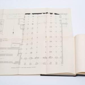
The tract book includes 104 cadastral or plat maps, noting “tract metes and bounds, [and] acreages” of plots in Pasadena and Altadena, which are denoted on the index map at the start of the book. Coverage ranges from the Arroyo Seco basin in the west (the city line now meeting the neighboring town of La Cañada Flintridge, then simply the former Rancho La Cañada) to Rosemead Blvd. in the east, and bounded on the north by the Angeles (“Angelus”) National Forest and on the south by South Pasadena and San Marino.
The Pacific Electric Railway, including the Mt. Lowe Railway which can be seen climbing up to Echo Mountain, appears frequently in the index map and individual section maps. The index map also notes a Thurston St. in Altadena, perhaps named for the cartographer, also (and now) called Marcheta St. Aside from the section maps, several pastedowns appear, promoting various developments, such as Deodar Circle and Vista, at the very front of the tract book, Pasadena Vista, and Hastings Ranch (large enough to constitute a whole neighborhood in eastern Pasadena, on the border with Sierra Madre).
Historical Context
As the tract book is testament to, this region was undergoing a real estate boom in the 1920s that saw it become one of the premier suburban destinations on the fringe of Los Angeles. Having already established a reputation as an ideal location for convalescents in the late 19th century, Pasadena in some ways became the archetype for Southern California boosterism, with palm trees aplenty in promotional materials seeking migrants to the growing town. Pasadena also benefitted from being developed at the height of the City Beautiful Movement, and was planned accordingly, with a magnificent domed city hall, other impressive civic buildings, Romanesque fountains, and the Rose Bowl Stadium, which was and continues to be one of the largest stadiums in the United States. As the city grew, both palatial mansions and more modest homes were built in the prevailing American Craftsman style.
Altadena also developed at this time, initially with mountainside homes of millionaires (including Andrew McNally, co-founder of map publishing powerhouse Rand McNally) and then with more middle and working class neighborhoods developing, including an African-American neighborhood, as the town was one of the few in Southern California without strict formal and informal means of ensuring segregation. Sadly, many of the individual family homes in Altadena were destroyed in the devastating Eaton Fire of January 2025.
Provenance
This tract book belonged to Reverend Ellis Bishop (1872 – 1933, signed on the inside cover), a New Jersey native who traveled widely and spent the last part of his life in Pasadena, engaged in civic and business affairs. Born in New Brunswick, New Jersey, Bishop attended Rutgers and then Berkeley Divinity School (now part of Yale Divinity School), became ordained as an Episcopalian priest, and became the assistant minister at Calvary Church in Manhattan. His career took him to Salt Lake City, his native New Brunswick, and back to Berkeley Divinity School, where he became a professor of pastoral theology.
Like many other Easterners and Midwesterners at the time, Bishop relocated to Pasadena for health reasons and acquired extensive real estate holdings in the fast-growing city, no doubt the reason for his owning this book. For instance, his Ellis Bishop Company (sometimes as “Ellis Bishop & Co.” later known as the Southlands Corporation) developed the Villa Anita Home Sites in northeastern Pasadena. He also developed real estate throughout Southern California, especially in San Diego County, and was deeply involved in the development of San Diego’s Kensington neighborhood. In 1928, Bishop built a Spanish Colonial Revival Style home in Rancho Santa Fe which is now listed on the National Register of Historic Places.
Census/ Rarity
This tract book is extremely rare. Only one other known example exists (OCLC 82915234), held by the Huntington Library. In addition to Thurston’s “key map,” the pastedown maps within the tract book are likewise very rare.
Cartographer(s):
Albert G. Thurston (c. 1880 – 1932) was a map and directory publisher active in Southern California. He most often produced maps of Pasadena, but also of the entire Southern California region and various locales therein. While operating his own business, Thurston was also closely connected to the Western Map and Publishing Co. and the Pasadena Blue Print Co. Thurston died in 1932, after which his daughter, Dorothy Thurston Sackett, briefly carried on his business.
Condition Description
Notable wear and soiling to the linen-wrapped cover boards. Interior pages mostly clean with some edge wear and adhesive residue from pastedowns.
References