The first printed map of Turkey.
Prima Asiae Tabula.
$9,500
1 in stock
Description
Asia Minor from the Rome edition of Ptolemy’s Cosmography, produced just decades after the fall of Constantinople.
This extraordinary 15th-century map of Asia Minor is among the earliest printed maps of any kind produced in Europe. At the time, the map’s scope constituted the heart of the Ottoman Empire. In modern terms, it depicts Turkey, an oddly shaped Cyprus, and the northern part of Syria. Also present are most of the Aegean islands, including Rhodes and Lesbos, and parts of Crete and the Peloponnese. The entire composition is framed by graticules indicating the Ptolemaic coordinate system that fixes the world in place and ultimately allowed new European traditions of cartography to emerge. Specific indications of the latitude are provided by printed comments in the side margins, outside the map proper.
The map is striking and vibrant, and the first thing that stands out is its splendid old color (lightly refreshed). As with all Ptolemaic maps, this composition builds on the re-discovered writings of Roman geographer Claudius Ptolemy, who compiled a compendium of coordinates for circa 10,000 known locations across the Earth. The extensive details and the delineation of provinces we see on this map are the results of that enormous compendium. In addition to bringing the map to life, the color enhances topographical features and delineates the region’s administrative subdivision into provinces.
The rendition shows Asia Minor as it was known in Antiquity. Consequently, the newly conquered Ottoman capital is labeled as Byzantium que et Constantinopolis, and other now-Turkish cities retain their Greek or Latin place names. Among the historical locations near the Bosphorus, we find Chalcedon. In 451 CE, this small town hosted the fourth ecumenical council, at which the schism over Christ’s true nature was first cemented through the Church’s insistence on dyophysitism (i.e. the idea that Christ is of both divine and human nature at the same time).
This map is one of the earliest examples of copperplate engraving for cartographic purposes. It was printed as two halves on separate sheets and then joined to form one of the original tavola maps produced for the first Rome edition of Ptolemy’s Cosmographia. This edition was initially published in 1478 but reissued in 1490 and again in 1507/08 (more context below). Scholars and collectors generally acknowledge the Rome edition of Ptolemy’s Cosmographia as among the most superior early Italian editions of Ptolemy for its accuracy and aesthetic achievement.
Raleigh A. Skelton, former Deputy Keeper of the Map Room at the British Museum, drew a distinction between the Rome edition and its counterparts from Bologna, which he described as carelessly designed and crudely carved. Skelton noted how the Rome edition was superior in every respect – from the clean and careful precision of the compilation to the ‘sensitive use of the burin in working the plates.’ He also notes the high quality of the printing. Everything about this edition, it seems, was executed by an experienced master and a true virtuoso.
Brief history of publication
Maximus Planudes, a Byzantine monk in Constantinople, likely produced the first Latin translation of Ptolemy’s Geography in the early 14th century. By the end of the century, a copy appears to have made it to Florence, from whence it was disseminated throughout Italy. Based on the Planudes translation, the Florentine friar Jacobus Angelus published the first Italian translation of Ptolemy into Latin. These early translations did not include maps. Still, it was possible to construct maps from the extensive compendium of toponyms with associated coordinates. The first Ptolemaic Geography issued with maps came in 1477 and was published in Bologna. The following year, in 1478, a new edition was published in Rome, and this dramatically exceeded the Bologna edition in accuracy and aesthetic quality.
Two Germanic friars, Conrad Sweynheym and Arnold Pannartz, conceived of the Rome edition. Sweynheym had most likely apprenticed with Johannes Gutenberg and had been part of the team behind his revolutionary printing press (Zedler, 1901). In 1462, Sweynheym was forced to flee Mainz, and, like Pannartz, he sought refuge in the Benedictine abbey of Subiaco in Italy. Here, these two learned men assembled the first printing press outside of Germany and published a number of early works. Three years after their arrival, the two printing friars moved on to Rome, where they began the auspicious project of creating the first printed edition of the Cosmographia to include actual maps.
The project was visionary. Sweynheym had taken up engraving while in Subiaco and had become quite proficient. He sought to create visualizations that would lift Ptolemy to new heights. The undertaking was nevertheless seriously impaired when Pannartz died of plague in 1476. A year later, Sweynheym also died, although the cause remains unclear. Having come so close to completing the work, a new editor proficient in printing was summoned from Köln. Arnold Bukinck thus became the formal editor of the Rome edition, even though most of the content was created by his predecessors. The work was finalized and published in 1478, a year after Sweynheym’s death, and became an immediate success.
Following the first edition’s success, the demand for a new and revised edition grew, especially after the Portuguese navigator Bartolomeu Dias rounded the Cape of Good Hope in 1488 and thus opened a sea route to India for the Portuguese. This crucial discovery prompted a new edition of the Rome Cosmographia, published in 1490 and including textual references to Dias’ feat. Following the even more decisive discovery of the Americas a few years later, newer editions of the work were necessary, augmented in ways that considered the rapidly expanding world geography. The original 1478 edition contained 27 folio map plates, consisting of one world map, ten Europe plates, four Africa plates, and twelve Asia plates (of which our listing is one). In the 1507 and 1508 editions, new, ‘modern’ map plates reflecting the discovery of America and the maritime passage to India were added (including a world map by Dutchman Johann Ruysch).
Despite adding new maps to the early 16th century editions, all four versions of the Rome Cosmographia (1478, 1490, 1507, & 1508) included the original 27 tavola maps engraved by Sweynheym. Until recently, scholars believed that these original maps remained unaltered and were printed from the same plates, possibly even in a single large ream used for all four editions. Recent research has nevertheless shown that this was not the case (Peerlings et al. 2018) but rather that the changes implemented on the original plates were so subtle and limited that they had gone unnoticed. A more systematic study showed that only three of the 27 maps have seen alterations in the plate and thus exist in multiple states.
Identifying and dating maps from the Rome edition
As noted, four distinct editions of the Rome Cosmographia were issued, but the bulk of the maps was printed from the same plates as the original 1478 edition. Consequently, it can be difficult, if not impossible, to identify from which edition a loose map might derive. We might as well state it outright: there is no way to know from which edition of the Rome Cosmographia our particular map comes.
Two principal clues aid scholars in dating separated Rome Ptolemy maps. The first, as mentioned above, are minor variations in the maps from edition to edition. Unfortunately, Prima Asiae Tabula has no variations in the four Rome editions. The second clue involves the paper’s watermark. Marcel Destombes (1952) was the first to seriously argue that individual sheets of the Rome editions could be identified by their watermark. Destombes also provided some initial analysis by attributing certain watermarks to specific editions, including a claim that a crossbow and lion denoted the 1478 edition. In contrast, a cardinal’s hat, a ladder, a French lily, or a T in a circle represented the 1490 edition.
More recent scholarship (Peerlings et al. 2017) has reinforced the idea that specific watermarks can be associated with certain editions. Still, they also note how – due in part to the printing procedure – many map sheets do not allow dating in this manner – at least not with any degree of certainty. Some maps, for example, have two contradicting watermarks, one in each half. In other cases, there is no watermark; this is the case for our map, which lacks a watermark.
Why would most Rome Ptolemy maps have one or two watermarks while others have none? We find the answer to this question in the printing methodology. Roughly half of the loose maps have two watermarks, whereas about a quarter have one, and about a quarter have none. Mathematically, this is explained by the procedure by which such maps were printed. We have already noted how these maps were printed as two halves and joined, with no text on the verso. In all likelihood, the reams of paper for printing would have required that each sheet was cut in half and subsequently printed using a single copperplate (i.e. half of a map). The printer completed each run before moving on to the next, seemingly indifferent to what sheet halves were used.
The consequence was a random mixture. Each large sheet of paper had one watermark but would become two sheets for printing. Later, the two halves were joined again to form the final map. If the printer did not concern himself with what half of a sheet was being used, or indeed what face or direction the paper turned when printing, statistically, the outcome would reflect what we have today. The procedure not only explains why we have sheets with no watermarks but also why there are sheets that have two. It even explains those rare cases where the two halves of a map contain different watermarks. Because the same plates were used in all four editions, half-sheets from different editions may have been joined in later composite atlases or simply from old inventory.
Skelton has argued that about 500 copies of the original 1478 edition were published, marking the smallest run of the four editions. Moreover, the variation of watermarks in the 1478 edition is the most limited, making their attribution easier as long as a watermark exists. In the case of no watermark, raw statistics suggest that 1478 is the least likely date for an unmarked map. However, even when no watermark exists, secondary indications can help one hone in on the date. The most critical element in this regard, which several scholars have noted, is that the 1478 and 1490 editions were printed on high-quality paper, which is certainly true of our map.
In light of the complex history behind this seminal work, Neatline cannot guarantee from which edition of the Rome Cosmographia our sheet derives. What we can say, however, is that it was printed from Sweynheym’s original plate without variations or amendments and that it belonged to one of the most important geographic publications in history.
Cartographer(s):
Roman geographer and mathematician Claudius Ptolemy (c. 100 – 170 CE) solidified geography as an independent discipline.
The Ptolemaic understanding of the world stems from Ptolemy’s seminal work, Geographia. Initially intended to revise and critique another (now lost) geography written by Marinus of Tyre, Ptolemy compiled Geographia in Alexandria around 150 CE. It consisted of a treatise on world geography, instructions on making maps, and a topographically-anchored gazetteer. It forms the basis of scientific cartography: a coordinate-based system meant that future cartographers (even many centuries later) could recreate its maps using the published data. The work covered an area from the Canary Islands in the west to the coasts of China and Korea in the east.
Condition Description
Old color, refreshed. Two sheets conjoined as usual. Trimmed into the printed border on left, as issued. Some old ink mss. on the map area.
References
Destombes, Marcel (1952). Catalogue des cartes gravées au xve siècle.
McGuirk Jr., Donald L. (1989). Ruysch World Map: Census and Commentary, Imago Mundi 41: 133-41.
Nordenskiöld, Adolf E. (1973) Facsimile Atlas to the early History of Cartography with Reproductions of the Most Important Maps Printed in the XV and XVI Centuries, New York.
Peerlings, Robert H.J., Frans Laurentius & Jaap van den Bovenkamp (2017). The Watermarks in the Rome editions of Ptolemy and More, Quaerendo 47: 307-27.
Peerlings, Robert H.J., Frans Laurentius & Jaap van den Bovenkamp (2018). New Findings and Discoveries in the 1507/8 Rome Edition of Ptolemy’s Cosmography, Quaerendo 48: 139-62.
Skelton, R.A. (1966). Claudius Ptolemaeus, Cosmographia: Roma 1478, with an introduction by Raleigh A. Skelton, Amsterdam.
Stevens, Henry N. (1972) Ptolemy’s Geography: A brief account of all the printed editions down to 1730, Amsterdam.
Zedler, Gottfried (1901). Gutenberg-Forschungen von Gottfried Zedler. Leipzig.
Related products
-
-
Add to cart
- East & Midwest United States, Featured Maps & Views
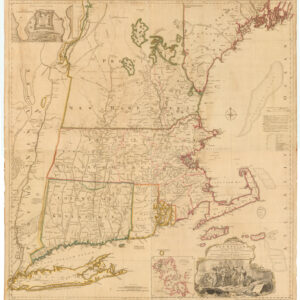
A MAP of the most INHABITED part of NEW ENGLAND, containing the PROVINCES of MASSACHUSETS BAY and NEW HAMPSHIRE, with the COLONIES of KONEKTIKUT AND RHODE ISLAND. Divided into Counties and Townships: The whole composed of Actual Surveys and its situation adjusted by ASTRONOMICAL OBSERVATIONS.
- $55,000
-
-
-