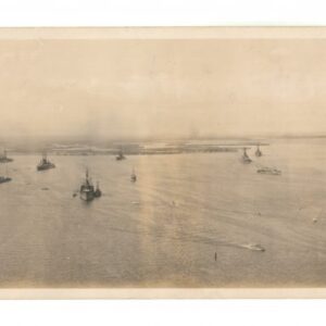
Panoramic photograph showing Cape Town and the Cape Colony during the heyday of British colonial rule.
[South Africa] Photograph panorama of Cape Town, c. 1870
$1,600
1 in stock
Description
This panoramic photograph of Cape Town captures one of the most intense periods of the city’s long colonial history. The panorama depicts Cape Town around 1870, a decisive year in the history of what was then known as the Cape Colony. This time saw the opening of South Africa’s four most productive diamond mines, a phenomenon that dramatically strengthened the motivation for fully incorporating Southern Africa into the British Empire.
The image has a somewhat unique vantage point, essentially looking northeast, across Table Bay. It is immediately evident that Cape Town had not yet developed into its current metropolis. The photographer presumably established his shots from the double coastal peaks known as Signal Hill and Lion’s Head. The view looks across the original colonial settlement and city center, with the District 6, Woodstock, and Salt River neighborhoods in the distance. From this viewpoint, the city lies between the Atlantic and the iconic Table Mountain, so named for its extended flat summit. The craggy pinnacle overlooking the town is known as Devil’s Peak.
The coastal mountain range creates a natural theater out to the bay, constituting the locus of the initial colonial settlement. On the left of the image, we see the city wharves and harbor, which would later develop into the Victoria & Albert Waterfront Area, but not until the 1880s and 1890s, after our panorama was taken. The city is laid out in the traditional grid of quickly built colonial cities, and the white houses for which Cape Town is still famous contrast starkly with the sandstone and granite suites of the local bedrock. Looking north beyond the central sprawl of occupation helps us understand that this is a very early representation of the city.
At the city’s heart, we see an elongated green stretch: Company’s Garden, the oldest garden built in South Africa. It was founded in the 1650s by the Dutch East India Company and was initially used by the first European settlers to grow fresh produce to sustain the colony and replenish ships rounding the Cape. In the 17th century, the gardens were already watered from the many natural springs found on Table Mountain. In the 1680s, the garden was converted into a pleasure garden and was celebrated as having one of the most diversified collections of plants, trees, and shrubs anywhere in the world. Even today, the Company Gardens boast the oldest cultivated tree in Southern Africa – a pear tree planted in 1652.
Behind the Company Park, further up the lower slopes of Table Mountain, we find the open space that, at this stage, belonged to the farm Oranjezigt (Orange View). This area was sold by the Van Breda Family to the Cape Town City Council in 1877, intending to create the city’s first fully public gardens. The project was completed in 1895, and part of its development included the construction of the now famous Molten Dam, which accumulates the water from Table Mountain and redirects it into the city – especially the Company’s Garden. None of these landmarks had yet been commenced when this photo was taken; instead, we find Cape Town on the cusp of its perhaps most dramatic development into a modern metropolis.
Context is Everything
Cape Town was among the first colonial settlements in South Africa. The Portuguese initially noted it during their endeavors to round the Cape and dominate trade in the Indian Ocean. The first European to land in Table Bay was the Portuguese captain Antonio de Saldanha, who also famously climbed the summit of Table Mountain. After Samdanha’s visit in 1503, the Portuguese continued to sail to this location to replenish the water and vegetable supplies before rounding the Cape. Portuguese sources record several violent skirmishes with the local Khoi, who were local cattle herders and pastoralists (and for centuries known to Europeans as Hottentots).
However, it was not until the mid-17th century that an actual settlement was created here. In 1647, the Dutch ship Haarlem was wrecked in Tabel Bay during a storm. Being a well-known stopping point, the surviving sailors were rescued, but not before they could assess conditions here more thoroughly. In 1651, following the marooned sailors’ reports of fertile soils and potentially friendly locals, the Dutch East India Company decided to establish an outpost here to assist in re-supplying friendly ships rounding Africa. The aforementioned Company Gardens were founded only a year later and were an integral part of this ambition.
The settlement grew in the coming years, partly due to the European settlers communing with the local Khoi people but mainly by the influx of new emigrants from the Old World. These included the unwanted in Dutch society, orphaned girls, and prostitutes in particular, but De Kaapsche Vlek, as it was known, also attracted a significant number of French Huguenot protestants feeling persecution in France. By the end of the 17th century, the settlement had more than a thousand inhabitants. Most of them were Dutch, but there were also communities from France, Belgium, Germany, and Denmark, not to mention Indian and African merchants. About half of the population of Cape Town in the year 1700 were slaves.
The settlement continued to grow in the following century until it was seized by the British in 1795 (with the Dutch garrison surrendering in 1806 and the Dutch only ceding the site formally to Britain in 1816). At that stage, Cape Town had a population of almost 15,000 people. Over the next hundred years, the Cape Colony, as the British called it, would enter into a period of constant hostility and strife known as the Cape Frontier Wars, which lasted roughly from 1779 to 1879. Several parties fought the wars. In the beginning, it was mainly about control of the cape. The established settlers and their patrons – primarily the Dutch – continuously had to ward off engagements from the British. But even after British hegemony had been established, the wars continued, mainly between the new British overlords and the local Xhosa peoples fighting to cast off the shackles of colonialism.
When the British formally took control in 1816, Cape Town had a population of circa 60,000. Around half of these were European settlers; just over a quarter were free Khoi and Xhosa peoples, and about a quarter were slaves, most of whom had been imported from other places in Africa and the Malay Peninsula. The latter group’s descendants still form the community of ‘Cape Muslims’ today. Over the coming decades, the region experiences repeated violent strife, with the British violently quelling local and colonial claims. From the time the British arrived in force and the capturing of this photograph in 1870, Cape Town had experienced no less than eight wars, famine, and the so-called Great Trek.
In 1854, the governorship of Cape Town passed to Sir George Grey, who is perhaps most famous as the British Governor, who both admired and completely suppressed the Maoris of New Zealand. In South Africa, Grey was responsible for the development of Cape Town and its hinterland and, to some degree, for halting the continuous bouts of carnage both between the various colonizing entities and between the colonizers and the region’s indigenous tribes. But he was also the kind of ruthless colonizer marked by infamy and notoriety today.
In 1854, in a complicated series of developments, the local Xhosa began a ritual slaughtering of their cattle, which constituted the tribes’ only real livelihood. This sacrificial slaughter was believed to inspire the Xhosa ancestors (and their dead cattle) to fight alongside the living Xhosa to regain their ancestral lands and rights. Instead, the outcome was a massive famine and starvation, to some degree spurred on by Grey and the colonial government. Grey also used the tragic and desperate decision by the Xhosa elders to cement full British control of the hinterland, arguing for the creation of a colony that covered all of southern Africa.
Indigenous resistance had dwindled to nothing due to the famine, and Grey now ordered that no European was to provide any form of assistance to the starving Xhosa. The most basic staples would only be provided to families on the condition that they signed labor contracts that obligated them to work the newly claimed ‘white land’ of the interior. Land that previously had been inhabited and used by them. When the crisis was over, more than 40,000 Xhosa had died from starvation, and more than 400,000 heads of cattle had been slaughtered for no reason.
Sir George Grey would define an era of Cape Town history because he developed the city and secured the productive hinterland for white settlers. Among his many commercially minded initiatives were opening several mining operations – especially in search of copper. In 1867, this led to the discovery of large diamond deposits, which would supply almost 90% of the world’s diamonds within a decade. The discovery cemented British interest in controlling all of South Africa and led to the annexation of both Basutoland and Bechuanaland by the British. Soon it would also lead to the violent and protruded conflict known as the First (1880-1881) and Second Boer War (1899-1902).
Cartographer(s):
Condition Description
4-part albumen print panorama, some slight creasing and minor wear. Uneven toning due to former matting.
References


