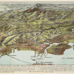
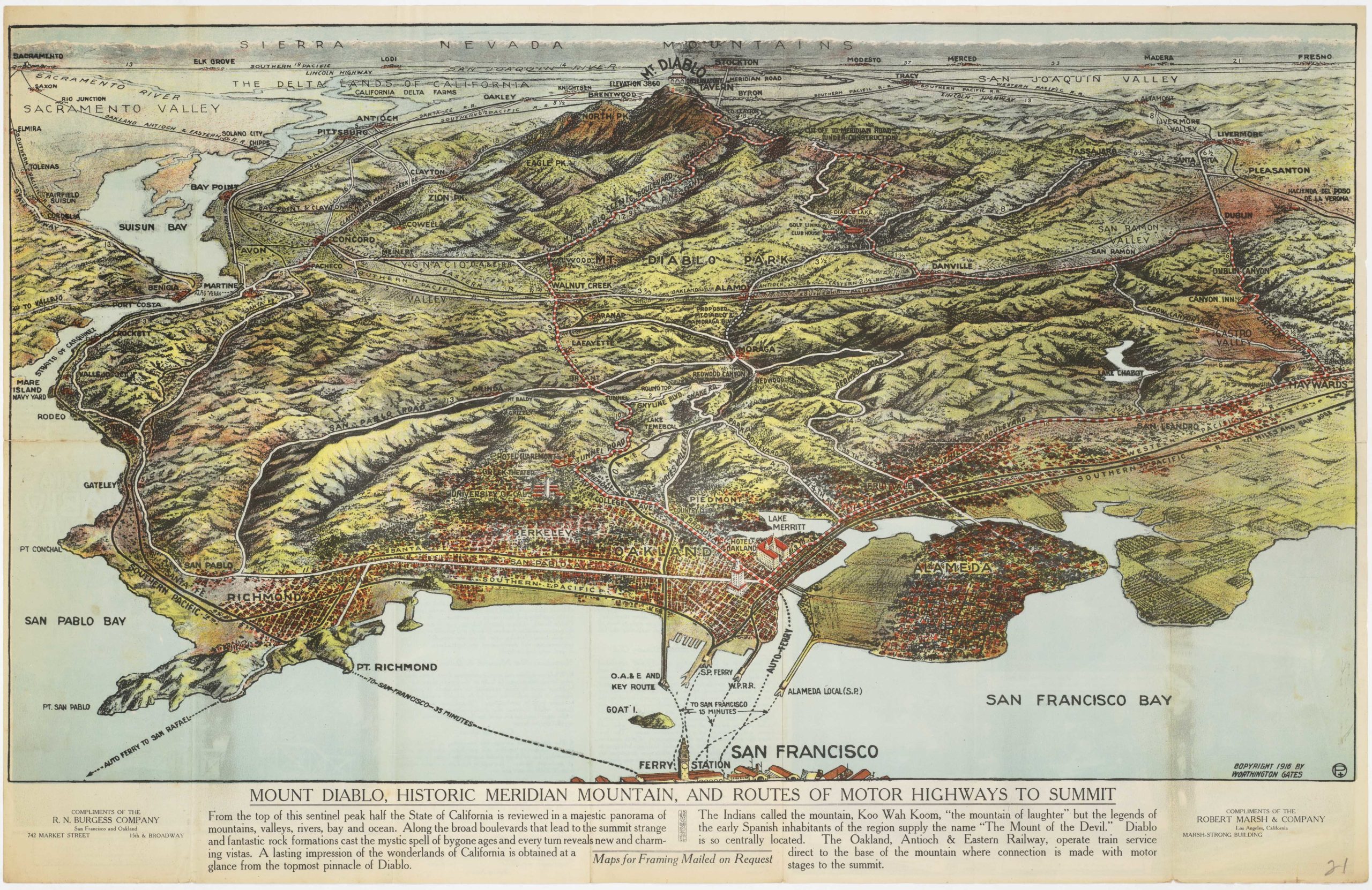
Rare 1952 pictorial map of San Francisco
Map of San Francisco, Points of Interest, A Birdseye View of the City by the Golden Gate
Out of stock
Description
Wonderful pictorial tourist pamphlet of San Francisco with points of interest across the city, as well as local newspapers, radio and tv stations.
Cartographer(s):
Don Bloodgood (1897-1989) was an American cartoonist and illustrator and a pioneer in the art of pictorial cartography. He was born in California, relocating to Arizona in 1960, at the height of his career.
Between 1935 and 1968, Bloodgood produced a substantial number of now sought-after pictorial maps, most of which depict places in the West, including California and Arizona, but also places like Alaska and Hawaii. The earliest map in this oeuvre shows San Diego and was compiled in 1935 for the California Pacific International Exposition. At the other end of the spectrum, we find his map of Navajoland, compiled in 1968 from his new home in Flagstaff, Arizona.
Condition Description
Excellent; some wear to verso (see image).
References