An essential map for collectors of California, the American West, and 19th-century American atlas maps.
County Map of the State of California.
Out of stock
Description
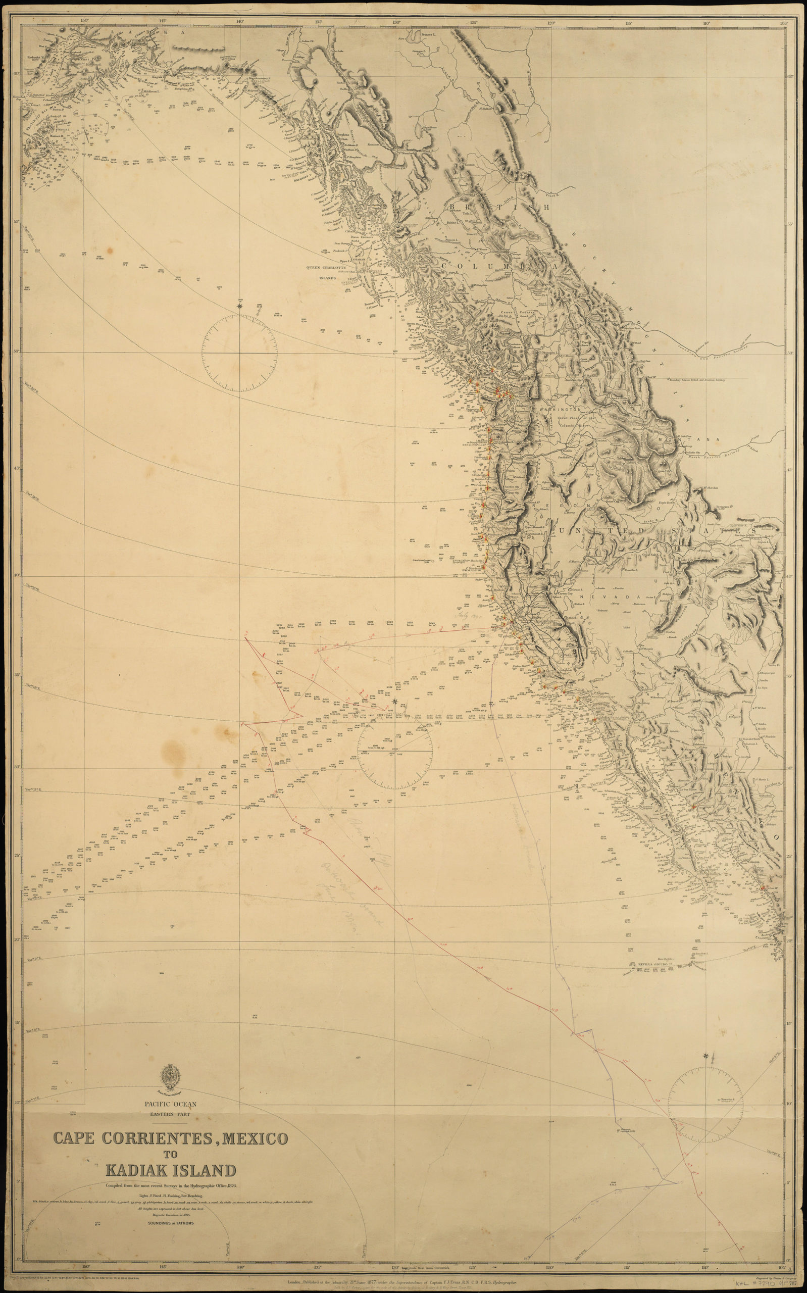
A fine example of Samuel Augustus Mitchell’s county map of California, with a large inset of San Francisco at top-right and a smaller inset of the wider Bay Area at bottom-left. The San Francisco map contains many fascinating features of the late-19th century city, including Long Bridge (today’s 3rd Street) and the initial infilling of Mission Bay, along with the Russian Hill reservoir and aqueduct.
Counties are shaded with different colors to distinguish them easily. The county system is different than today’s configuration; for example, Riverside, Orange, Imperial and Ventura counties are all missing.
Among other features, the remarkable density of railroads (thick black lines) in California at the time is evident, as well as the streetcar (still horse-drawn) and cable car network in San Francisco.
Cartographer(s):
Samuel Augustus Mitchell Jr. inherited one of the most commercially successful cartographic publishing houses in nineteenth-century America. His father, Mitchell Sr., had built the Philadelphia firm into a dominant force in American popular cartography from the 1830s onward, producing the school atlases, travel guides, and reference maps that furnished the geographical education of generations of American readers. When Mitchell Sr. retired in 1860, the younger Mitchell assumed control and continued to publish under the family name, maintaining the firm’s defining approach: clear, accessible cartography produced efficiently and sold cheaply enough to reach a broad middle-class market.
Under Mitchell Jr., the firm navigated the rapid changes that followed the Civil War, expanding coverage of the trans-Mississippi West as railroad growth and public education drove demand for updated maps. The Mitchell name remained synonymous with everyday American reference cartography well into the final decades of the century, though by the 1880s increasing competition and consolidation in the map trade were eroding the firm’s once-dominant position. The maps produced under his stewardship are today among the most commonly encountered examples of Victorian-era American cartography — their ubiquity a testament to the commercial machine his father built and he sustained.
Condition Description
Very good. Even toning.
References