Eminent geographer and historian George Davidson tracks the West Coast voyage of Sebastian Vizcaino.
RECONNAISSANCE OF THE WESTERN COAST OF THE UNITED STATES MIDDLE SHEET FROM SAN FRANCISCO TO UMPQUAH RIVER
$1,400
1 in stock
Description
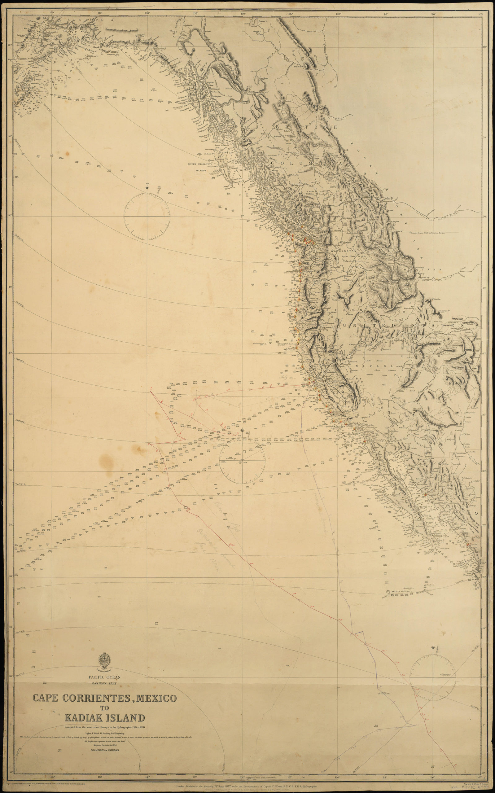
Coast Survey chart of the Northern California and Oregon Coast, heavily annotated by George Davidson in his effort to reconstruct the 1603 voyages of Vizcaino and Aguilar.
Born in England, Davidson (1825-1911) emigrated to the United States in 1832. After graduating from Girard College in Philadelphia, in 1845 he began a five-decade career with the United States Coast Survey. Much of his work was on the West Coast, where among many, many accomplishments he oversaw triangulation and geodetic work in the region, surveyed the Yolo and Los Angeles base lines, authored the Coast Pilot of California, Oregon and Washington (1857-1887) and Coast Pilot of Alaska (1868), and founded the Davidson Observatory in San Francisco. Following his retirement from the Coast Survey in 1895, at the age of 70 he became the first professor of geography at Berkeley, where he taught until retiring in 1905.
Davidson also applied his perhaps unparalleled knowledge of Northwest Coast geography to historical problems, attempting to reconcile modern knowledge with the first- and second-hand reports of the region’s early explorers. In the course of his research he acquired and heavily annotated large numbers of Coast Survey charts, which ended up with his papers in the collection of the Bancroft Library. Quite some years ago a great deal of this material was deaccessioned, much of it eventually ending up in the collection of Warren Heckrotte until being sold at auction in a series of PBA Galleries sales in 2015-16.
Offered here is one such item, being Davidson’s copy of the Coast Survey chart of the coast from San Francisco Bay to the outlet of Oregon’s Umpqua River. At one level it is an entirely typical Coast Survey chart, with densely-spaced soundings; navigation aids and hazards indicated; numerous well-engraved coastal profiles; and at upper left fairly extensive text providing sailing directions, tide tables &c. In the title block Davidson himself his credited with having provided “geographical positions.”
Davidson has however annotated the chart quite heavily in pencil, in an attempt to piece together the track and discoveries of Sebastian Vizcaino’s 1602-3 California expedition. Vizcaino had been appointed by the Spanish Viceroy in Mexico to sail north from Acapulco, map the California coast and locate a safe harbor for the Manila galleons. He explored and named San Diego and Monterey Bays and many other coastal features, though he missed the Golden Gate entirely. In early January 1603 one of his ships, the Tres Reyes commanded by Martin Aguilar, became separated during a storm in the vicinity of Point Reyes. Aguilar continued sailing north, reaching what is now the southwest coast of Oregon before returning to Mexico because of scurvy among his crew.
Using the expedition’s logs as a starting point, Davidson applied his deep knowledge of prevailing winds, currents, and topography, as well as a careful reconstruction of the errors in the instruments available to Spanish mariners in 1603. He recorded notes and findings in manuscript on this chart—though his handwriting requires some deciphering!–in order to recreate Vizcaino’s and Aguilar’s courses and observations. His findings were I believe first published in the 1886 Report of the Superintendent of the U. S. Coast and Geodetic Survey.
Note as well “Cape Sebastian” and “Cape Ferrelo” added in ink along the southern Oregon coast. These names were assigned by Davidson in tribute to Vizcaino and Barleme Ferrelo, a pilot on Cabrillo’s 1542 expedition, and were formalized in print in the 1869 Coast Pilot of California, Oregon and Washington.
In the 1886 Report Davidson wrote at length about his historical work:
“During my work on the Pacific coast of the United States since the spring of 1850, I became deeply interested in the discoveries and explorations of the early Spanish navigators who had followed the coast from Cape San Lucas to Alaska. Part of my duty consisted in the determination of the latitude and longitude of the headlands, islands, rocks, harbors, rivers, &c., and in the geographical reconnaissance of the shores from the Mexican boundary to the forty-ninth parallel. While in command of the surveying brig R. H. Fauntleroy, I entered (in addition to my regular duties) upon the self-imposed task of writing a Coast Pilot for California, Oregon, and Washington Territory…. Very naturally, my early interest in the old explorations became intensified, and I made many special examinations of the narratives and their application to supposed localities. I think I have been able to reconcile many of the discrepancies of the old Spanish, English, American, and French navigators. Their inaccuracies arose principally from “constant” errors of their instruments, ignorance of the coast currents, errors of judgment in estimating distances, &c. Among the Spanish discoverers, the meagerness of detailed descriptions, a failure to seize the salient points for the determining of their positions, the want of minute accuracy in most of their plans—sometimes giving weight to general features and sometimes to details without distinction—and a leaning to exaggerate certain discoveries and to completely overlook others, have much involved the locating of many of their landfalls, headlands, mountains, and streams…. I cannot withhold my admiration for the indomitable courage and perseverance of the old Spanish navigators, who, in small, ill-conditioned, and ill-supplied vessels, with crews nearly destroyed by scurvy, fought their way to the wildest parts of the Alaskan coast almost regardless of season. “There were giants in the earth in those days.”
“The records of such of these voyages as are published are too short to be of much more value than isolated statements of what was done; and the inaccuracy of the observations for the determination of the geographical positions has led many to judge that all were touched with the spirit of Maldonado, de Fonte, and de Fuca. But with the present knowledge of our coast it is possible to locate Ulloa; to track Cabrillo and Ferrelo in their discoveries in mid-winter; to place Drake under Cape Ferrelo and Point Reyes, and to fix with certainty the most of Vizcaino’s positions.” (Davidson, “An Examination of Some of the Early Voyages of Discovery and Exploration on the Northwest Coast of America, from 1539 to 1603,” in Report of the Superintendent of the U. S. Coast and Geodetic Survey… June, 1886.)
In all, a remarkable artifact of the workings of one of the country’s great geographical minds of the 19th century, with much of interest for scholars of early Spanish exploration of the West Coast.
Cartographer(s):
The Office of Coast Survey is the official chartmaker of the United States. Set up in 1807, it is one of the U.S. government’s oldest scientific organizations. In 1878 it was given the name of Coast and Geodetic Survey (C&GS). In 1970 it became part of the National Oceanic and Atmospheric Administration (NOAA).
The agency was established in 1807 when President Thomas Jefferson signed the document entitled “An act to provide for surveying the coasts of the United States.” While the bill’s objective was specific—to produce nautical charts—it reflected larger issues of concern to the new nation: national boundaries, commerce, and defense.
Alexander Dallas Bache, great-grandson of Benjamin Franklin, was the second Coast Survey superintendent. Bache was a physicist, scientist, and surveyor who established the first magnetic observatory and served as the first president of the National Academy of Sciences. Under Bache, Coast Survey quickly applied its resources to the Union cause during the Civil War. In addition to setting up additional lithographic presses to produce the thousands of charts required by the Navy and other vessels, Bache made a critical decision to send Coast Survey parties to work with blockading squadrons and armies in the field, producing hundreds of maps and charts.
In 1871, Congress officially expanded the Coast Survey’s responsibilities to include geodetic surveys in the interior of the country, and one of its first major projects in the interior was to survey the 39th Parallel across the entire country. Between 1874 and 1877, the Coast Survey employed the naturalist and author John Muir as a guide and artist during the survey of the 39th Parallel in the Great Basin of Nevada and Utah. To reflect its acquisition of the mission of surveying the U.S. interior and the growing role of geodesy in its operations, the U.S. Coast Survey was renamed the United States Coast and Geodetic Survey (USC&GS) in 1878.
Condition Description
Signed in ink and heavily annotated in ink and pencil by George Davidson. Toning and light soiling, chipping and other wear in margins.
References
Oscar Lewis, George Davidson, Pioneer West Coast Scientist. (1954); (McArthur 1) Oregon Geographic Names:. Oregon Historical Quarterly, Vol. 26, No.4 (Dec 1925) pp 309-423; (McArthur 3) Oregon Geographic Names: Third Supplement. Oregon Historical Quarterly, Vol. 44, No.2 (June 1943) pp. 176-218.
