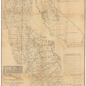
An engrossing historic 1871 map of Marin County from Corte Madera to Novato.
Sale map no. 8 of salt marsh and tide lands situated in the county of Marin.
Out of stock
Description
This extraordinary map is a bi-product of one the most significant political and economic controversies in California history and an illustrative example of the fiercely competitive powerhouses that shaped modern America.
The current sheet is a cadastral map of the reclaimed salt marsh and tidal lands in and around Marin County. The map – and indeed the real estate plots it has been designed to portray – was created by the Board of Tide Land Commissioners (BTLC) and constitutes one in a series of charts published between 1869 and 1873. The maps were explicitly designed to delineate and define the available land plots coming up for public sale under the authority of the BTLC. It is a cartographic auction catalog, with the items for sale being swathes of reclaimed public land.
The series consisted of at least twelve maps, of which the current one is number eight. It was compiled by Ferdinand Hafenrichter and George Allardt, respectively, the BTLC’s chief draughtsman and chief engineer, and depicts the area from the Gallinas Canal in the north down to San Quentin and the Corte Madera Canal in the south. In the westernmost part of the map, we find the town of San Rafael laid out on public land.
Map details
This map filled with fascinating details that together provide a snapshot of Marin history during a dynamic era. The natural landscape it portrays is recognizable but has been significantly altered. One feature worth highlighting as an example of the stories told by this map is Agnes Island and its “Ferry Landing” near San Quentin Prison. In the 1860s, Martha Buckelew established a wharf here. This island has since disappeared, having been covered over during the construction of the Marin approach to the Richmond-San Rafael Bridge. However, in 1870, a ferry service starting from Buckelew’s wharf marked the beginning of Marin County’s first reasonably priced commute to San Francisco. Buckelew, a shrewd businesswoman, successfully defended her rights to the island against a challenge from James Ross, a prominent competitor and the founder of the town of Ross. Ultimately, Buckelew outmaneuvered Ross and persuaded the state to grant her a 20-year authorization for operating the island’s wharf for ferry services.
The map subdivides Marin using an overlaid grid, breaking the coastal regions of the old Rancho San Pedro and Rancho Quentin down into numbered quadrants, here termed sectors (or sec.). Each quadrant is then further subdivided into 24 large plots, which are partitioned in various ways (e.g. halved or quartered, but in some cases also establishing more organic borders based on the natural landscape and building capacity on each plot).
This formal delineation also resolved the outstanding issue of how much land would be allocated to the railroad companies; indeed, a right-of-way is defined for the San Francisco and North Pacific Railroad along the right fringe of the map. Nevertheless, the auction allowed private businesses and citizens to acquire some attractive new plots created around San Francisco and the Marin Peninsula during these formative years.
The plots were sold at public auction on July 18th, 1871, at Platt’s Hall in San Francisco. Our map was based on comprehensive surveys of Marin’s tidelands but explicitly made for this event. Comparable maps for San Francisco and other areas within the Bay also exist from this period.
Census
The OCLC identifies 12 institutional holdings of this map, including the California State Library and the university libraries of Brown, Cornell, UC Berkeley, and Stanford (OCLC no. 77563022).
Context is Everything
Nowadays, the sale of California Tide Lands is constitutionally prohibited, but this was not always the case. With the explosive demographic growth of the Gold Rush, the State Legislature allowed the sale of Tide Lands in San Francisco Bay to private enterprise. A body known as the Board of Tide Land Commissioners (BTLC) was created to oversee this process, which had unleashed hundreds of competing land claims and was fraught with politics and corruption. As early as 1868, long before any form of construction was viable, the BTLC had begun mapping out and selling entire blocks of waterfront real estate in San Francisco.
Once the Tide Lands Act of 1868 had passed, the area coming under scrutiny was dramatically expanded to include Marin and the surrounding areas. A significant task of the BTLC was sorting out whether the southern waterfront should be granted to the railroad companies as rights-of-way and, if so, how much land that should entail. As part of this process, extensive swathes of marsh and tidal lands were surveyed and evaluated, and our map is one in a series of cadastral maps produced by the BTLC in the late 1860s and early 1870s.
While our map captures part of the BTLC’s difficult task and, as such, evinces the benefits of government oversight, it also manifests the darker drivers in the American story. More often than not, the well-positioned and wealthy stakeholders won, whereas others – especially those without political and financial clout – lost out. As such, this map not only embodies the development of Marin County into one of the most attractive places to live on the planet, but it also reveals a history of policy and decision-making inextricably linked to private commercial interests.
Cartographer(s):
Grafton Tyler Brown (1841–1918) was an American painter, lithographer, and cartographer. Brown was the first African American artist to create works depicting the Pacific Northwest and California. The son of a freedman, Brown worked for a printer in Philadelphia before moving to San Francisco in the 1860s. In San Francisco, Brown worked at Kuchel & Dressel from 1861 until 1867, when he opened his own firm and in 1878 created The Illustrated History of San Francisco, which consisted of 72 topographical images of the city.
Brown’s work in the Bay Area and in the Nevada Territory included documentation of settlements, property sales, claims and city boundaries. His works are held in the collections of the Oakland Museum of California, Smithsonian American Art Museum, and the Los Angeles County Museum of Art.
George F. AllardtGeorge F. Allardt (died July 27, 1903) was a civil engineer based in San Francisco who conducted extensive surveys of the State of California. He is most known for being the lead surveyor for the Board of Tide Land Commissioners (BTLC), which was charged with defining the high tide line for the Bay Area, thus forming the basis for the official reclamation of tidal lands in the Bay Area. Allardt was deeply involved in the survey and subdivision of 17,000 acres of the San Pablo Rancho. At the time, it was one of the largest surveys ever made in California. Moreover, he created Allardt’s Official Map of Alameda County.
Condition Description
Wear along fold lines, repaired tears at margins. Repaired areas of loss along edge. Rebacked.
References
