George F. Allardt (died July 27, 1903) was a civil engineer based in San Francisco who conducted extensive surveys of the State of California. He is most known for being the lead surveyor for the Board of Tide Land Commissioners (BTLC), which was charged with defining the high tide line for the Bay Area, thus forming the basis for the official reclamation of tidal lands in the Bay Area. Allardt was deeply involved in the survey and subdivision of 17,000 acres of the San Pablo Rancho. At the time, it was one of the largest surveys ever made in California. Moreover, he created Allardt’s Official Map of Alameda County.
-
- Add to cart
- Marin, Sonoma, & Napa Valley
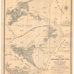
Sale map no. 8 of salt marsh and tide lands situated in the county of Marin.
- $4,500
- An engrossing historic 1871 map of Marin County from Corte Madera to Novato.
-
- Add to cart
- San Francisco, Railroad Maps
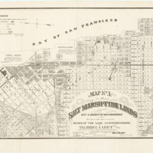
Map no. 3. Salt marsh and tide lands situate in the city and county of San Francisco. To be sold at public auction by order of the Board of Tide Land Commissioners by Talbert & Leet, auctioneers, at their sales rooms no. 526 California Street, San Francisco. Sale to commence Friday Nov. 26th, 1869.
- $3,400
- Rare cadastral and Southern Pacific Railroad right-of-way tidal lands map of Mission Bay.
-
- Add to cart
- San Francisco, San Francisco Bay Area & Silicon Valley
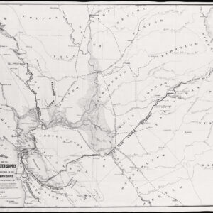
General Map of the Surveys for the San Francisco Water Supply made under the direction of the Board of Supervisors…
- $600
- Large, impressive San Francisco water supply system map.


