A little-known late-19th-century wall map of California.
Lentell’s New Railroad, Township, & Educational Map of the State of California.
Out of stock
Description
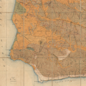
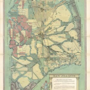
This is a rare and monumental wall map of California, crafted by J.N. Lentell in 1896. It depicts the state divided into its counties, showcasing intricate details of roads, railways, and waterways, including canals. The map also highlights mountains, varied terrain, springs, and settlements. It notably features settlements from the gold rush era, many of which were transitioning into ghost towns. The map accurately represents the state’s boundaries at the time, including the recently formed Kings, Madera, and Riverside Counties, while excluding Imperial County, which wasn’t established until 1907. Survey lines are drawn across California, with the notable exclusion of extremely isolated regions such as Death Valley.
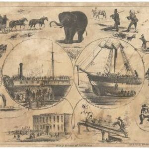
Vignette illustrations depict six institutions near the title: the State Capitol building in Sacramento, the State University (University of California Berkeley), the State Normal School Los Angeles (UCLA), the State Normal School Chico (Cal State Chico), the State Normal School San Jose (San Jose State University), and the Lick Observatory on Mt. Hamilton. Five inset maps display the relative size and position of California in the United States, a climatological map of California, a geological map of the state, a map of California’s congressional districts, and a small inset of San Francisco. Tables and text boxes discuss the state’s history, population, government, education system, larger towns and cities, and more.
The map is so large that it can provide for local detail despite covering the entire state. For instance, in Los Angeles, the ‘Soldiers’ Home,’ now the location of the Veterans’ Affairs Hospital next to UCLA, is noted. Similarly, outlying areas of San Francisco such as Bernal (Heights) and Oceanview, which at the time were still partly agricultural and sparsely settled, are indicated. Grid lines surround the city of Fresno in Fresno County, marking out plots and hinting at the area’s emergence as the agricultural heartland of California in the preceding years, thanks to extensive irrigation efforts.
Census and rarity
This map was compiled by civil engineer J. N. Lentell, lithographed by Galloway Lithographing Co., and published by J. M. Flowers & Co., all based in San Francisco.
It is quite rare; the present edition is only recorded in the OCLC at the University of California Los Angeles. An 1899 edition is also held by UCLA, the University of California Berkeley, and the Wisconsin Historical Society.
Typically varnished, Lentell’s wall maps are generally in poor condition, damaged and even degraded. The present example has been fully professionally restored, returning it to its original magnificent and varied color.
Cartographer(s):
J.N. Lentell was a surveyor and civil engineer active in California from the 1890s through the 1930s. He may have initially resided in Sacramento and San Francisco, but definitely was settled in Eureka by 1904. His works included a huge wall map of California published in several editions in the 1890s and several pocket maps of California counties in the first decade of the 20th century.
Condition Description
Areas of cracking, soiling, and infill, especially at bottom. Professionally restored and stabilized. Laid on new Belgium linen, minor color touch-ups. Overall, a very good copy of a spectacular map.
References