One of the most iconic 19th-century maps of San Francisco.
Bancroft’s Official Guide Map of the City and County of San Francisco, Compiled from Official Maps in Surveyor’s Office.
$2,200
1 in stock
Description
Pre-Earthquake San Francisco: Shifting Shorelines, Racetracks, Toll Roads, Industry
A handsome and iconic late 19th-century map of San Francisco, issued before the 1906 earthquake and fire reshaped the city. An inset at upper corner depicts the broader Bay Area; in Marin County, Sausalito appears under its older spelling, Saucelito. The natural shoreline — extending well inland of today’s Embarcadero seawall — is highlighted in blue, a vivid reminder that much of modern San Francisco stands on Gold Rush-era landfill. Beginning in the 1850s, the city aggressively infilled tidal flats to reach deeper anchorage, create buildable land, and repeatedly rebuild after devastating fires.
The map is a treasure trove of urban detail. A comprehensive key along the lower margin identifies hundreds of institutions, businesses, parks, and public works. Developed blocks are shaded, allowing the viewer to grasp the incomplete state of urban expansion: much of western San Francisco — including the lands of the former San Miguel Rancho — remained only partially integrated into the city grid.
The western districts preserve a remarkable record of vanished features. Shown prominently are Bay District Park (the great 19th-century horse-racing ground), the Ocean Race Track, and the Ocean House, once a celebrated seaside resort and excursion point along the dunes. These leisure destinations predated Golden Gate Park’s maturation and marked the social frontier of the city before residential development pushed westward.
Infrastructure is equally well represented. The San Miguel Toll Road traces one of the principal carriage routes across the dunes toward the coast — a reminder that western San Francisco was opened first by private toll roads before streetcars and boulevards regularized the grid. The Spring Valley Water Company’s reservoir and flume illustrate the private water system that sustained the growing city decades before the Hetch Hetchy project. Southern Pacific Railroad lines enter from the southern peninsula, underscoring San Francisco’s integration into regional and transcontinental transport networks.
At the intersection of Greenwich and Octavia streets, the map preserves the ghost of Washerwoman’s Lagoon, a tidal basin in Cow Hollow later erased by landfill. The lagoon functioned as an informal outdoor laundry site during the Gold Rush.
Cemeteries at Lone Mountain are shown before their later removal to Colma; the Alms House Tract (today Laguna Honda Hospital) anchors the southwestern quadrant; and concentric one-mile rings radiate from the Ferry Building, reflecting the primacy of ferry travel decades before the Golden Gate and Bay Bridges transformed regional movement.
Intriguingly, the Marina area includes projected but unrealized streets such as Tonguin and Lewis — planned atop anticipated landfill but never built (Tonguin evolving into Marina Boulevard; Lewis into Marina Green Drive). These speculative names speak to the optimism and ambition of late 19th-century expansion schemes.
Taken together, this map is not merely a street plan but a layered urban document — capturing San Francisco in transition: partially built, partially speculative, still bounded by dunes and marsh, yet already driven by rail, waterworks, leisure culture, and maritime commerce.
Publication information
First issued in 1871, Bancroft’s pocket map of San Francisco proved immediately popular and was revised repeatedly in 1873 (two editions), 1877, 1881, 1882, 1883, 1887, and 1891 (present edition). The second 1873 issue significantly expanded coverage westward to include Golden Gate Park and newly subdivided lands. Some earlier editions show landfill areas in eastern San Francisco outlined in blue — a feature omitted after 1887.
The map is well represented institutionally but remains scarce on the market.
Cartographer(s):
Hubert Howe Bancroft (May 5, 1832 – March 2, 1918) was an American historian and ethnologist who wrote, published, and collected works concerning the western United States, Texas, California, Alaska, Mexico, Central America, and British Columbia.
In March 1852, Bancroft was provided with an inventory of books to sell and sent to the booming California city of San Francisco to establish a West Coast regional office of the firm. Bancroft was successful in building his company while entering the world of publishing. He also became a serious collector of books, building a collection numbering in the tens of thousands of volumes.
In 1868, he resigned from his business in favor of his brother, A. L. Bancroft. He had accumulated a great library of historical material and abandoned business to devote himself entirely to writing and publishing history.
Condition Description
Minor wear and discoloration, per usual. Backed on archival tissue for added stability.
References
Related products
-
-
Add to cart
- San Francisco
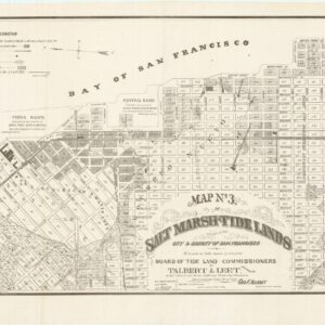
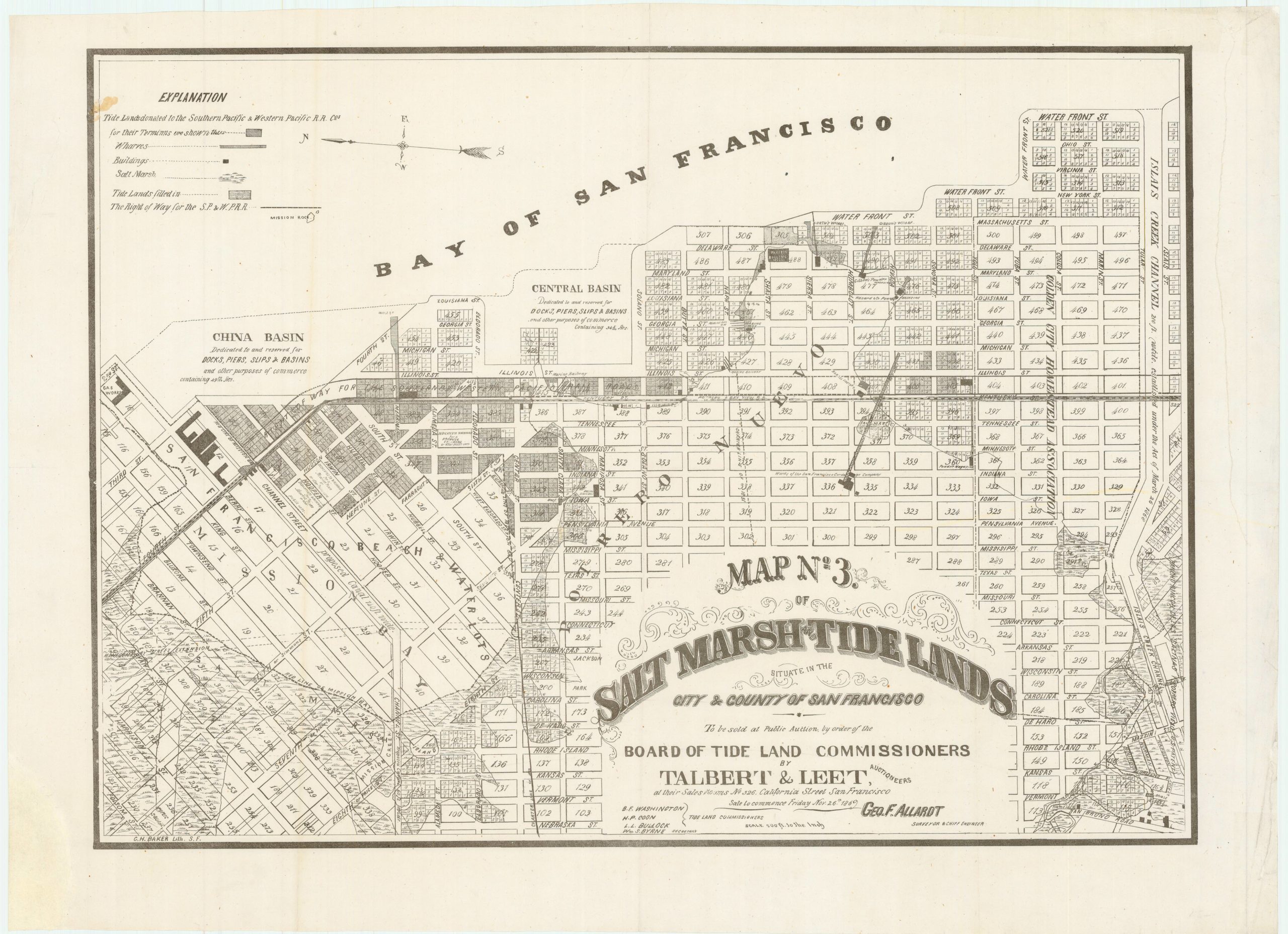
Map no. 3. Salt marsh and tide lands situate in the city and county of San Francisco. To be sold at public auction by order of the Board of Tide Land Commissioners by Talbert & Leet, auctioneers, at their sales rooms no. 526 California Street, San Francisco. Sale to commence Friday Nov. 26th, 1869.
- $3,400
-
-
-