The extremely rare first edition map from San Francisco’s greatest early 20th century cartographer.
The Commercial Pictorial and Tourist Map of San Francisco.
Out of stock
Description
The first example we have ever seen for sale!
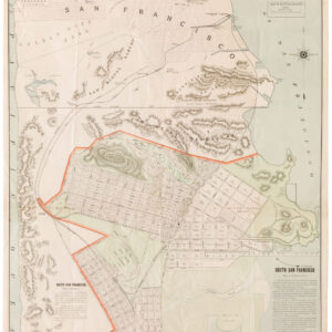
This is the highly sought-after first edition 1904 Chevalier map of San Francisco. Its large scale, comprehensiveness (including indications of elevation), and illustrations of notable buildings make it a fantastic snapshot of San Francisco as it existed before the 1906 earthquake and fire. It is, simply put, one of the most iconic maps in the history of San Francisco cartography.
This horizontally oriented map, printed using chromolithography, offers a detailed overview of the most inhabited parts of the city and county of San Francisco. It is a window to the past, tying together the city’s different neighborhoods with cable car, streetcar, and rail lines. The shaded Chinatown, a reflection of the perceived risk of plague, and the illustrations of civic buildings, schools, churches, monuments, skyscrapers, and other prominent buildings all reflect the city’s complex history.
One of the more noticeable features of the map is its portrayal of ongoing landfill and development in the Marina District, which is noted as ‘being filled.’ Various efforts had been made in the preceding years to level off sand dunes and regulate water flow along the coast; following the 1906 earthquake and fire, rubble from destroyed buildings was driven into the marshy soil and sand, providing a foundation for later construction, including the site of the Panama–Pacific International Exposition.
Aside from the Marina District, portions of the street grid in the southern and western parts of the city are speculative. Sometimes, their ultimate configuration does not match what is envisaged here. This is most obvious around Islais Creek at the bottom-right and near Mt. Sutro, where Stanyan St. terminates at the intersection of Belgrave Ave. instead of continuing southwards. Streets in the still sparsely-developed Richmond and Sunset Districts maintain their simple alphabetic names (A, B, C, etc.), later elaborated to complete names (Anza, Balboa, Cabrillo, etc.).
Adolph Sutro’s San Francisco
The city seen here bears the imprint of wealthy businessman Adolph Sutro, who had served as the populist mayor of the city between 1895 and 1897. Aside from his personal estate in the city’s northwest corner, he also opened Sutro Baths, built a new Cliff House on the site of the one that had burned down in 1894, and opened the gardens of his private estate to the public (Sutro Heights). He then built a railway to connect these attractions with downtown San Francisco directly.
Sutro also owned land below Golden Gate Park on and around Mount Parnassus, later renamed Mount Sutro (here it is named ‘Blue Mt.,’ a name more typically applied to Mt. Davidson just to the south). He donated a portion of these lands to the ‘Affiliated Colleges,’ the state colleges for medicine, dentistry, and the like, which opened a new campus there in 1898, making this among the earliest maps to depict the University of California San Francisco’s Parnassus campus.
The ‘Statue of Liberty’ atop Mt. Olympus, also known as the ‘Triumph of Light,’ was another of Adolph Sutro’s contributions to the city, completed in 1887. Sitting near the city’s geographic center, the statue once dominated the landscape. However, it was quickly lost in the thicket of real estate development in the following decades (the statue was removed in the 1950s under mysterious circumstances, but the pedestal remains). Several elements in Golden Gate Park are also notable, including a quarry (later filled in and made into the Lily Pond), the Buffalo Paddock at its original location (later moved to the park’s western end), and the Strawberry Hill Observatory (also known as the Sweeny Observatory, for observing the park, not the stars).
Census and publication information
This map was prepared by August Chevalier in 1903 (copyright date) and published in August 1904. It is accompanied by a 32-page guide booklet containing photographs and information, which advertises the map (with some justification) as ‘the most complete and practical map ever made.’
The present map is the first edition of Chevalier’s ‘Commercial, Pictorial and Tourist map of San Francisco,’ issued in several sizes and formats until 1915. Aside from being a first edition, it is also notable for its unusual horizontal orientation. In contrast, Chevalier’s later maps adopted a more conventional vertical orientation to include the less-populated southern areas within city limits.
We note physical examples (rather than digital scans) of this edition of the map in the holdings of the California State Library, University of California Berkeley, California Historical Society, the Claremont Colleges, and the David Rumsey Historical Map Collection.
Cartographer(s):
Augustus Chevalier issued a number of fine maps of San Francisco, including a monumental wall map. By the early 20th century, his maps of San Francisco were perhaps the best known and respected of the city.
Condition Description
Professionally restored. Areas of infill in left margin and at fold intersections. Toning along fold lines. Sporadic soiling. Accompanied by original guide booklet.
References
Related products
-
-
Add to cart
- San Francisco
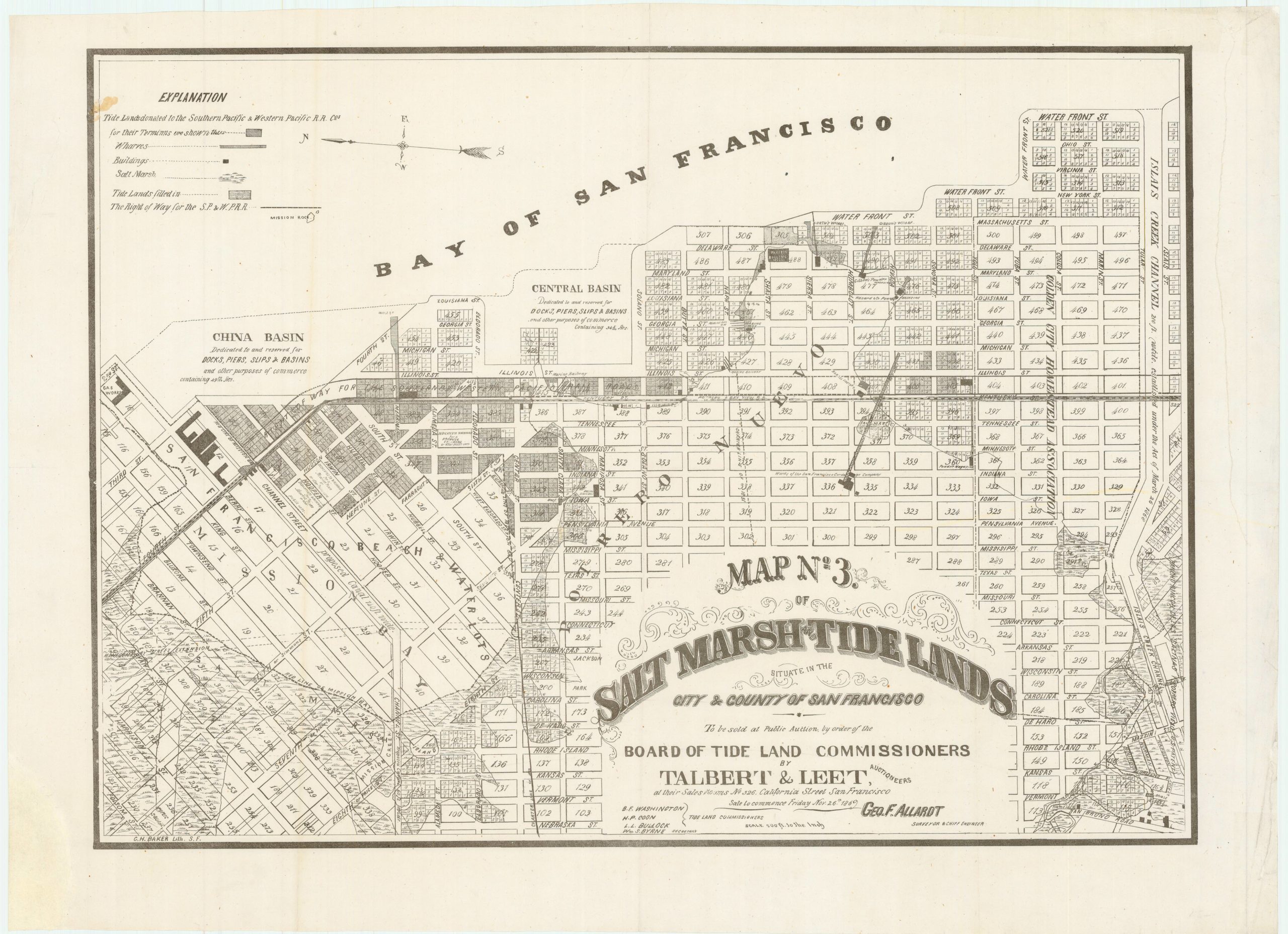
Map no. 3. Salt marsh and tide lands situate in the city and county of San Francisco. To be sold at public auction by order of the Board of Tide Land Commissioners by Talbert & Leet, auctioneers, at their sales rooms no. 526 California Street, San Francisco. Sale to commence Friday Nov. 26th, 1869.
- $3,400
-
-
-