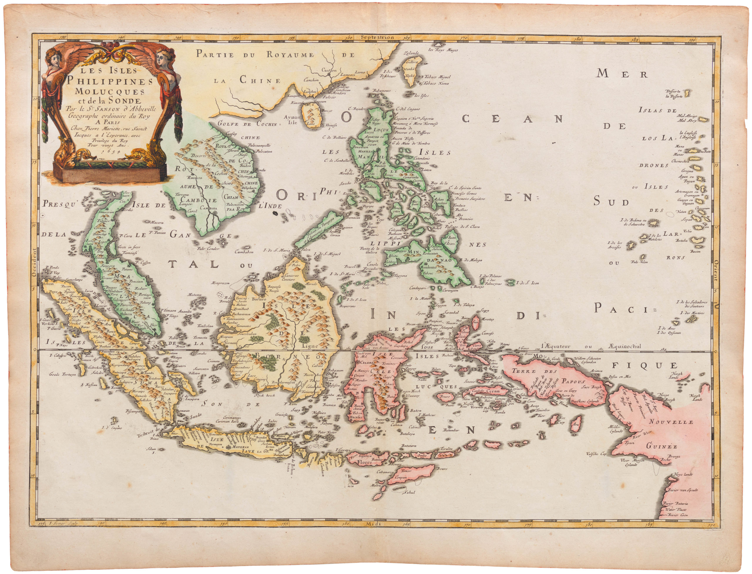
Lovely mid-18th century Anson chart of the Philippines
Carte du Canal des Iles Philippines Par lequel passe le Galion de Manille, et les Isles voisins de ce canal
Out of stock
Add to Wishlist
Add to Wishlist
Description
A large chart of the Philippines from a French edition of Anson’s account of his circumnavigation, one of the last great buccaneering voyages. Anson captured a Spanish galleon laden with so much silver that they needed thirty-two wagons to transfer it to the Tower of London.
Cartographer(s):
Condition Description
Trimmed to printed border on right, false margin added and tear repaired.
References