Mapping the greatest mountain range on Earth: a 1970s map that was in many ways as revolutionary as Mercator’s first projection of the world.
The Floor of the Oceans.
$1,600
1 in stock
Description
“The Floor of the Oceans” represents a decisive and paradigmatic shift in the geological understanding of Earth’s history and formation. This is the original map of the ocean surface as they were charted by renowned oceanographers Marie Tharp and Bruce Heezen. The map shows the entire surface of the planet, but focuses on those parts located at the bottom of the ocean. Naturally, it has only been possible to document this topography in any kind of detail during the course of the 20th century, with the development of sonar technologies, along with advances in bathymetric theory. Bathymetry is the maritime equivalent of topography and essentially consists of mapping the surface of ocean floors in great detail, which in this case necessitated an exorbitant number of sonar scans in order to produce low resolution impressions of the deep-sea floor.
The map is a large offset color lithograph measuring around 41 x 27 inches; dimensions suited to be placed on almost any wall. It was mostly intended for schools, boaters, and scholars with oceanographic interests, but was soon seen as an ideal means of raising public awareness of the incredible topography that lies hidden beneath the ocean surface. This was the first time that this remarkable topography was visualized as a single whole. The chart was published by the American Geographical Society with formal support from the United States Navy Office for Naval Research. The final product itself was designed and painted by French artist Tanguy de Remur, and printed by Pierre Charron in Paris.
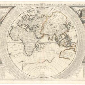
At first glance, the composition of the map may seem a little strange compared to what we are accustomed. It is clearly a Mercator-type projection (as is indicated in the lower left corner of the map), but the Eurasian and African landmasses have in this case been centrally placed, with the Americas flanking them on either side; the left flank shows all of South America and the right shows the entire North American continent. The purpose of this arrangement is of course to show the world’s great oceanic spaces as one coherent entity, thereby providing a canvas on which to reveal the spectacular topography at its floor.
Among the many discoveries Tharp and Reezen made and presented on this map was the presence of a single coherent mountain range that connected the Pacific and Atlantic Oceans. The impressive terrain includes gigantic fracture zones, deep trenches, rift valleys, and several underwater mountain ranges, including the colossal Mid-Oceanic Ridge just mentioned. Extensive labeling of geological features and ubiquitous depth and altitude measurements all serve to make the map accessible, even to a layperson.
Context is everything
This map is the result of thousands upon thousands of sonar images of the seabed. It constitutes an end-product of sorts, being the outcome of decades of research by American geologists and oceanographers Marie Tharp (1920-2006) and Bruce Charles Heezen (1924-1977). Both worked as oceanographers for the Lamont-Doherty Geographical Observatory of Columbia University. While Heezen was a specialist in accumulating sonar data and extracting verifiable patterns from this, Tharp worked as an oceanographic cartographer and geological formation specialist. We have mentioned Tharp’s discovery of the Mid-Atlantic Ridge; a massive chain of mountains which cut through the middle of the Atlantic Ocean, before circumventing Africa where it joins with the Mid-Indian Ocean Ridge to form an escarpment just south of Arabia (entitled the Carlsberg Ridge). In addition to showing how comprehensive and connected the Earth’s submarine topography in fact is, Tharp also developed new theories on plate tectonics and the phenomenon of continental drift. Until that point, the most common theory of the Earth’s geological formation built on a notion that the planet was gradually expanding, causing the tectonic plates on the crust to shift as a result.
Among the proponents of this theory was Bruce Heezen, a professor of oceanographic geology at Columbia University. Tharp worked as Heezen’s assistant while they were both younger, and he initially dismissed her first major discovery: a rift valley in the North Atlantic. Yet despite being the senior (and male) scholar, Heezen was gradually converted to Tharp’s views of the Earth’s submarine formation, which included identifying the Mid-Oceanic Range as a single coherent geological entity and rejecting the hypothesis that tectonic shifting was due to Earth’s gradual expansion. Soon he would come around to the paradigm-change that Tharp’s research suggested and together they would go on to produce the first full topographical view of the Earth’s submarine surface.
Marie Tharp was a pioneering figure in science who struggled through repeated rejections of her ideas and research in favor of her male counterparts. Even as her ideas gained traction – to a large degree due to the growing public support of an at first skeptical Bruce Heezen – she was often not credited for her findings. Today she is considered one of the greatest geological scholars of the 20th century.
Cartographer(s):
Marie Tharp (1920-2006) and Bruce Charles Heezen (1924-1977) were oceanographers and geologists with Columbia University in New York. During the 1960s and early 70s, they collected enough sonar data to produce the first full view of the Earth’s submarine topography (also known as bathymetry). Tharp in particular is considered a scientific pioneer, in part due to her rise to academic prominence during a time where women struggled to make it in academia. But the real source of her acknowledgement continues to be the comprehensive revisionist theories of how the Earth was formed geologically.
Condition Description
Minor wear and ruffling along edges.
References